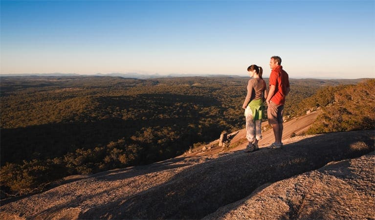
In summer, what better place to relax than by a river? River walk, which can be joined at several places along Falls Road, connects Cypress-pine campground and Boonoo Boonoo Falls picnic area. Spring is also a great time along River walk, as the park is a haven for wildflowers including a variety of wattles, pea flowers and rock orchids.
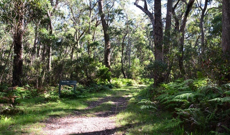
The track takes you through dry eucalypt forest and vegetation in the riparian zone - the interface between the land and the waterway - a little way back from the river. Make the most of the two river visits by having a dip, a swim, or at the very least by splashing someone in your group.
If you've approached the river quietly, you may be lucky enough to spot a platypus. Around sunrise and sunset, wallabies and kangaroos might be seen grazing or drinking at the river.
The weather in this area can be extreme and unpredictable, so please ensure you're well-prepared for your visit.
Remember to take your binoculars if you want to birdwatch
Visit NSW National Parks and Wildlife Service for more information on this trail.
The longitude and latitude of the start and end points are approximately only and should not be used for navigation purposes. Please contact me if you know the correct coordinates.
Got some great shots from this hike? Upload your photos here to inspire others and show off the beauty of the trail!
Submitting your photos doesn’t mean you lose ownership. You can be credited for your contributions, and you can request removal at any time.
Please don’t copy GPX files or content from this site to AllTrails or other platforms. Each trail has been personally mapped, documented, and refined to support Australia’s bushwalking and hiking community. While some details come from land managers, every listing reflects significant personal effort. This is a free, community-driven initiative—your respect helps keep it that way.
It looks like I don’t have a GPX file for this trail yet. If you have one to share, please email it to me! I’ll verify it against official maps before adding it to help other hikers have a safer, easier experience. Thanks for contributing to a better hiking resource.
Getting there
Getting to the trailhead: Boonoo Boonoo National Park.
On entering Boonoo Boonoo National Park, for Cypress-pine campground:Follow Boonoo Boonoo Falls Road and the campground is on the left- hand side and is well-signpostedFor Boonoo Boonoo Falls picnic area:Follow the unsealed Boonoo Boonoo Falls Road for 4km to the park entranceContinue for a further 9km to the picnic area Road quality Check the weather before you set out as the road to Boonoo Boonoo Falls can become flooded during heavy rains. Parking Parking is available at Boonoo Boonoo campground. Bus parking is available.
Closest towns to this walk: Boonah, Drake, Glen Innes, Goondiwindi, Stanthorpe, Tenterfield, Wallangarra
About the region
Boonoo Boonoo National Park in the Country NSW region
Boonoo Boonoo National Park is always open but may have to close at times due to poor weather or fire danger.
Similar walks nearby
Looking for more walks in or near Boonoo Boonoo National Park? Try these trails with a similar difficulty grade.
Favourite

Favourite

Favourite

Favourite

Track grade
Grade 3 (Moderate) - Walks for Most Fitness Levels: Grade 3 on the
AWTGS represents moderate walking tracks. These are ideal for walkers with some fitness who are comfortable with some hills and uneven terrain. While suitable for most ages, some bushwalking experience is recommended to ensure a safe and enjoyable experience. Tracks may have short, steep hill sections, a rough surface, and many steps. The total distance of a Grade 3 walk can be up to 20 kilometers.
Explore safe
Plan ahead and hike safely! Carry enough water, pack layers for changing conditions, and bring safety gear like a torch, PLB, and reliable communication device. Check official sources for trail updates, closures, and access requirements, and review local weather and bushfire advice. Most importantly, share your plans with someone before you go. Being prepared makes for a safer and more enjoyable hike! Stay Safe, Explore More, and Always #ExploreSafe.
Packing checklists
What you carry in your pack depends on factors like weather, terrain, and your adventure type. Not sure what to bring? My free planning, food, and packing checklists are a great starting point, covering day hikes, overnight trips, and multi-day adventures. Use them to customise your kit and always prioritise safety.
Let someone know
Before heading out, take a moment to fill out your trip intentions form. It’s a quick way to share your hike details with family or friends. If something goes wrong, they can notify emergency services, ensuring a faster response and peace of mind. Stay safe and enjoy your adventure
Suggest an edit
Spotted a change on this trail? Maybe there are new features, the route has shifted, or the trail is permanently closed. Whatever the update, I’d love your input. Your feedback helps fellow hikers stay informed and ensures that our trail info stays fresh and reliable.


