Hike at a Glance
Max elevation: 29m
Min elevation: 6m
Total Ascent: 47m
Hike overview
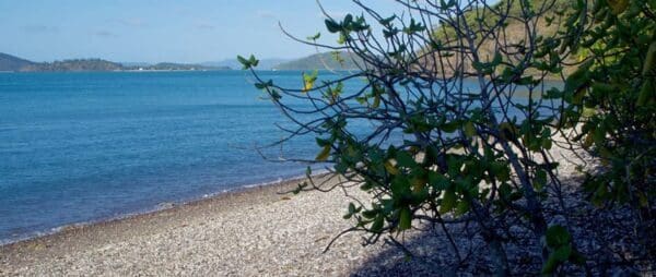
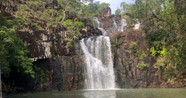
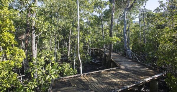
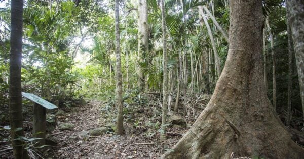
Paddle Bay Track is located on South Molle Island within Molle Islands National Park. White sandy beaches, pockets of rainforest and pale blue waters make these picturesque inshore islands a wildlife refuge and a scenic retreat for nature lovers. Open eucalypt forests clothe the hillsides, rainforest grows in sheltered gullies and grasslands cover the more exposed slopes.
The track winds down to a beach of coral fragments and continues along the beach away from the resort. A picnic area overlooks Daydream, Mid and North Molle islands. At low tide you can walk to Mid Molle Island access is restricted to the two-hour period before and after low tide. Check tides before setting out.
Tips
While you are on the islands, remove soil, weeds, seeds and pests from your boat, gear and clothes before moving to a new site. Wrap seeds and plant material, and place them in your rubbish.
Track grade
Grade 2 (Easy) - A Gentle Introduction to Inclines: Grade 2 on the AWTGS represents easy walking tracks that offer a slightly more challenging experience compared to Grade 1. Similar to Grade 1, no prior bushwalking experience is required. The track surface is typically hardened or compacted and may have gentle hill sections or occasional steps. The total distance of a Grade 2 walk is typically no greater than 10 kilometers. These walks are still suitable for families with a bit more experience or those seeking a gentle introduction to some inclines.
Walk map and GPX file
Max elevation: 29 m
Min elevation: 6 m
Total climbing: 47 m
Total descent: -47 m
Content use
Please don’t copy GPX files or content from this site to AllTrails or other platforms. Each trail has been personally mapped, documented, and refined to support Australia’s bushwalking and hiking community. While some details come from land managers, every listing reflects significant personal effort. This is a free, community-driven initiative—your respect helps keep it that way.
Gallery
Got any photos from this hike? Your photos can help others plan. Share shots from along the trail so fellow hikers know what to expect.
Click to add your photos >>
Getting there
Getting to the trailhead: Molle Islands National Park.
Molle Islands National Park is just east of Shute Harbour. Access is by private or commercial boat from Airlie Beach or Shute Harbour. Some commercial transfer companies drop off and collect campers, bushwalkers and mountain bike riders. Arrange your passage before booking your camp site.
The tracks can be accessed from Bauer Bay (follow the track from the Bauer Bay jetty to the back of the golf course) or from Sandy Bay camping area. Access from Paddle Bay is walking only.
Need a rental car to get you to the hike? Find one here.
Find a place to stay
Wondering where to stay near this hike? Find accommodation close to the trailhead — hotels, cabins and campgrounds nearby. Click the button to view the interactive map.
Closest towns to this walk: Airlie Beach, Cannonvale, Hamilton Island, Jubilee Pocket, Long Island, Proserpine, Shute Harbour
Let someone know
Heading out? Fill in a trip intentions form so someone knows your plans. If things go wrong, they can raise the alarm fast, giving you peace of mind on the trail.
About the region
Molle Islands National Park is in North Queensland, Australia, 913 km northwest of Brisbane. The park covers several continental islands a short distance offshore including Long Island, Shite Island, Tancred Island, Repair Island, Planton Island, Goat Island, Denman Island and the majority of North Molle Island, Mid Molle Island and South Molle Island. The park features white sandy beaches, open eucalypt forests, rainforest-clad gullies and grasslands. The traditional owners of the islands were the Ngaro people.
White sandy beaches, pockets of rainforest and pale blue waters make these picturesque inshore islands a wildlife refuge and a scenic retreat for nature lovers. Molle Islands National Park is a group of continental islands lying off the Queensland coast 10km east of Airlie Beach.
Open eucalypt forests clothe the hillsides, rainforest grows in sheltered gullies and grasslands cover the more exposed slopes. The Ngaro Aboriginal people lived on and visited these islands for thousands of years. They used fire to flush out game and maintain the natural grasslands. A stone quarry for making tools and weapons remains on South Molle Island.
Once used for grazing, South Molle Island later became a national park and a resort was established in 1937. The islands and surrounding waters are protected in the Great Barrier Reef World Heritage Area.
Enjoy stunning views along South Molle's shared tracks (walking and mountain bike riding) with a variety of vegetation, wildlife and spectacular destinations on offer.
Similar walks nearby
Looking for more walks in or near Molle Islands National Park? Try these trails with a similar difficulty grade.
Explore safe
Plan ahead and hike safely! Carry enough water, pack layers for changing conditions, and bring safety gear like a torch, PLB, and reliable communication device. Check official sources for trail updates, closures, and access requirements, and review local weather and bushfire advice. Most importantly, share your plans with someone before you go. Being prepared makes for a safer and more enjoyable hike! Stay Safe, Explore More, and Always #ExploreSafe.
Packing checklists
What you carry in your pack depends on factors like weather, terrain, and your adventure type. Not sure what to bring? My free planning, food, and packing checklists are a great starting point, covering day hikes, overnight trips, and multi-day adventures. Use them to customise your kit and always prioritise safety.
Suggest an edit
Notice something different about this trail? Whether it’s a new feature, a route change, or a closure, share your update so we can keep our info accurate and helpful for fellow hikers.
Click to suggest edits >>
Acknowledgement of Country
Trail Hiking Australia acknowledges the Traditional Owners of the lands on which we hike and pay respects to their Elders, past and present, and we acknowledge the First Nations people of other communities who may be here today.


