Hike at a Glance
Max elevation: 130m
Min elevation: 5m
Total Ascent: 549m
Important info
WARNING: The Onkaparinga Gorge is a demanding Grade 5 hike requiring a full day or overnight commitment. This is an unmarked route with no designated trail. Strong navigational skills, a GPS device, and PLB are essential for completing this adventure. Only experienced bushwalkers should attempt this hike.
Hike overview
Onkaparinga Gorge Hike: A Challenging Adventure for Experienced Bushwalkers. The Onkaparinga Gorge Hike is a demanding, full day or overnight adventure designed for experienced bushwalkers. This 17km, grade 5 hike traverses the entirety of Onkaparinga River National Park, a short drive south of Adelaide, following the Onkaparinga River from east to west.
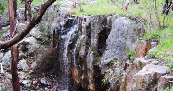
Be prepared for a remote and rugged experience. The hike primarily follows the riverbed itself, with no formed or maintained paths. You'll navigate towering cliffs, serene waterholes, and ancient river red gums, encountering obstacles, water crossings, and sections without established trails. Strong navigational skills and route-finding abilities are crucial for completing this challenging trek.
Importantly, this hike is only recommended during the summer months when the water levels are low. High water can render the route inaccessible and dangerous due to difficult or impossible river crossings.
Track grade
Grade 5 (Difficult) - Walks for the Most Experienced: Grade 5 represents the most challenging walking tracks on the AWTGS. These are only recommended for very experienced and fit walkers with specialised skills, including navigation and emergency first aid. Tracks are likely to be very rough, very steep, and unmarked. Walks may be more than 20 kilometers. These challenging walks demand a high level of fitness and experience to navigate difficult terrain, significant elevation changes, and potentially unformed paths.
Walk map and GPX file
Max elevation: 130 m
Min elevation: 5 m
Total climbing: 549 m
Total descent: -643 m
Content use
Please don’t copy GPX files or content from this site to AllTrails or other platforms. Each trail has been personally mapped, documented, and refined to support Australia’s bushwalking and hiking community. While some details come from land managers, every listing reflects significant personal effort. This is a free, community-driven initiative—your respect helps keep it that way.
Gallery
Got any photos from this hike? Your photos can help others plan. Share shots from along the trail so fellow hikers know what to expect.
Click to add your photos >>
Getting there
Getting to the trailhead: Onkaparinga River National Park.
While Onkaparinga River National Park itself sits roughly 35 kilometres south of Adelaide, the Onkaparinga Gorge Hike begins at a more specific location: Baker Gully Track. To reach this trailhead, you can drive. Head south on Main South Road until you see signs for Hackham. Take the exit and follow the signs to Onkaparinga River National Park. From there, follow Piggott Range Road until you reach the designated carpark for Baker Gully Track. Public transport isn’t available directly to the trailhead, so a car is the most convenient option.
Need a rental car to get you to the hike? Find one here.
About the region
Explore Onkaparinga River National Park's Rugged Beauty. Onkaparinga River National Park offers a diverse range of adventures. Hike to clifftops for stunning views or descend to permanent rock pools teeming with life. Witness the rugged ridges and the dramatic Onkaparinga Gorge, a haven for native vegetation. Spot koalas, kangaroos, birds, and maybe even an echidna.
Discover the park's rich history. Explore heritage-listed huts and ruins of 1880s houses, remnants of the area's past as farmland. Shared trails welcome mountain bikers and horse riders.
Located just 35km south of Adelaide, the park caters to all interests. Explore the main walking trails on the north side of the gorge, accessible via Piggott Range Road. Public transport is also available from Adelaide's city center.
Choose a scenic spot by the river or enjoy a more formal picnic area with amenities, barbecues, and stunning views. The area near gate 25 offers a shaded picnic ground with shelters, perfect for a relaxing meal. Nearby wineries provide the opportunity to pair your picnic with a delicious South Australian red wine.
The Pink Gum Campground at the park's eastern end provides 11 campsites, including caravan-friendly options. Amenities include toilets, washing facilities, and fire pits (usable outside fire ban seasons).
Important Note: The park closes on days of Catastrophic Fire Danger and may also be closed on days of Extreme Fire Danger. Please check fire danger ratings before visiting.
Find a place to stay
Wondering where to stay near this hike? Find accommodation close to the trailhead — hotels, cabins and campgrounds nearby. Click the button to view the interactive map.
Closest towns to this walk: Aldinga Beach, Christies Beach, McLaren Vale, Noarlunga Centre, O'Sullivan Beach, Old Noarlunga, Port Noarlunga, Reynella, Seaford, Willunga
Let someone know
Heading out? Fill in a trip intentions form so someone knows your plans. If things go wrong, they can raise the alarm fast, giving you peace of mind on the trail.
Similar walks nearby
Looking for more walks in or near Onkaparinga River National Park? Try these trails with a similar difficulty grade.
Suggest an edit
Notice something different about this trail? Whether it’s a new feature, a route change, or a closure, share your update so we can keep our info accurate and helpful for fellow hikers.
Click to suggest edits >>
Explore safe
Plan ahead and hike safely! Carry enough water, pack layers for changing conditions, and bring safety gear like a torch, PLB, and reliable communication device. Check official sources for trail updates, closures, and access requirements, and review local weather and bushfire advice. Most importantly, share your plans with someone before you go. Being prepared makes for a safer and more enjoyable hike! Stay Safe, Explore More, and Always #ExploreSafe.
Packing checklists
What you carry in your pack depends on factors like weather, terrain, and your adventure type. Not sure what to bring? My free planning, food, and packing checklists are a great starting point, covering day hikes, overnight trips, and multi-day adventures. Use them to customise your kit and always prioritise safety.
Acknowledgement of Country
Trail Hiking Australia acknowledges the Traditional Owners of the lands on which we hike and pay respects to their Elders, past and present, and we acknowledge the First Nations people of other communities who may be here today.


9 Reviews on “Onkaparinga Gorge Hike (17km)”
Just received this comment so thought I would share it here: Trail is completely missing. Had to bail out halfway. Go on this hike if you wanna kiss snakes on all fours for 8+ h, or swim the entire way.
and also one of the most spectacular ones
Emma Mickle add it to the list
Emma Mickle nahh you’re my fav