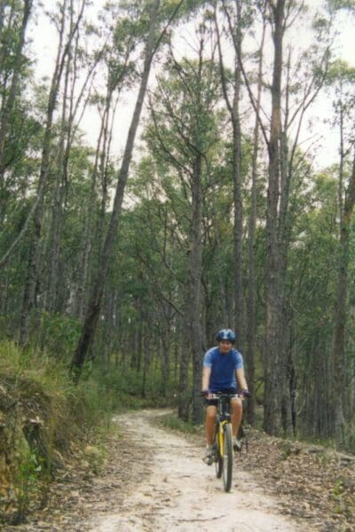
The Mushroom Rocks hike is a popular walk along a short section of the Australian Alpine Walking Track in the Baw Baw National Park. Commencing at the Mount Erica car park the narrow trail winds its way gradually upwards to lead to a maze of giant granite tors. If you felt like camping overnight there are a handful of level campsites scattered amongst the tors.
Optional walk - Beech Gully Track (400m, 30 min return)
Starting at the Mount Erica carpark, the Beech Gully Nature Walk provides an excellent introduction to the plants and wildlife of the Mountain Ash forests and cool temperate rainforests of the southern slopes of the Baw Baws.
J.W. McMahon Ski Lodge
The Lodge was built for the Scout Association and is not for private use. It sleeps approximately 20 people and equipment and is equipped with the following:
- Cooking utensils such as pots, plates and cutlery (it is advised to bring extra for larger groups)
- An outside pit toilet
- Duel fuel lighting and candles
- Dish washing equipment
- Pot belly stove for heating (limited wood supplied)
- Visitors need to supply their own food and sleeping gear, as well as an extra pair of shoes or slippers to wear only in the hut.
- Large parking area and toilets at the Mount Erica car park
- Fuel fires only
Grade 3 (Moderate) - Walks for Most Fitness Levels: Grade 3 on the
AWTGS represents moderate walking tracks. These are ideal for walkers with some fitness who are comfortable with some hills and uneven terrain. While suitable for most ages, some bushwalking experience is recommended to ensure a safe and enjoyable experience. Tracks may have short, steep hill sections, a rough surface, and many steps. The total distance of a Grade 3 walk can be up to 20 kilometers.
Total distance: 4273 m
Max elevation: 1242 m
Min elevation: 1107 m
Total climbing: 213 m
Total descent: -210 m
Content use
Please don’t copy GPX files or content from this site to AllTrails or other platforms. Each trail has been personally mapped, documented, and refined to support Australia’s bushwalking and hiking community. While some details come from land managers, every listing reflects significant personal effort. This is a free, community-driven initiative—your respect helps keep it that way.
Getting there
Getting to the trailhead: Baw Baw National Park.
Baw Baw National Park is approximately 120km east of Melbourne and 50km north of the Latrobe Valley. The main access to the plateau is from the Mount Erica and St Gwinear car parks along sign posted roads off the Thomson Valley Road (C481), north of Erica.
Need a rental car to get you to the hike? Find one here.
About the region
The Baw Baw National Park is a national park located on the boundaries between the Central Highlands and Gippsland regions of Victoria, Australia. The 13,530-hectare national park is situated approximately 120 kilometres east of Melbourne and 50 kilometres north of the Latrobe Valley.
Find a place to stay
Wondering where to stay near this hike? Find accommodation close to the trailhead — hotels, cabins and campgrounds nearby. Click the button to view the interactive map.
Closest towns to this walk: Drouin, Erica, Mount Baw Baw, Neerim South, Noojee, Rawson, Tanjil Bren, Tanjil South, Thorpdale, Tyers, Walhalla, Warragul, Willow Grove, Yarragon
Let someone know
Heading out? Fill in a trip intentions form so someone knows your plans. If things go wrong, they can raise the alarm fast, giving you peace of mind on the trail.
Similar walks nearby
Looking for more walks in or near Baw Baw National Park? Try these trails with a similar difficulty grade.
Favourite

Favourite

Favourite

Favourite

Suggest an edit
Notice something different about this trail? Whether it’s a new feature, a route change, or a closure, share your update so we can keep our info accurate and helpful for fellow hikers.
Click to suggest edits >>
Explore safe
Plan ahead and hike safely! Carry enough water, pack layers for changing conditions, and bring safety gear like a torch, PLB, and reliable communication device. Check official sources for trail updates, closures, and access requirements, and review local weather and bushfire advice. Most importantly, share your plans with someone before you go. Being prepared makes for a safer and more enjoyable hike! Stay Safe, Explore More, and Always #ExploreSafe.
Packing checklists
What you carry in your pack depends on factors like weather, terrain, and your adventure type. Not sure what to bring? My free planning, food, and packing checklists are a great starting point, covering day hikes, overnight trips, and multi-day adventures. Use them to customise your kit and always prioritise safety.
/Mushroom-Rocks-Walk_29.jpg)
/Mushroom-Rocks-Walk_24.jpg)
/Mushroom-Rocks-Walk_41.jpg)
/Mushroom-Rocks-Walk_10.jpg)
/Mushroom-Rocks-Walk_14.jpg)
/Mushroom-Rocks-Walk_39.jpg)
/Mushroom-Rocks-Walk_23.jpg)
/Mushroom-Rocks-Walk_40.jpg)
/Mushroom-Rocks-Walk_13.jpg)
/Mushroom-Rocks-Walk_22.jpg)
/Mushroom-Rocks-Walk_17.jpg)
/Mushroom-Rocks-Walk_45.jpg)
/Mushroom-Rocks-Walk_3.jpg)
/Mushroom-Rocks-Walk_44.jpg)
/Mushroom-Rocks-Walk_2.jpg)


3 Reviews on “Mushroom Rocks Walk (4.25km)”
Got Mt Buffalo on my visit list for Dec.
Andy Grope lucky you. Enjoy. It’s been a few years since I was up there.
A great hike!
This is a great little hike. Exploring around mushroom rocks is a lot of fun. Nice spot for an overnight camp too.