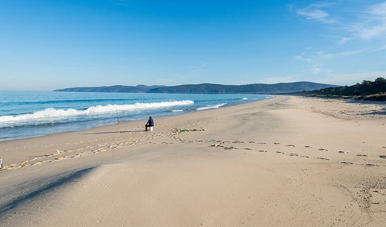
Enjoy spectacular views of the surrounding forests and heathlands as well as Point Hicks and the dunes from a large sloping rock face on Mount Everard. The track commences from the car park on the Mount Everard Track. To access the track, turn off the Point Hicks Rd onto Cicada Trail (4WD only), 6km north of Thurra River Campground.
- Make sure that you have a 'moderate fitness level' as some parts of this trail are quite steep. Acess the track with a 4WD vehicle.
- There is no mobile phone reception in the area.
- You will know when you have reached top when you get to the surveying point at the top.
Contributed by Eisak Tabensky
Please don’t copy GPX files or content from this site to AllTrails or other platforms. Each trail has been personally mapped, documented, and refined to support Australia’s bushwalking and hiking community. While some details come from land managers, every listing reflects significant personal effort. This is a free, community-driven initiative—your respect helps keep it that way.
WP GPX Maps Error: GPX file not found! /home/trailhik/public_html/wp-content/uploads/gpx/Mount Everard.gpx
Getting there
Getting to the trailhead: Croajingolong National Park.
Croajingolong National Park in Far East Gippsland is located approximately 450km east of Melbourne and 500km south of Sydney. The park is accessed from multiple points along the Princes Highway between Cann River and the New South Wales border. Roads to Wingan Inlet, Mueller Inlet, Thurra River and Shipwreck Creek campgrounds are unsealed and not recommended for caravans. Access is weather dependent.
Follow M1 to Newborough. Take the exit towards Moe/Newborough/Yallourn Nth at C103 from the M1. Follow C103 and Cairnbrook Rd and get onto the Princes Hwy/A1 in Rosedale. Follow the Princes Hwy to Cann River. At Cann River, turn onto Tamboon Road and then onto Point Hicks Road. Turn off the Point Hicks Rd onto Cicada Trail (4WD only), 6km north of Thurra River Campground. The trail commences from the car park on the Mount Everard Track.
Closest towns to this walk: Bemm River, Cann River, Eden, Genoa, Mallacoota, Marlo, Orbost, Tamboon
About the region
The Croajingolong National Park is a coastal national park in the East Gippsland region of the Australian state of Victoria. The 88,355-hectare national park is situated approximately 450 kilometres east of Melbourne and 500 kilometres south of Sydney.
Similar walks nearby
Looking for more walks in or near Croajingolong National Park? Try these trails with a similar difficulty grade.
Favourite

Croajingolong National Park
Favourite

Favourite

Beowa (Ben Boyd) National Park
Favourite

Beowa (Ben Boyd) National Park
Track grade
Grade 3 (Moderate) - Walks for Most Fitness Levels: Grade 3 on the
AWTGS represents moderate walking tracks. These are ideal for walkers with some fitness who are comfortable with some hills and uneven terrain. While suitable for most ages, some bushwalking experience is recommended to ensure a safe and enjoyable experience. Tracks may have short, steep hill sections, a rough surface, and many steps. The total distance of a Grade 3 walk can be up to 20 kilometers.
Explore safe
Plan ahead and hike safely! Carry enough water, pack layers for changing conditions, and bring safety gear like a torch, PLB, and reliable communication device. Check official sources for trail updates, closures, and access requirements, and review local weather and bushfire advice. Most importantly, share your plans with someone before you go. Being prepared makes for a safer and more enjoyable hike! Stay Safe, Explore More, and Always #ExploreSafe.
Packing checklists
What you carry in your pack depends on factors like weather, terrain, and your adventure type. Not sure what to bring? My free planning, food, and packing checklists are a great starting point, covering day hikes, overnight trips, and multi-day adventures. Use them to customise your kit and always prioritise safety.
Let someone know
Before heading out, take a moment to fill out your trip intentions form. It’s a quick way to share your hike details with family or friends. If something goes wrong, they can notify emergency services, ensuring a faster response and peace of mind. Stay safe and enjoy your adventure
Suggest an edit
Spotted a change on this trail? Maybe there are new features, the route has shifted, or the trail is permanently closed. Whatever the update, I’d love your input. Your feedback helps fellow hikers stay informed and ensures that our trail info stays fresh and reliable.
/Mount-Everard-Hike_3.jpg)
/Mount-Everard-Hike_1.jpg)
/Mount-Everard-Hike_2.jpg)


