Sorry, no records were found. Please adjust your search criteria and try again.
Sorry, unable to load the Maps API.
Explore stunning hiking trails of Croajingolong National Park
Discover the diverse trails of Croajingolong National Park, Victoria, offering hikes and walks for all skill levels and interests. Find your perfect adventure today.
Discover 4 hiking trails in Croajingolong National Park



Where Victoria’s Far East Coast Stretches Wild and Long
Overview
Croajingolong National Park runs along far eastern Victoria for about 100 kilometres, from Sydenham Inlet to the New South Wales border. About 430 kilometres east of Melbourne, it protects a long, varied section of coast shaped by inlets, estuaries, dune systems, rocky headlands and forested hinterland. The park is also part of the Croajingolong Biosphere Reserve, recognised through UNESCO’s Man and the Biosphere Program.
What makes this place stand out is the contrast packed into one long coastal strip. You get sheltered inlets and lagoons, long beaches, prominent cliffs, extensive sand dunes and pockets of rainforest, all within the same protected landscape. Much of the park remains lightly developed, which gives it a sense of scale and quiet that is increasingly rare on the Victorian coast.
Highlights
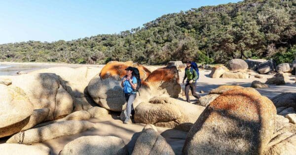
The scenery here is defined by water and sand. Tamboon, Wingan and Mallacoota inlets are among the park’s best-known natural features, and they sit within a coastline of estuaries, lagoons and dune-blocked lakes that change character from one section to the next. There are also striking rocky points and cliffs, especially where the forested land drops abruptly to the sea.
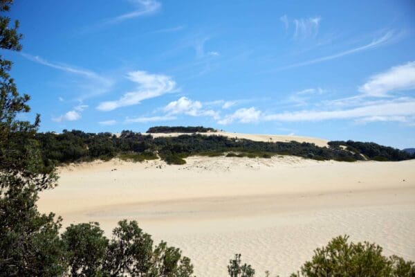
Some of the park’s standout landforms are its dune systems. Near Thurra River, the dunes rise high above the coast, while elsewhere the park protects extensive sand sheets, freshwater interdune lakes and swamp systems. Around Howe Flat and Lake Barracoota, the landscape shifts again into one of the park’s most important wetland areas, with Lake Barracoota notable as Victoria’s largest freshwater coastal lake.
Best Time to Visit
Croajingolong suits different kinds of visits across the year. Warmer months are best if you want long daylight, milder conditions on the coast and calmer weather around the inlets. Autumn can be especially appealing, with more settled conditions and fewer holiday crowds, while spring usually brings fresh growth through the heathlands and forests.
In winter, the park can feel quieter and more atmospheric, particularly around the coast and larger inlets, though cooler temperatures make it better suited to walkers who enjoy brisk conditions rather than beach weather. Because this is such a large park with both coastal and forest environments, the feel of the place changes noticeably with the season.
Plants and Animals
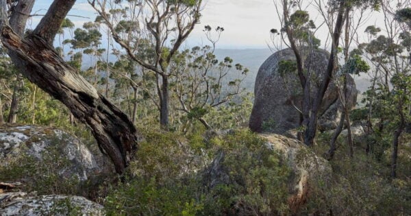
The range of habitats is one of Croajingolong’s real strengths. Coastal heathland covers a substantial part of the park and is especially rich in plant life. Elsewhere, there are forests, wetlands, lagoons and significant rainforest pockets, including warm temperate rainforest at unusually low elevations near the coast and an important overlap of warm and cool temperate rainforest in the Howe Range.
This variety of country supports a long list of native wildlife, including many threatened species. The park is known habitat for animals such as the Ground Parrot, Eastern Bristlebird and Powerful Owl, and it also protects The Skerries, an important breeding site for seabirds and one of Victoria’s Australian Fur Seal colonies. Around the inlets and forests, birdlife is a constant part of the experience, and the change from heath to wetland to tall timber means the wildlife can feel very different from one area to the next.
Find more places to explore…
Help expand the trail collection!
Know of an official trail not listed on Trail Hiking Australia? I’m focused on showcasing the best tracks managed by land managers, and I’d love your help! Sharing a trail adds to our community and helps others discover safe, new adventures.
Submit your trail here

