Hike at a Glance
Max elevation: 0m
Min elevation: 0m
Total Ascent: 0m
Hike overview
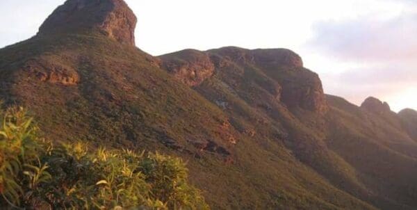
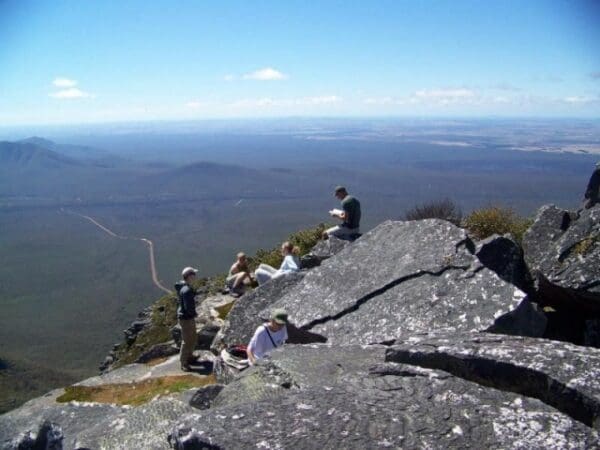
Mount Arid walk trail is in Cape Arid National Park and can only be accessed via Yokinup Bay. 4WD accessible ONLY. Tides and weather conditions must be consulted before driving on the beach. Spectacular views to the south and west overlooking the RecherchÃÆÆ© Archipelago. Two kilometre return hike to the summit of Mount Arid.
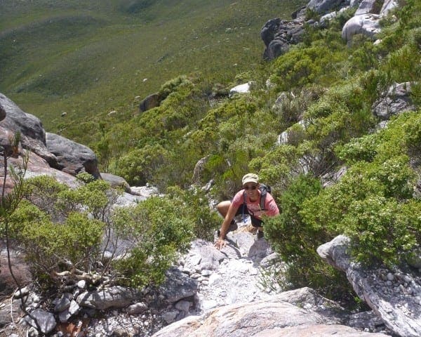
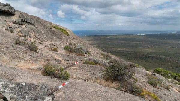
Mount Arid hike is a challenging 2km steep climb to the summit. The trail is narrow and unmarked apart from where the vegetation has been trimmed to delineate the path or an occasional wooden marker peg is used over the exposed granite. Though can be difficult to follow over granite rocks where it is quiet open. Walk trail surface consists of natural pavements made up of loose rocky material including gravel and granite rock. Walkers need to watch where they are placing their feet. The walk trail leaves Mount Arid Car Park and ascends to the summit. The begining of the walk is a gentle slope winding through low coastal heath but becomes challenging. Spectacular views to the south and west overlooking the RecherchÃÆÆ© Archipelago. Slip risk especially when wet and over uneven surfaces. Cape Barren geese are often seen on the beach in front of Mount Arid on Arid Bay as well as Hooded plovers that use the coastal beaches as breeding grounds laying their eggs directly on the sand. To get to the trail you must first 4WD to the start. Enter onto Yokinup Bay via Thomas River Road. Follow the beach and headlands around for 20km until turnoff for Mount Arid Car Park from the beach. Beware that sign for turnoff is well back from beach so high tides and swell don't wash sign away. It can often be difficult to see so set your odometre. Experience with beach driving essential.
Tips
Start Point: Enter onto Yokinup bay via Thomas River Road. Follow the beach and headlands around for 20km until turnoff for Mount Arid Car Park
End Point: Enter onto Yokinup bay via Thomas River Road. Follow the beach and headlands around for 20km until turnoff for Mount Arid Car Park
Region: Cape Arid National Park, Golden Outback
For more information, a location map and GPS file please visit Trails WA.
Track grade
Grade 5 (Difficult) - Walks for the Most Experienced: Grade 5 represents the most challenging walking tracks on the AWTGS. These are only recommended for very experienced and fit walkers with specialised skills, including navigation and emergency first aid. Tracks are likely to be very rough, very steep, and unmarked. Walks may be more than 20 kilometers. These challenging walks demand a high level of fitness and experience to navigate difficult terrain, significant elevation changes, and potentially unformed paths.
Walk map and GPX file
Do you have a GPX file for this hike? Feel free to email it to me so I can add it to this hikes info.
Click to add your file >>
Content use
Please don’t copy GPX files or content from this site to AllTrails or other platforms. Each trail has been personally mapped, documented, and refined to support Australia’s bushwalking and hiking community. While some details come from land managers, every listing reflects significant personal effort. This is a free, community-driven initiative—your respect helps keep it that way.
Gallery
Got any photos from this hike? Your photos can help others plan. Share shots from along the trail so fellow hikers know what to expect.
Click to add your photos >>
Getting there
Getting to the trailhead: Cape Arid National Park.
Need a rental car to get you to the hike? Find one here.
Find a place to stay
Wondering where to stay near this hike? Find accommodation close to the trailhead — hotels, cabins and campgrounds nearby. Click the button to view the interactive map.
Closest towns to this walk: Cape Le Grand, Condingup, Esperance, Munglinup, Nornalup, Ravensthorpe, Salmon Gums, Salmon Gums Balladonia, Scaddan Balladonia
Let someone know
Heading out? Fill in a trip intentions form so someone knows your plans. If things go wrong, they can raise the alarm fast, giving you peace of mind on the trail.
About the region
Cape Arid National Park is a wildly beautiful and biodiverse area. Coastal sandheaths, mallee and low granite hills extend inland to Mount Ragged after which the vegetation is transformed into woodlands dominated by saltbush and bluebush. The jagged Russell Range, which rises to its highest point at Tower Peak (almost 600m), comprises ancient uplifted quartzite that has the same origins as the Barrens Range in Fitzgerald River National Park.
Similar walks nearby
Looking for more walks in or near Cape Arid National Park? Try these trails with a similar difficulty grade.
Explore safe
Plan ahead and hike safely! Carry enough water, pack layers for changing conditions, and bring safety gear like a torch, PLB, and reliable communication device. Check official sources for trail updates, closures, and access requirements, and review local weather and bushfire advice. Most importantly, share your plans with someone before you go. Being prepared makes for a safer and more enjoyable hike! Stay Safe, Explore More, and Always #ExploreSafe.
Packing checklists
What you carry in your pack depends on factors like weather, terrain, and your adventure type. Not sure what to bring? My free planning, food, and packing checklists are a great starting point, covering day hikes, overnight trips, and multi-day adventures. Use them to customise your kit and always prioritise safety.
Suggest an edit
Notice something different about this trail? Whether it’s a new feature, a route change, or a closure, share your update so we can keep our info accurate and helpful for fellow hikers.
Click to suggest edits >>
Acknowledgement of Country
Trail Hiking Australia acknowledges the Traditional Owners of the lands on which we hike and pay respects to their Elders, past and present, and we acknowledge the First Nations people of other communities who may be here today.


