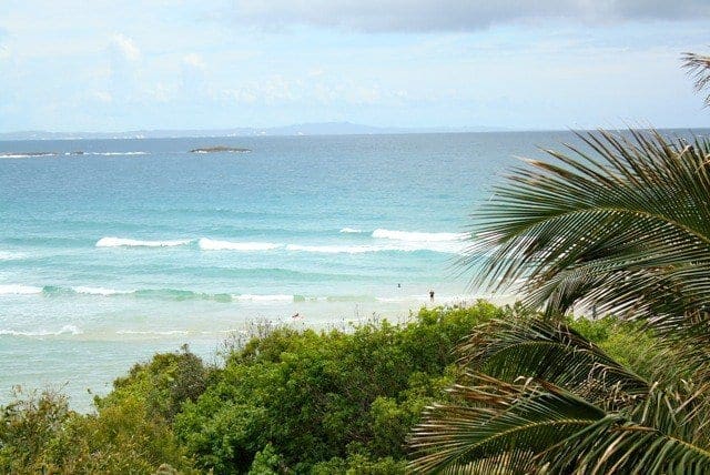
Moreton Island is the most natural of the large sand islands in Moreton Bay's sheltered waters. At 285 metres high, Mount Tempest is the highest stabilised sand dune in the world. The walk to the top of Mount Tempest is a memorable one, with sweeping views of Moreton Bay and the island's length a spectacular experience. Enjoy the wildflowers in spring and look for migrating humpback whales in late winter and spring.
Got some great shots from this hike? Upload your photos here to inspire others and show off the beauty of the trail!
Submitting your photos doesn’t mean you lose ownership. You can be credited for your contributions, and you can request removal at any time.
Please don’t copy GPX files or content from this site to AllTrails or other platforms. Each trail has been personally mapped, documented, and refined to support Australia’s bushwalking and hiking community. While some details come from land managers, every listing reflects significant personal effort. This is a free, community-driven initiative—your respect helps keep it that way.
It looks like I don’t have a GPX file for this trail yet. If you have one to share, please email it to me! I’ll verify it against official maps before adding it to help other hikers have a safer, easier experience. Thanks for contributing to a better hiking resource.
Getting there
Getting to the trailhead: Moreton Island National Park.
Closest towns to this walk: Amity Point, Bulwer, Dunwich, Kooringal, Point Lookout, Tangalooma
About the region
Tall sand dunes, miles of sandy beaches, crystal clear creeks and lagoons, coastal heath, rocky headlands and abundant wildflowers make Mulgumpin (Moreton Island) a jewel in Moreton Bay. Mulgumpin (Moreton Island) features crystal clear creeks and lagoons, coastal heath, rocky headlands, abundant wildflowers, tall sand dunes, an historic lighthouse, ruins of coastal forts and miles of sandy beaches.
Most of Mulgumpin (Moreton Island) is both national park and recreation area, which covers the national park to high water mark and the beaches to low water mark. Tidal wetlands and waters around the island are protected as part of Moreton Bay Marine Park.
Similar walks nearby
Looking for more walks in or near Moreton Island National Park? Try these trails with a similar difficulty grade.
Favourite

Redcliffe Botanic Gardens
Favourite

Favourite

Favourite

Track grade
Grade 2 (Easy) - A Gentle Introduction to Inclines: Grade 2 on the
AWTGS represents easy walking tracks that offer a slightly more challenging experience compared to Grade 1. Similar to Grade 1, no prior bushwalking experience is required. The track surface is typically hardened or compacted and may have gentle hill sections or occasional steps. The total distance of a Grade 2 walk is typically no greater than 10 kilometers. These walks are still suitable for families with a bit more experience or those seeking a gentle introduction to some inclines.
Explore safe
Plan ahead and hike safely! Carry enough water, pack layers for changing conditions, and bring safety gear like a torch, PLB, and reliable communication device. Check official sources for trail updates, closures, and access requirements, and review local weather and bushfire advice. Most importantly, share your plans with someone before you go. Being prepared makes for a safer and more enjoyable hike! Stay Safe, Explore More, and Always #ExploreSafe.
Packing checklists
What you carry in your pack depends on factors like weather, terrain, and your adventure type. Not sure what to bring? My free planning, food, and packing checklists are a great starting point, covering day hikes, overnight trips, and multi-day adventures. Use them to customise your kit and always prioritise safety.
Let someone know
Before heading out, take a moment to fill out your trip intentions form. It’s a quick way to share your hike details with family or friends. If something goes wrong, they can notify emergency services, ensuring a faster response and peace of mind. Stay safe and enjoy your adventure
Suggest an edit
Spotted a change on this trail? Maybe there are new features, the route has shifted, or the trail is permanently closed. Whatever the update, I’d love your input. Your feedback helps fellow hikers stay informed and ensures that our trail info stays fresh and reliable.


9 Reviews on “Mount Tempest Lookout Walk (2.5km)”
There are some great walks on Morton Island that we describe in our book Take A Walk in South East Queensland
Fiona Butterworth
Bob Manthey