Hike at a Glance
Max elevation: 0m
Min elevation: 0m
Total Ascent: 0m
Hike overview
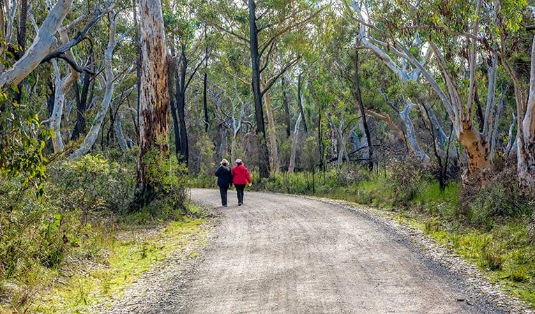
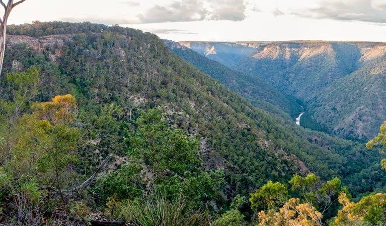
Mount Penang loop walk is only 3km, but you'll need to be a relatively experienced bushwalker nonetheless, due to the short but steep hills and unmarked trail. The effort will be worth it though, as at the peak you'll be able to enjoy soaking in some truly amazing 360-degree views from the summit of Mount Penang.
Beginning at Tugalong Road, this challenging but rewarding loop winds steadily uphill and continues on to the scenic summit of Mount Penang. Take in the awe-inspiring views from the top, savour the serenity of your surroundings, and look out for local birdlife soaring overhead before making your way back.
This walk is best enjoyed during the more temperate seasons of spring and autumn.
Tips
Drinking water is not available in this area, so it's a good idea to bring your own.
It's a good idea to put sunscreen on before you set out and remember to take a hat.
This park is in a remote location and weather can be unpredictable, so please ensure you're well-prepared for your visit.
If you're bushwalking in this park, it's a good idea to bring a topographic map and compass, or a GPS.
There is limited/no mobile reception in this park.
Visit NSW National Parks and Wildlife Service for more information on this trail.
The longitude and latitude of the start and end points are approximately only and should not be used for navigation purposes. Please contact me if you know the correct coordinates.
Gallery
Got some great shots from this hike? Upload your photos here to inspire others and show off the beauty of the trail!
Click to view form >>
Submitting your photos doesn’t mean you lose ownership. You can be credited for your contributions, and you can request removal at any time.
Content use
Please don’t copy GPX files or content from this site to AllTrails or other platforms. Each trail has been personally mapped, documented, and refined to support Australia’s bushwalking and hiking community. While some details come from land managers, every listing reflects significant personal effort. This is a free, community-driven initiative—your respect helps keep it that way.
Walk map and GPX file
It looks like I don’t have a GPX file for this trail yet. If you have one to share, please email it to me! I’ll verify it against official maps before adding it to help other hikers have a safer, easier experience. Thanks for contributing to a better hiking resource.
Getting there
Getting to the trailhead: Bangadilly National Park.
To Mount Penang access. Mount Penang walk is in the north section of Bangadilly National Park. To get there:From Sydney or Goulburn:Exit the freeway at Sutton Forest (exit signposted as ‘Illawarra Highway – Moss Vale, Wollongong’). Follow the signs to Canyonleigh for 10km along Canyonleigh Road, then turn right into Tugalong Road. Travel 22km along Tugalong Road until you come to Attunga Camp on your left and the park on your right. Park at the entrance to the park fire trail and walk into the park. Park entry points Mount Penang access See on map Parking Parking is available at the fire trail entrance on Tugalong Road. Bus parking is available.
Closest towns to this walk: Bowral, Bundanoon, Exeter, Moss Vale, Wingello
About the region
Bangadilly National Park in the Country NSW region
Bangadilly National Park is always open but may have to close at times due to poor weather or fire danger.
Similar walks nearby
Looking for more walks in or near Bangadilly National Park? Try these trails with a similar difficulty grade.
Track grade
Grade 5 (Difficult) - Walks for the Most Experienced: Grade 5 represents the most challenging walking tracks on the AWTGS. These are only recommended for very experienced and fit walkers with specialised skills, including navigation and emergency first aid. Tracks are likely to be very rough, very steep, and unmarked. Walks may be more than 20 kilometers. These challenging walks demand a high level of fitness and experience to navigate difficult terrain, significant elevation changes, and potentially unformed paths.
Explore safe
Plan ahead and hike safely! Carry enough water, pack layers for changing conditions, and bring safety gear like a torch, PLB, and reliable communication device. Check official sources for trail updates, closures, and access requirements, and review local weather and bushfire advice. Most importantly, share your plans with someone before you go. Being prepared makes for a safer and more enjoyable hike! Stay Safe, Explore More, and Always #ExploreSafe.
Packing checklists
What you carry in your pack depends on factors like weather, terrain, and your adventure type. Not sure what to bring? My free planning, food, and packing checklists are a great starting point, covering day hikes, overnight trips, and multi-day adventures. Use them to customise your kit and always prioritise safety.
Let someone know
Before heading out, take a moment to fill out your trip intentions form. It’s a quick way to share your hike details with family or friends. If something goes wrong, they can notify emergency services, ensuring a faster response and peace of mind. Stay safe and enjoy your adventure
Suggest an edit
Spotted a change on this trail? Maybe there are new features, the route has shifted, or the trail is permanently closed. Whatever the update, I’d love your input. Your feedback helps fellow hikers stay informed and ensures that our trail info stays fresh and reliable.
Acknowledgement of Country
Trail Hiking Australia acknowledges the Traditional Owners of the lands on which we hike and pay respects to their Elders, past and present, and we acknowledge the First Nations people of other communities who may be here today.


