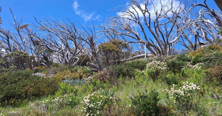
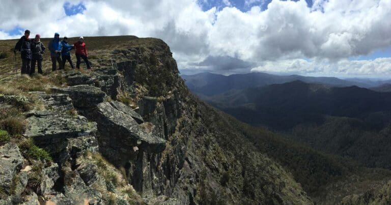
The Mount McDonald and The Nobs hike summits Mount McDonald which lies at the heart of one of the wildest and least known regions deep within the Alpine National Park. Sandwiched between the remote Macalister and Jamieson Rivers, its rarely visited summit offers hikers a genuine sense of escape. The rugged north ridge provides a direct steep climb to the summit.
Mount MacDonald is a 1,402 m mountain peak near Mansfield, Victoria, Australia. Based on peakery data, it ranks as the 17th highest mountain in Victoria and the 82nd highest mountain in Australia. The nearest peaks are Mount Magdala, Mount Skene, Mount Buller, Mount Howitt, Mount Tamboritha, and Mount Cobbler.
Be Prepared
This hike requires that you have a sufficient level of equipment (in good working order), fitness and self-reliance.
Please don’t copy GPX files or content from this site to AllTrails or other platforms. Each trail has been personally mapped, documented, and refined to support Australia’s bushwalking and hiking community. While some details come from land managers, every listing reflects significant personal effort. This is a free, community-driven initiative—your respect helps keep it that way.
Total distance: 19798 m
Max elevation: 1597 m
Min elevation: 783 m
Total climbing: 1138 m
Total descent: -1138 m
Getting there
Getting to the trailhead: Alpine National Park.
From Mansfield, continue along the Mount Buller Road for 19.5km to Merijig, then a further 2km to the Howqua Track turnoff on the right. Follow the unsealed Howqua Track for 16.5km to Sheepyard Flat. Continue through the flat and along Brocks Road (which becomes a bit rougher) for 19.5km to Eight Mile Gap. Turn right and descend the steep winding road to the banks of the Jamieson River. Continue a further 800m to park in the clearing next to the river, about 200m before reaching the Low Saddle Road turnoff.
Camping at Sheepyard Flat on the first night and heading to the start point will ensure you get an early start. Return to Sheepyard Flat on the last night to camp is you are feeling tired.
Closest towns to this walk: Benalla, Bright, Dinner Plain, Falls Creek, Harrietville, Hotham Heights, Mansfield, Mitta Mitta, Mount Beauty, Mount Hotham, Myrtleford, Omeo, Porepunkah, Tawonga South, Wangaratta
Access conditions
- 2WD Access
- Gravel Road
- Steep Road
- Winding Road
- Untreated Water
- Camping Area
About the region
The Alpine National Park is a national park in the Central Highlands and Alpine regions of Victoria, Australia. The 646,000-hectare national park is located northeast of Melbourne. It is the largest National Park in Victoria, and covers much of the higher areas of the Great Dividing Range in Victoria, including Victoria's highest point, Mount Bogong at 1,986 metres and the associated subalpine woodland and grassland of the Bogong High Plains. The park's north-eastern boundary is along the border with New South Wales, where it abuts the Kosciuszko National Park.
Similar walks nearby
Looking for more walks in or near Alpine National Park? Try these trails with a similar difficulty grade.
Favourite

Favourite

Favourite

Favourite

Track grade
Grade 4 (Hard) -
Challenging Walks for Experienced Walkers: Grade 4 on the
AWTGS signifies challenging walking tracks. Bushwalking experience is recommended for these tracks, which may be long, rough, and very steep. Directional signage may be limited, requiring a good sense of navigation. These walks are suited for experienced walkers who are comfortable with steeper inclines, rougher terrain, and potentially longer distances.
Explore safe
Plan ahead and hike safely! Carry enough water, pack layers for changing conditions, and bring safety gear like a torch, PLB, and reliable communication device. Check official sources for trail updates, closures, and access requirements, and review local weather and bushfire advice. Most importantly, share your plans with someone before you go. Being prepared makes for a safer and more enjoyable hike! Stay Safe, Explore More, and Always #ExploreSafe.
Packing checklists
What you carry in your pack depends on factors like weather, terrain, and your adventure type. Not sure what to bring? My free planning, food, and packing checklists are a great starting point, covering day hikes, overnight trips, and multi-day adventures. Use them to customise your kit and always prioritise safety.
Let someone know
Before heading out, take a moment to fill out your trip intentions form. It’s a quick way to share your hike details with family or friends. If something goes wrong, they can notify emergency services, ensuring a faster response and peace of mind. Stay safe and enjoy your adventure
Suggest an edit
Spotted a change on this trail? Maybe there are new features, the route has shifted, or the trail is permanently closed. Whatever the update, I’d love your input. Your feedback helps fellow hikers stay informed and ensures that our trail info stays fresh and reliable.
/Mount-Mcdonald-&-the-Nobs-Hike_39.jpg)
/Mount-Mcdonald-&-the-Nobs-Hike_1.jpg)
/Mount-Mcdonald-&-the-Nobs-Hike_28.jpg)
/Mount-Mcdonald-&-the-Nobs-Hike_18.jpg)
/Mount-Mcdonald-&-the-Nobs-Hike_31.jpg)
/Mount-Mcdonald-&-the-Nobs-Hike_14.jpg)
/Mount-Mcdonald-&-the-Nobs-Hike_34.jpg)
/Mount-Mcdonald-&-the-Nobs-Hike_26.jpg)
/Mount-Mcdonald-&-the-Nobs-Hike_23.jpg)
/Mount-Mcdonald-&-the-Nobs-Hike_37.jpg)
/Mount-Mcdonald-&-the-Nobs-Hike_19.jpg)
/Mount-Mcdonald-&-the-Nobs-Hike_36.jpg)
/Mount-Mcdonald-&-the-Nobs-Hike_24.jpg)
/Mount-Mcdonald-&-the-Nobs-Hike_29.jpg)
/Mount-Mcdonald-&-the-Nobs-Hike_15.jpg)


5 Reviews on “Mount Mcdonald & the Nobs Hike (19.8km)”
Laura Tonzing