Hike at a Glance
Max elevation: 357m
Min elevation: 160m
Total Ascent: 829m
Hike overview
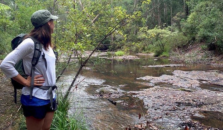
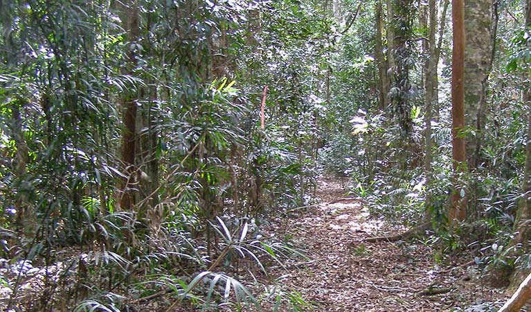
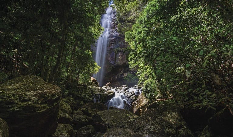
Minyon Falls walking track is a journey through some of the most striking landscapes in Nightcap National Park, offering a mix of lush rainforest, rugged escarpments, and cascading waterfalls. This 13km return hike, graded moderate, takes around 3.5 hours to complete and is a popular choice for those exploring the hinterland beyond Byron Bay. It’s a track that rewards with both grand views and quiet moments, weaving through dense forest and alongside crystal-clear creeks.
The trail winds through the Nightcap escarpment, where towering brushbox trees rise above a tangle of vines and ferns. On the western side of Repentance Creek, a stand of ancient brushbox trees provides a glimpse into the untouched wilderness that once covered vast stretches of northern New South Wales. Keep an eye out for birdlife flitting through the canopy—wompoo fruit-doves call from above, while whipbirds and lyrebirds add their distinctive voices to the sounds of the forest.
For those wanting a peaceful break, the fern-lined creeks along the way offer quiet spots to pause and soak in the surroundings. The track links up with the Boggy Creek walk, which extends north to Rummery Park campground in the neighbouring Whian Whian State Conservation Area, making it an excellent option for those wanting to explore further.
Hikers can begin their walk from either of the picnic areas near Minyon Falls. Minyon Grass picnic area, a short distance from the main falls lookout, is a great spot to unwind. With picnic tables and sweeping views of the falls and surrounding forest, it’s a quieter alternative to the more frequented Minyon Falls lookout, making it ideal for those wanting a more relaxed experience after the hike.
Tips
- Please note there is no public access within 100m of the top of Minyon Falls.
- This walk is in a remote location and weather can be unpredictable, so please ensure you’re well-prepared, bring appropriate clothing and equipment, and advise a family member or friend of your travel plans.
Gallery
Got some great shots from this hike? Upload your photos here to inspire others and show off the beauty of the trail!
Click to view form >>
Submitting your photos doesn’t mean you lose ownership. You can be credited for your contributions, and you can request removal at any time.
Content use
Please don’t copy GPX files or content from this site to AllTrails or other platforms. Each trail has been personally mapped, documented, and refined to support Australia’s bushwalking and hiking community. While some details come from land managers, every listing reflects significant personal effort. This is a free, community-driven initiative—your respect helps keep it that way.
Walk map and GPX file
Max elevation: 357 m
Min elevation: 160 m
Total climbing: 829 m
Total descent: -829 m
Getting there
Getting to the trailhead: Nightcap National Park.
Reaching the trailhead for Minyon Falls walking track involves a scenic drive through the rolling hinterland of northern New South Wales. There are two main approaches to this section of Nightcap National Park—one from the north and east, the other from the south. From Bangalow, the route winds through Clunes and the quiet village of Rosebank before following Repentance Creek Road into the forested foothills. From Lismore, the drive takes you through Modanville, Dunoon, and Dorroughby, with Nightcap Range Road offering a gradual transition from farmland to dense national park.
Travellers from Brisbane can take a picturesque detour via Coolamon Scenic Drive, passing through Coorabell and Federal before connecting to Repentance Creek Road. Whichever way you come, the final stretch along Minyon Falls Road leads past Wren’s Nest Café before reaching the park entrance, where Minyon Drive guides the way to the falls. Parking is available at both Minyon Falls and Minyon Grass picnic areas, though it can fill up quickly on weekends and holidays. Arriving early is the best way to secure a spot and enjoy the tranquillity before the crowds arrive.
Closest towns to this walk: Bangalow, Brunswick Heads, Clunes, Dunoon, Lismore, Mullumbimby, Nimbin, The Channon
About the region
Nightcap National Park
Nightcap National Park, located near Lismore in north-eastern New South Wales, is a stunning retreat into one of the most ancient and pristine landscapes in the country. This park is part of the Gondwana Rainforests of Australia World Heritage Area, where you can lose yourself in the grandeur of old-growth rainforests, crystal-clear creeks, and dramatic escarpments. The park’s natural beauty and significance offer both a peaceful escape and an opportunity to connect with Australia’s deep history.
As you wander through Nightcap’s lush rainforest, you’ll encounter a diverse range of plant and animal life. The park is home to the newly discovered nightcap oak, a rare and remarkable species, as well as several threatened animals like Albert's lyrebird and Fleay's barred frog. These frogs, with their distinctive "ok-ok-ok-ok-ok" call after rain, can often be heard sheltering beneath the leaf litter, adding a magical soundtrack to the forest's natural symphony.
Minyon Falls, one of the park’s most celebrated features, offers breathtaking views from its lookout. Here, the landscape stretches out before you, showcasing the grandeur of the surrounding rainforests and escarpments. The sight of water cascading over the cliff face into the valley below is truly spectacular, providing a sense of awe and connection to the land’s natural forces. Nearby, the Rummery Park campground offers a comfortable base for those wishing to stay overnight and fully immerse themselves in the park’s beauty.
Nightcap National Park is easily accessible from both Lismore and Nimbin, making it a great option for day trips or longer stays. Whether you're enjoying a picnic by the creek, embarking on a bushwalk through the rainforest, or camping under the stars, the park offers a range of experiences. Its rich natural history, combined with incredible views of the 20-million-year-old Wollumbin shield volcano, makes it a truly unique destination. For those interested in the park’s past, there is also the chance to learn about the history of Terania Creek and the passionate protests that helped preserve this extraordinary place.
Similar walks nearby
Looking for more walks in or near Nightcap National Park? Try these trails with a similar difficulty grade.
Track grade
Grade 3 (Moderate) - Walks for Most Fitness Levels: Grade 3 on the AWTGS represents moderate walking tracks. These are ideal for walkers with some fitness who are comfortable with some hills and uneven terrain. While suitable for most ages, some bushwalking experience is recommended to ensure a safe and enjoyable experience. Tracks may have short, steep hill sections, a rough surface, and many steps. The total distance of a Grade 3 walk can be up to 20 kilometers.
Explore safe
Plan ahead and hike safely! Carry enough water, pack layers for changing conditions, and bring safety gear like a torch, PLB, and reliable communication device. Check official sources for trail updates, closures, and access requirements, and review local weather and bushfire advice. Most importantly, share your plans with someone before you go. Being prepared makes for a safer and more enjoyable hike! Stay Safe, Explore More, and Always #ExploreSafe.
Packing checklists
What you carry in your pack depends on factors like weather, terrain, and your adventure type. Not sure what to bring? My free planning, food, and packing checklists are a great starting point, covering day hikes, overnight trips, and multi-day adventures. Use them to customise your kit and always prioritise safety.
Let someone know
Before heading out, take a moment to fill out your trip intentions form. It’s a quick way to share your hike details with family or friends. If something goes wrong, they can notify emergency services, ensuring a faster response and peace of mind. Stay safe and enjoy your adventure
Suggest an edit
Spotted a change on this trail? Maybe there are new features, the route has shifted, or the trail is permanently closed. Whatever the update, I’d love your input. Your feedback helps fellow hikers stay informed and ensures that our trail info stays fresh and reliable.
Acknowledgement of Country
Trail Hiking Australia acknowledges the Traditional Owners of the lands on which we hike and pay respects to their Elders, past and present, and we acknowledge the First Nations people of other communities who may be here today.


