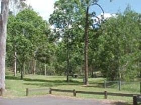
The Westside Track is located within D'Aguliar National Park (south D'Aguilar section). The Maiala area was the first national park declared on the D'Aguilar Range. Originally cleared for a timber mill, Maiala is now a spacious and peaceful place to visit. Some machinery and remnant hoop pine plantation remain as evidence of Maiala's loud and laborious past. Enjoy a picnic, barbecue or rainforest walk.
Got some great shots from this hike? Upload your photos here to inspire others and show off the beauty of the trail!
Submitting your photos doesn’t mean you lose ownership. You can be credited for your contributions, and you can request removal at any time.
Please don’t copy GPX files or content from this site to AllTrails or other platforms. Each trail has been personally mapped, documented, and refined to support Australia’s bushwalking and hiking community. While some details come from land managers, every listing reflects significant personal effort. This is a free, community-driven initiative—your respect helps keep it that way.
It looks like I don’t have a GPX file for this trail yet. If you have one to share, please email it to me! I’ll verify it against official maps before adding it to help other hikers have a safer, easier experience. Thanks for contributing to a better hiking resource.
Getting there
Getting to the trailhead: D'Aguilar National Park.
Closest towns to this walk: Bellthorpe, Dayboro, Fernvale, Kilcoy, Mount Glorious, Mount Mee, Mount Pleasant, Samford Valley, Wamuran, Woodford
About the region
D'Aguilar is a national park in Queensland, Australia, 31 km northwest of Brisbane. The southern part of the park was formerly known as Brisbane Forest Park, while the northern part of the park is at Mount Mee.
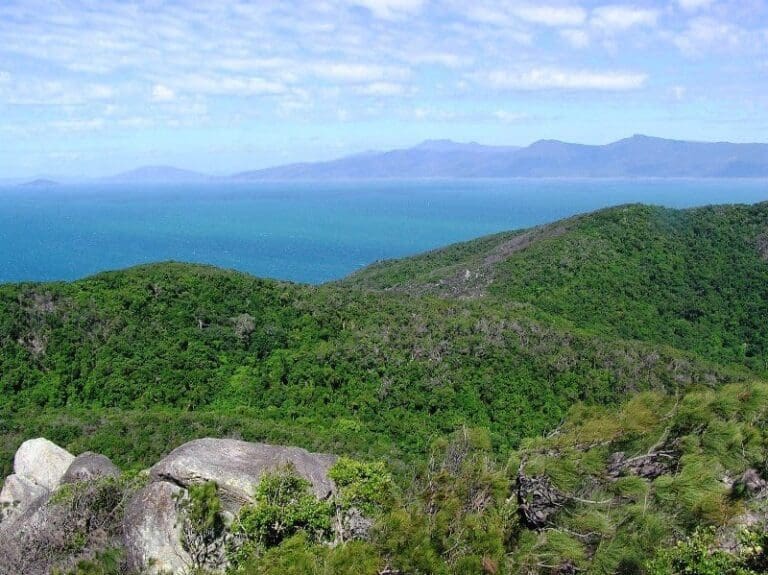
The park contains expanses of eucalypt woodland, sheltered pockets of subtropical rainforest, remote gorges and spectacular views to Moreton Bay and the Glass House Mountains. The popular Walkabout Creek Visitor Centre is located at the edge of the park. There are two formal, vehicle accessible camping areas in the Mount Mee section and eight remote bush camping sites (accessible only by walking) in the southern D'Aguilar (formerly Brisbane Forest Park) section.
Woodlands and dry eucalypt forests predominate on the drier, shallower soils of the park's foothills. Spotted Gum (Corymbia variegata) and Narrow-leaved Ironbark are two of the main species. There are also small areas of heath and ridges dominated by grass trees (Xanthorrhoea spp). Remnant pockets of lowland rainforest occur in the valleys along some of the watercourses.
At higher altitudes the forests become more complex due to the increased rainfall and generally deeper soils. These mid-altitude forests are dominated by Grey Gum, Pink Bloodwood and Brush Box. Occasional rainforest species are also present and there is a thick understorey of ferns, vines and shrubs.
Moist sub-tropical rainforest grows on the highest parts of the range where the rainfall is two-thirds greater than in the foothills, particularly on the rich basaltic soils north of Mount Glorious. Huge strangler figs (Ficus watkinsiana) can be seen emerging through the canopy.
For more information on this hiking trail, please visit Queensland.com
Similar walks nearby
Looking for more walks in or near D'Aguilar National Park? Try these trails with a similar difficulty grade.
Favourite

Favourite

Favourite

Bunyaville Conservation Park
Favourite

Track grade
Grade 3 (Moderate) - Walks for Most Fitness Levels: Grade 3 on the
AWTGS represents moderate walking tracks. These are ideal for walkers with some fitness who are comfortable with some hills and uneven terrain. While suitable for most ages, some bushwalking experience is recommended to ensure a safe and enjoyable experience. Tracks may have short, steep hill sections, a rough surface, and many steps. The total distance of a Grade 3 walk can be up to 20 kilometers.
Explore safe
Plan ahead and hike safely! Carry enough water, pack layers for changing conditions, and bring safety gear like a torch, PLB, and reliable communication device. Check official sources for trail updates, closures, and access requirements, and review local weather and bushfire advice. Most importantly, share your plans with someone before you go. Being prepared makes for a safer and more enjoyable hike! Stay Safe, Explore More, and Always #ExploreSafe.
Packing checklists
What you carry in your pack depends on factors like weather, terrain, and your adventure type. Not sure what to bring? My free planning, food, and packing checklists are a great starting point, covering day hikes, overnight trips, and multi-day adventures. Use them to customise your kit and always prioritise safety.
Let someone know
Before heading out, take a moment to fill out your trip intentions form. It’s a quick way to share your hike details with family or friends. If something goes wrong, they can notify emergency services, ensuring a faster response and peace of mind. Stay safe and enjoy your adventure
Suggest an edit
Spotted a change on this trail? Maybe there are new features, the route has shifted, or the trail is permanently closed. Whatever the update, I’d love your input. Your feedback helps fellow hikers stay informed and ensures that our trail info stays fresh and reliable.


