Hike at a Glance
Max elevation: 265m
Min elevation: 120m
Total Ascent: 275m
Hike overview
The Lynton Reserve and Sleeps Hill Reserve Circuit Walk offers a scenic 5.7-kilometre loop trail, suitable for moderately fit walkers. This route, estimated to take around 1.75 hours to complete, winds its way through the interconnected trails of both reserves.
Developed in 2010, Lynton Reserve boasts a diverse network of trails catering to walkers, mountain bikers, and even horse riders in designated areas. The Circuit Walk itself combines segments of several trails, including the Mead Street Walking Trail and the Sleeps Hill Walking Trail. This thoughtful design allows for a varied and engaging experience, despite the park's relatively compact size.
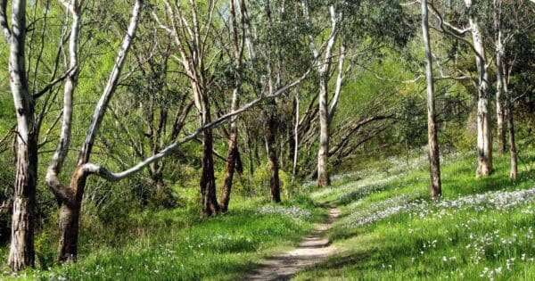
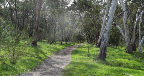
The trail traverses the park's unique landscape, bordering the Adelaide Plains and Belair. Gentle climbs reward walkers with glimpses of the city skyline, while the circuit also passes through intact Grey Box grassy woodlands. A notable feature of the park is the presence of twelve old, small quarry sites, adding a touch of historical intrigue to the natural beauty.
The walk conveniently begins near the Lynton Train Station, at the end of Beagle Terrace, making it easily accessible by public transport.
Track grade
Grade 3 (Moderate) - Walks for Most Fitness Levels: Grade 3 on the AWTGS represents moderate walking tracks. These are ideal for walkers with some fitness who are comfortable with some hills and uneven terrain. While suitable for most ages, some bushwalking experience is recommended to ensure a safe and enjoyable experience. Tracks may have short, steep hill sections, a rough surface, and many steps. The total distance of a Grade 3 walk can be up to 20 kilometers.
Walk map and GPX file
Max elevation: 265 m
Min elevation: 120 m
Total climbing: 275 m
Total descent: -276 m
Content use
Please don’t copy GPX files or content from this site to AllTrails or other platforms. Each trail has been personally mapped, documented, and refined to support Australia’s bushwalking and hiking community. While some details come from land managers, every listing reflects significant personal effort. This is a free, community-driven initiative—your respect helps keep it that way.
Gallery
Got any photos from this hike? Your photos can help others plan. Share shots from along the trail so fellow hikers know what to expect.
Click to add your photos >>
Getting there
Getting to the trailhead: Lynton Reserve.
Accessing Lynton Reserve is convenient. By car, simply navigate towards the Adelaide Hills. From Adelaide CBD, follow the South Eastern Freeway (M3) eastbound until it transitions into the Glen Osmond Road (C219). Continue on Glen Osmond Road for approximately 13 kilometres. You’ll then see signs for Lynton Reserve on your right. Turn right and follow the signs to the carpark. The walk conveniently begins near the Lynton Train Station, at the end of Beagle Terrace, making it easily accessible by public transport.
Need a rental car to get you to the hike? Find one here.
Find a place to stay
Wondering where to stay near this hike? Find accommodation close to the trailhead — hotels, cabins and campgrounds nearby. Click the button to view the interactive map.
Closest towns to this walk: Belair, Blackwood, Hawthorn, Kingswood, Lynton, Mitcham, Myrtle Bank, Unley, Unley Park
Let someone know
Heading out? Fill in a trip intentions form so someone knows your plans. If things go wrong, they can raise the alarm fast, giving you peace of mind on the trail.
About the region
Nestled in the Adelaide Hills, Lynton Reserve boasts a diverse network of trails designed for various uses. Established in 2010, the trails cater to walkers, mountain bikers, and even horse riders in designated areas.
The park offers a 10-kilometre shared-use trail perfect for walking and cycling, open during daylight hours (excluding Total Fire Ban days). This trail winds its way through Grey Box grassy woodlands, offering glimpses of the city skyline and dramatic quarry faces.
Beyond the shared trail, Lynton Reserve, along with Sleeps Hill Reserve and Lynton Depot Reserve, feature a combination of wider vehicle tracks and single walking trails. These meandering paths allow visitors to explore the park's unique landscape at their own pace, taking in the natural beauty and historical significance of the former quarry sites.
The design of the trail network itself reflects the park's physical characteristics and conservation values. This ensures a balanced experience for visitors, allowing them to enjoy the natural environment while respecting its delicate ecosystem.
Similar walks nearby
Looking for more walks in or near Lynton Reserve? Try these trails with a similar difficulty grade.
Explore safe
Plan ahead and hike safely! Carry enough water, pack layers for changing conditions, and bring safety gear like a torch, PLB, and reliable communication device. Check official sources for trail updates, closures, and access requirements, and review local weather and bushfire advice. Most importantly, share your plans with someone before you go. Being prepared makes for a safer and more enjoyable hike! Stay Safe, Explore More, and Always #ExploreSafe.
Packing checklists
What you carry in your pack depends on factors like weather, terrain, and your adventure type. Not sure what to bring? My free planning, food, and packing checklists are a great starting point, covering day hikes, overnight trips, and multi-day adventures. Use them to customise your kit and always prioritise safety.
Suggest an edit
Notice something different about this trail? Whether it’s a new feature, a route change, or a closure, share your update so we can keep our info accurate and helpful for fellow hikers.
Click to suggest edits >>
Acknowledgement of Country
Trail Hiking Australia acknowledges the Traditional Owners of the lands on which we hike and pay respects to their Elders, past and present, and we acknowledge the First Nations people of other communities who may be here today.


