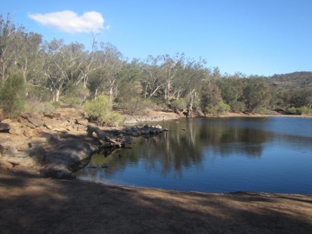
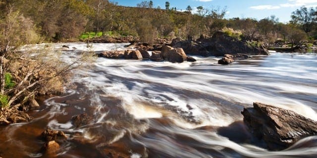
Located in Walyunga National Park, this six kilometre easy trail follows the river upstream to Syd's Rapids before heading up a steep gravel track. This area was burnt a few years ago and now has a thick understory of regrowth with the burnt eucalypt trunks visible above. It intersects with the Echidna and Kangaroo trails.
Walyunga National Park covers 1,800 hectares of the Darling Range, tucked behind the Darling Scarp, covering both sides of a steep valley. Just to the east of the park, in the picturesque Avon Valley, the Avon River joins the Brockman River to form the Swan River which passes through the tree lined valley. Walyunga contains one of the largest known Aboriginal campsites around Perth and was still in use by the Nyoongar people late last century. The area has been used as a meeting place for more than 6000 years. Walyunga is an Aboriginal name, but its meaning is uncertain. Local Nyoongar people believe the Swan River was carved by the Waugal, and greet the dreamtime serpent here by rubbing sand on their bodies and throwing it in the water. The Swan River is the main attraction in the park as it thunders through in winter and meanders by in the drier months, lined with smooth granite boulders. The walk trail starts beside the lower pool in Walyunga and follows the river to Syd's rapids and then ascends into the woodland. The trail markers are blue footprints and are designed to be followed in an anti clockwise direction.
Start Point: Walyunga Pool Walyunga National Park, 35km north east of Perth
End Point: Walyunga Pool Walyunga National Park, 35km north east of Perth
Region: Walyunga National Park, Perth
For more information, a location map and GPS file please visit Trails WA.
Got some great shots from this hike? Upload your photos here to inspire others and show off the beauty of the trail!
Submitting your photos doesn’t mean you lose ownership. You can be credited for your contributions, and you can request removal at any time.
Please don’t copy GPX files or content from this site to AllTrails or other platforms. Each trail has been personally mapped, documented, and refined to support Australia’s bushwalking and hiking community. While some details come from land managers, every listing reflects significant personal effort. This is a free, community-driven initiative—your respect helps keep it that way.
It looks like I don’t have a GPX file for this trail yet. If you have one to share, please email it to me! I’ll verify it against official maps before adding it to help other hikers have a safer, easier experience. Thanks for contributing to a better hiking resource.
Getting there
Getting to the trailhead: Walyunga National Park.
Closest towns to this walk: Bullsbrook, Chidlow, Darlington, Ellenbrook, Gidgegannup, Henley Brook, Midland, Mundaring, Swan View, Upper Swan
Similar walks nearby
Looking for more walks in or near Walyunga National Park? Try these trails with a similar difficulty grade.
Favourite

Favourite

Favourite

Favourite

John Forrest National Park
Track grade
Grade 2 (Easy) - A Gentle Introduction to Inclines: Grade 2 on the
AWTGS represents easy walking tracks that offer a slightly more challenging experience compared to Grade 1. Similar to Grade 1, no prior bushwalking experience is required. The track surface is typically hardened or compacted and may have gentle hill sections or occasional steps. The total distance of a Grade 2 walk is typically no greater than 10 kilometers. These walks are still suitable for families with a bit more experience or those seeking a gentle introduction to some inclines.
Explore safe
Plan ahead and hike safely! Carry enough water, pack layers for changing conditions, and bring safety gear like a torch, PLB, and reliable communication device. Check official sources for trail updates, closures, and access requirements, and review local weather and bushfire advice. Most importantly, share your plans with someone before you go. Being prepared makes for a safer and more enjoyable hike! Stay Safe, Explore More, and Always #ExploreSafe.
Packing checklists
What you carry in your pack depends on factors like weather, terrain, and your adventure type. Not sure what to bring? My free planning, food, and packing checklists are a great starting point, covering day hikes, overnight trips, and multi-day adventures. Use them to customise your kit and always prioritise safety.
Let someone know
Before heading out, take a moment to fill out your trip intentions form. It’s a quick way to share your hike details with family or friends. If something goes wrong, they can notify emergency services, ensuring a faster response and peace of mind. Stay safe and enjoy your adventure
Suggest an edit
Spotted a change on this trail? Maybe there are new features, the route has shifted, or the trail is permanently closed. Whatever the update, I’d love your input. Your feedback helps fellow hikers stay informed and ensures that our trail info stays fresh and reliable.


