Hike at a Glance
Max elevation: 129m
Min elevation: 65m
Total Ascent: 108m
Hike overview
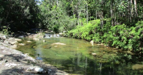
The Jourama Falls Lookout Walk, a 3km, grade 3 hike in Paluma Range National Park, Queensland, offers a rewarding experience for nature lovers. This walk typically takes about 1.25 hours to complete and is a great way to explore the park’s diverse landscapes. The trail begins with a pleasant stroll through open woodland, where you may spot various wildlife along the way. A creek crossing adds a touch of adventure before the path begins its steady ascent towards the lookout.
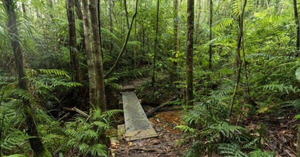
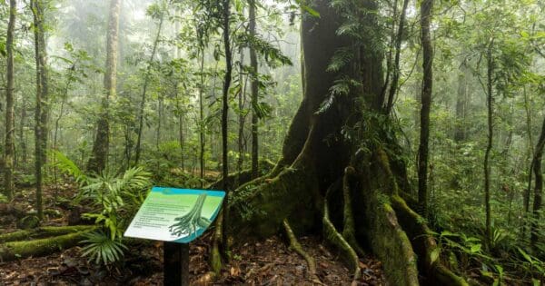
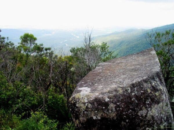
As you make your way uphill, the track provides glimpses of the rainforest that surrounds the falls. The last 600 metres to the lookout are a consistent climb, but the effort is well worth it. From the top, you’ll be treated to sweeping views over the falls and the lush rainforest that stretches beyond. The area around Jourama Falls is rich in wildlife, with birds, freshwater turtles, and goannas commonly spotted near the creek. In the drier foothills, the open woodland is home to a variety of birds, including the endangered mahogany glider, adding another layer of interest to the hike.
At the signposted junction, about 100 metres past the creek, you can either continue up to the lookout or take a detour to explore the creek further upstream. Either way, this walk provides a peaceful and rewarding escape into nature, perfect for those looking to enjoy the beauty and tranquillity of Paluma Range National Park.
Tips
- The Jourama Falls Lookout Walk is not wheelchair-accessible.
- The walk is open 24 hours a day, but access may be restricted during the summer wet season when Waterview Creek rises and causeways become impassable.
- Always check park alerts for the most up-to-date information on access, closures, and trail conditions.
Track grade
Grade 3 (Moderate) - Walks for Most Fitness Levels: Grade 3 on the AWTGS represents moderate walking tracks. These are ideal for walkers with some fitness who are comfortable with some hills and uneven terrain. While suitable for most ages, some bushwalking experience is recommended to ensure a safe and enjoyable experience. Tracks may have short, steep hill sections, a rough surface, and many steps. The total distance of a Grade 3 walk can be up to 20 kilometers.
Walk map and GPX file
Max elevation: 129 m
Min elevation: 65 m
Total climbing: 108 m
Total descent: -108 m
Content use
Please don’t copy GPX files or content from this site to AllTrails or other platforms. Each trail has been personally mapped, documented, and refined to support Australia’s bushwalking and hiking community. While some details come from land managers, every listing reflects significant personal effort. This is a free, community-driven initiative—your respect helps keep it that way.
Gallery
Got any photos from this hike? Your photos can help others plan. Share shots from along the trail so fellow hikers know what to expect.
Click to add your photos >>
Getting there
Getting to the trailhead: Paluma Range National Park.
To reach the Jourama Falls trailhead, head 91km north from Townsville or 24km south from Ingham along the Bruce Highway. Turn off the highway onto a 4.5km unsealed access road, which is suitable for most conventional vehicles and caravans. The Jourama Falls Lookout Walk begins at the end of this access road, approximately 700m beyond the Jourama Falls camping area.
Need a rental car to get you to the hike? Find one here.
Find a place to stay
Wondering where to stay near this hike? Find accommodation close to the trailhead — hotels, cabins and campgrounds nearby. Click the button to view the interactive map.
Closest towns to this walk: Crystal Creek, Giru, Halifax, Herberton, Hervey Range, Herveys Range, Hidden Valley, Ingham, Little Crystal Creek, Mount Fox, Mount Spec, Mt. Spec, Paluma, Ravenswood
Let someone know
Heading out? Fill in a trip intentions form so someone knows your plans. If things go wrong, they can raise the alarm fast, giving you peace of mind on the trail.
About the region
Just over 60 kilometres north of Townsville, Paluma Range National Park offers a rich variety of outdoor experiences. The park is split into two sections, each with its own charm and appeal for bushwalkers and nature lovers alike. In the north, the Jourama Falls section features a stunning waterfall framed by lush rainforest. This area also includes a mix of vine forest and open woodlands, providing an ideal setting for walks and wildlife spotting. The southern section, Mount Spec, rises nearly 1,000 metres above the Big Crystal Creek floodplain, offering sweeping views and access to diverse ecosystems, including tropical rainforest and eucalypt woodland.
The park holds cultural significance for the Traditional Owners, the Nywaigi Aboriginal people, who have deep connections to the land. They invite visitors to respect and enjoy this special place. Known as Munan Gumburu, meaning "misty mountain," the park is often blanketed in morning mists, adding an ethereal quality to the experience.
To access Jourama Falls, travel along an unsealed road off the Bruce Highway, which is suitable for most vehicles and caravans, though conditions can be challenging during the wet season. The Mount Spec section is easily accessible from both Townsville and Ingham, with two turn-offs from the Bruce Highway leading to the recreation areas.
Whether you're looking for serene rainforest walks, the beauty of cascading waterfalls, or a peaceful retreat for birdwatching, Paluma Range National Park offers a diverse range of experiences for all.
Similar walks nearby
Looking for more walks in or near Paluma Range National Park? Try these trails with a similar difficulty grade.
Explore safe
Plan ahead and hike safely! Carry enough water, pack layers for changing conditions, and bring safety gear like a torch, PLB, and reliable communication device. Check official sources for trail updates, closures, and access requirements, and review local weather and bushfire advice. Most importantly, share your plans with someone before you go. Being prepared makes for a safer and more enjoyable hike! Stay Safe, Explore More, and Always #ExploreSafe.
Packing checklists
What you carry in your pack depends on factors like weather, terrain, and your adventure type. Not sure what to bring? My free planning, food, and packing checklists are a great starting point, covering day hikes, overnight trips, and multi-day adventures. Use them to customise your kit and always prioritise safety.
Suggest an edit
Notice something different about this trail? Whether it’s a new feature, a route change, or a closure, share your update so we can keep our info accurate and helpful for fellow hikers.
Click to suggest edits >>
Acknowledgement of Country
Trail Hiking Australia acknowledges the Traditional Owners of the lands on which we hike and pay respects to their Elders, past and present, and we acknowledge the First Nations people of other communities who may be here today.


