Hike at a Glance
Max elevation: 314m
Min elevation: 119m
Total Ascent: 807m
Important info
Temperatures across the Northern Territory can be very hot between October and April. It can exceed 40 degrees Celsius in some locations. High humidity in the Top End can also make you tire easily. Check forecast temperatures before you visit. Find out how to prepare and stay safe in the heat.
Hike overview
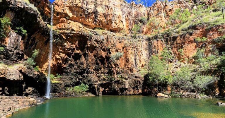
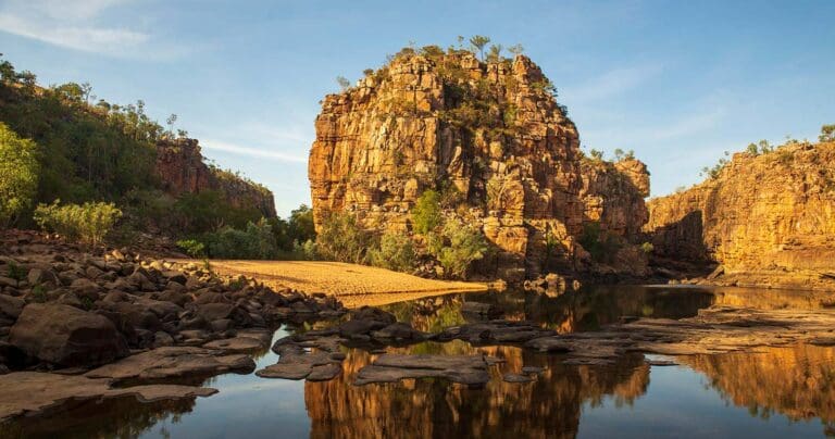
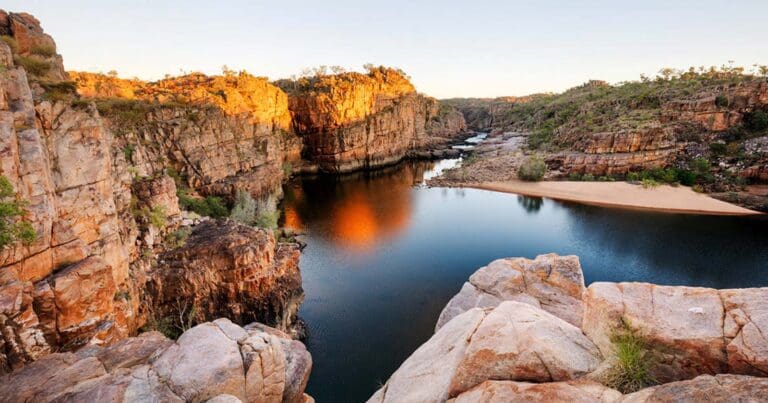
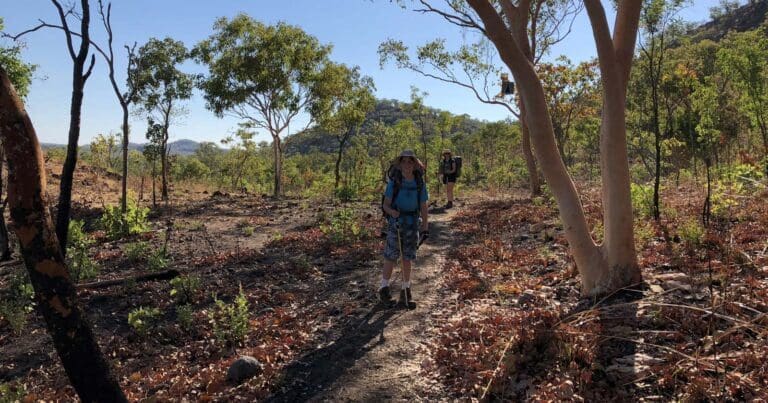
The Jatbula Trail is a one-way, 62km adventure that takes you from the dramatic Nitmiluk Gorge to the cascading beauty of Leliyn (Edith Falls). This immersive experience traverses the western edge of the Arnhem Land escarpment, offering a diverse landscape of sandstone plateaus, woodlands, open forests, monsoon rainforests, and vibrant riverine environments.
Hike in the footsteps of the Jawoyn people, who have travelled these paths for generations. The trail itself is named after Jawoyn Traditional Owner, Peter Jatbula, a key figure in securing land rights for his people.
The Jatbula Trail is graded as moderate to difficult (grade 4) and typically takes 5 or 6 days to complete. A good level of fitness and some bushwalking experience are essential, as you'll be carrying your backpack over sometimes rough terrain. Camping is restricted to designated sites along the trail, with each location offering a scenic backdrop near a spring or cascade. These campsites are limited to 15 people per night, so be sure to plan and book in advance. It's important to note that you cannot skip campsites to shorten the hike, and Leliyn itself is not a campsite on the trail (separate camping fees apply if you wish to stay there).
This historic trail offers a unique opportunity to immerse yourself in Jawoyn culture and witness the breathtaking beauty of the Nitmiluk National Park. For more information on permits, bookings, and park regulations, be sure to visit the official website.
Jatbula Trail overview and itinerary
- Day 1 - Nitmiluk to Biddlecombe Cascades - 8.3 km
- Day 2 - Biddlecombe to Crystal Falls - 11 km
- Day 3 - Crystal Falls to 17 Mile Falls - 10 km
- Day 4 - 17 Mile Falls to Sandy Camp - 16.8 km
- Day 5 - Sandy Camp to Sweetwater Pool 11.1 km or via Leliyn 15.6 km
- Day 6 - Sweetwater (overnight) to Leliyn - 4.5 km
When to walk
The best time of year to walk the Jatbula Trail is from 1 June to 30 September. During the cooler months, from June to August, the temperatures range from 30 degrees Celsius during the day dropping to 10 degrees Celsius at night. Conditions on the trail start to heat up in mid-August with temperatures rising to over 40 degrees Celsius from October to late November. From December to April the trail is difficult due to high temperatures and humidity, monsoonal rain and the risk of flooding. Increased vegetation growth in the wet season can also hide trail markers, adding to the difficulty.
If you wish to walk out of season, you must be an experienced group or organisation. To book, you must contact the Parks and Wildlife permits office and apply for permits for camping overnight outside a designated area.
Tips
You must respect the environment and cultural heritage by doing the following:
- Take all rubbish and food scraps with you and put in bins at Leliyn
- Wipe off insect repellent and sunscreen before swimming - wet wipes are ideal for this
- Stay on marked tracks
- Do not touch rock art and respect sacred sites
- Do not light fires, cooking is restricted to gas cookers only.
Trail features
- Aboriginal Art
- Waterfalls
- Scenic Viewpoints
- Rock Scrambling
- River Crossings
- Untreated Water
- Swimming Spots
- Overnight Campsites
Content use
Please don’t copy GPX files or content from this site to AllTrails or other platforms. Each trail has been personally mapped, documented, and refined to support Australia’s bushwalking and hiking community. While some details come from land managers, every listing reflects significant personal effort. This is a free, community-driven initiative—your respect helps keep it that way.
Walk map and GPX file
Max elevation: 314 m
Min elevation: 119 m
Total climbing: 807 m
Total descent: -798 m
Getting there
Getting to the trailhead: Nitmiluk National Park.
Getting There and Back
The Jatbula Trail is a one-way journey, starting at Nitmiluk Gorge and concluding at Leliyn (Edith Falls). Here’s how to navigate transportation:
Reaching the Trailhead:
- A shuttle service is available from Katherine (27km away) to Nitmiluk Gorge.
- From the gorge, a ferry takes you directly to the trail’s starting point near 17 Mile Creek. The ferry departs twice daily at 7am and 9am, costing $23 per person. Be sure to arrive at the boat ramp 15 minutes early with your permits.
- Book your ferry through Nitmiluk Tours.
Departing Leliyn:
- After completing the hike, transfers are available to take you back to Katherine or the Nitmiluk Visitor Centre.
- Leliyn is approximately a 45-minute drive (63km) from Katherine and a 1-hour drive (90km) from Nitmiluk Gorge.
Booking Ground Transfers:
- Ground transfers can be booked through the Katherine Visitor Information Centre website.
Important Tips:
- Always inform someone outside your group about your travel plans in case of emergencies.
- Public parking is available at both trailheads (Nitmiluk Gorge and Leliyn). Remember to register your vehicle details and return date at the respective park office or kiosk.
- Regular bus and air services connect Darwin and Katherine for those traveling by public transport.
Closest towns to this walk: Adelaide River, Barunga, Beswick, Daly Waters, Edith Falls, Jabiru, Jilkminggan, Katherine, Larrimah, Leliyn, Mataranka, Pine Creek
Access conditions
- 2WD Access
- Bitumen Road
- Entry Fee
- Large Car Park
- Public Toilets
- Drinking Water
- Picnic Shelter
- Picnic Table
- BBQ Facilities
- Camping Area
About the region
Be drawn to the spectacular sandstone country of Nitmiluk National Park and the majestic Nitmiluk (Katherine) Gorge with spectacular cliffs that glow in the changing light.
Nitmiluk National Park, just 30 kilometres north-east of Katherine, covers a vast area, including 13 impressive gorges carved from the ancient sandstone country which stretch for as far as the eye can see.
Accommodation is available within the National Park. Choose from camping, to chalets through to the upmarket Cicada Lodge. Nitmiluk National Park has something for everyone.
Similar walks nearby
Looking for more walks in or near Nitmiluk National Park? Try these trails with a similar difficulty grade.
Track grade
Grade 4 (Hard) - Challenging Walks for Experienced Walkers: Grade 4 on the AWTGS signifies challenging walking tracks. Bushwalking experience is recommended for these tracks, which may be long, rough, and very steep. Directional signage may be limited, requiring a good sense of navigation. These walks are suited for experienced walkers who are comfortable with steeper inclines, rougher terrain, and potentially longer distances.
Explore safe
Plan ahead and hike safely! Carry enough water, pack layers for changing conditions, and bring safety gear like a torch, PLB, and reliable communication device. Check official sources for trail updates, closures, and access requirements, and review local weather and bushfire advice. Most importantly, share your plans with someone before you go. Being prepared makes for a safer and more enjoyable hike! Stay Safe, Explore More, and Always #ExploreSafe.
Packing checklists
What you carry in your pack depends on factors like weather, terrain, and your adventure type. Not sure what to bring? My free planning, food, and packing checklists are a great starting point, covering day hikes, overnight trips, and multi-day adventures. Use them to customise your kit and always prioritise safety.
Let someone know
Before heading out, take a moment to fill out your trip intentions form. It’s a quick way to share your hike details with family or friends. If something goes wrong, they can notify emergency services, ensuring a faster response and peace of mind. Stay safe and enjoy your adventure
Suggest an edit
Spotted a change on this trail? Maybe there are new features, the route has shifted, or the trail is permanently closed. Whatever the update, I’d love your input. Your feedback helps fellow hikers stay informed and ensures that our trail info stays fresh and reliable.
Acknowledgement of Country
Trail Hiking Australia acknowledges the Traditional Owners of the lands on which we hike and pay respects to their Elders, past and present, and we acknowledge the First Nations people of other communities who may be here today.
/The-Jatbula-Trail-Trek_370.jpg)
/The-Jatbula-Trail-Trek_175.jpg)
/The-Jatbula-Trail-Trek_261.jpg)
/The-Jatbula-Trail-Trek_16.jpg)
/The-Jatbula-Trail-Trek_258.jpg)
/The-Jatbula-Trail-Trek_86.jpg)
/The-Jatbula-Trail-Trek_290.jpg)
/The-Jatbula-Trail-Trek_167.jpg)
/The-Jatbula-Trail-Trek_217.jpg)
/The-Jatbula-Trail-Trek_274.jpg)
/The-Jatbula-Trail-Trek_267.jpg)
/The-Jatbula-Trail-Trek_413.jpg)
/The-Jatbula-Trail-Trek_382.jpg)
/The-Jatbula-Trail-Trek_349.jpg)
/The-Jatbula-Trail-Trek_278.jpg)


5 Reviews on “The Jatbula Trail Trek (62km)”
Ryan Wielgosz
My family and I had an awesome five days on the Jatbula. A couple of long and hot days but the walking isn’t difficult. It’s amazing to stop each afternoon at camp and swim in the cascades, creeks and waterfalls. Highly recommended.
What a fantastic experience. Absolutely loved swimming in the stunning waterfalls and rock pools at every campsite.
Me too next year fir me! It’s been in my list fir years now I have to next year I’m more than ready now!!?
Hi Alexandra, I have just uploaded mine to the site
Did this hike in June, was just beautiful, and hot. Being able to swim at every camp was fantastic. Only allowing 15 hikers through a day adds to its appeal.
Dani Campbell this is top of my list, I really really really want to do this one
Met a group last week at Leliyn top pools who’d just finished this awesome walk. They all said they’d do it again the next day.
Yes! Can’t wait to do this next year ???
Just completed this with my family. An excellent adventure
This is an excellent walk. You get to camp beside permanent water every day and there is plenty of Aboriginal art along the way. It’s one of our favourite walks in the Northern Territory.
This is for you Jatbula Hiker Opal!!! ?
This is my favourite hike in Australia. I would also hire a kayak and camp overnight in the upper parts of Katherine Gorge before starting the hike proper.
Book in on the 1st November ! Most places go to tour companies – or book with one of them. Would love to do it! Love this NP
what about this one. Peter McNamara Ben Wyatt only 5 days away.
Diane Ferreira like this page and we will find a hike to do
Lyn Harms