Loading...

Explore stunning hiking trails of Angle Crossing

Discover the diverse trails of Angle Crossing, ACT, offering hikes and walks for all skill levels and interests. Find your perfect adventure today.

Grade 2

Angle Crossing River Track (800m)

Angle Crossing: Explore Nature, Culture & History

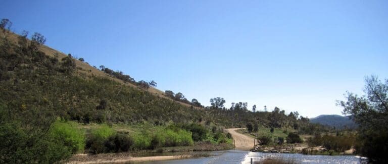
The Murrumbidgee River reaches its southernmost point within the ACT at Angle Crossing. This area is situated on Ngunnawal Country, the traditional land of the Ngunnawal people. The waterways have played a vital role in sustaining life here for generations, including plants, animals and the Ngunnawal people themselves. The Murrumbidgee River is embedded within Ngunnawal songlines – pathways etched in the landscape that hold stories and knowledge for their culture.

Angle Crossing is part of the protected Gigerline Nature Reserve, established under the Nature Conservation Act 2014. Visitors are encouraged to respect and conserve this natural environment.

Reaching Angle Crossing is straightforward. Take Angle Crossing Road, which is accessible via either the Monaro Highway near Williamsdale or Smiths Road near Tharwa in New South Wales.

The location offers a variety of experiences for visitors. Look out for the spectacular migration of thousands of Yellow-faced Honeyeaters and White-naped Honeyeaters during autumn, as they journey from the mountains to warmer coastal regions. Explore the surrounding Gigerline Nature Reserve, renowned for its exceptional birdlife and diverse habitat. And of course, enjoy the scenic Murrumbidgee River itself.