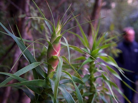
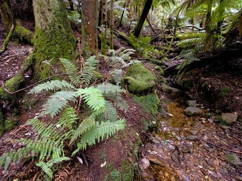
Organ Pipes Mt Wellington is a 7.7km, grade 3 hike located in Mount Wellington, Tasmania. The hike should take around 3 hours to complete.
Hike overview
Beautiful Mount Wellington has a range of walking tracks. This walk leaves from the Springs and takes walkers beneath the fluted columns known as the Organ Pipes.
Highlights
The Organ Pipes are one of the most distinctive features on Mount Wellington, and form a magnificent sight along this track which runs just below their base. The dolerite rock that comprises the towering, columnar cliffs was formed during the Jurassic when Tasmania was in the process of separating from Antarctica during the final stages of the breakup of Gondwana. The cliffs are a favourite haunt of rock climbers.
Route and GPX file
Max elevation: 1023 m
Min elevation: 696 m
Total climbing: 458 m
Total descent: -458 m
For more information about this hiking trail please visit Parks and Wildlife Service Tasmania
Tips
Toilets, drinking water, day shelters and fireplaces located at the Springs and Fern Tree. Day shelter huts along the track.
Supervise children , tracks subject to severe weather conditions all year round, weather may change quickly, tracks are difficult to navigate when covered in snow and may be impassable.
Biycles are not permitted on this walk. Dogs are permitted on a section of this walk, but not the entire walk, and must be kept on a leash. (Map at track start has further details).
Trail location
Sorry, no records were found. Please adjust your search criteria and try again.
Sorry, unable to load the Maps API.
Getting there
Davey Street and Huon Road from Hobart to Fern Tree, then the Pinnacle Road to the Springs (13km from Hobart). Alternatively, catch the public bus service from Franklin Square in Hobart to Fern Tree and then take a 40-50 minute uphill walk to the Springs by walking track. Walk starts on the Pinnacle Track, across the road from the Springs toilet block. A small track leads to the top of a loop road where the Pinnacle Track begins.
Gallery
If you have any photos from this hike and are happy to share them, please upload your .jpg files here.
Please note: Uploading photos does not transfer ownership of copyright away from you. If requested, you will be credited for any photos you provide and can ask they be deleted at any time.
About the region
No matter where you are in Hobart you are never far away from the City's beloved mountain, kunanyi / Mt Wellington. Rich in wildlife and blanketed in forest, woodlands and alpine environments, it is a natural playground for the people of Hobart. An extensive network of walking and mountain bike tracks are great ways of exploring the mountain, taking visitors past waterfalls, through fern glades and gullies, and opening up great views of Hobart and, on good days, the Tasmanian Wilderness World Heritage Area.
Similar trails nearby
Explore Safe
While planning your hike, it’s important to check official government sources for updated information, temporary closures and trail access requirements. Before hitting the trail, check local weather and bushfire advice for planned burns and bushfire warnings and let someone know before you go. Plan ahead and hike safely.
Let someone know
Adventure with peace of mind: Fill out your trip intentions form. Before you hit the trail, fill out an online form to privately send important details about your hike to your family or friends. If you don’t return on time, they can easily alert emergency services, preventing worry and ensuring a swift response. Hike with peace of mind and enjoy your outdoor adventure to the fullest. Be smart, be safe: Register your plans here.
Gear to consider

My free planning, food and packing checklists provide an introduction to things your could consider (as well as the Ten Essentials) on your day, overnight and multi-day adventures. Customise your kit according to your personal needs, always considering safety first.
Suggest an edit
Does this hikes information need updating? Sometimes the route, trail features or access conditions change.
Acknowledgement of Country
Trail Hiking Australia acknowledges the Traditional Owners of the lands on which we hike and pay respects to their Elders, past and present, and we acknowledge the First Nations people of other communities who may be here today.


3 Reviews on “Organ Pipes Mt Wellington Hike (7.75km)”
Did this circuit last year, but down past the Chalet and down Old Hobartians Track and back to The Springs via Lenah Valley Track. Navigating the rock scree heading down was very challenging! But a stunning area and a fantastic hike.
Sacha Rattray put this on the list!
You’ll need to start a new list