Hike at a Glance
Max elevation: 1975m
Min elevation: 595m
Total Ascent: 1541m
Important info
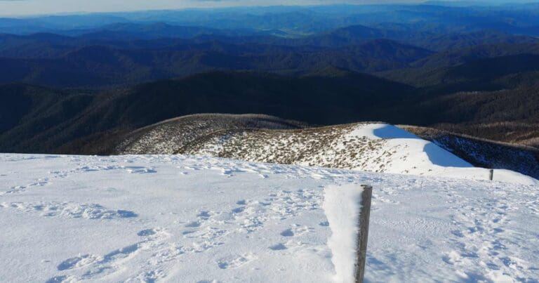
The hike is strenuous and requires a good level of fitness. The hike is exposed and there is little shelter from the elements. During the winter months you should consider this a Grade 5 hike. Weather conditions can change rapidly and without warning in the alpine region.
Hike overview
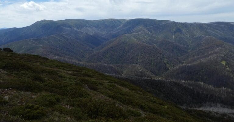
Mount Bogong, Victoria's tallest mountain, stands at an impressive 1986 meters, towering over its neighboring peaks. The Mount Bogong via Staircase Spur Trail provides a direct route to the summit, starting from the Mountain Creek Picnic Area and culminating at the peak.
The journey begins at the Mountain Creek Picnic Area, where a vehicle track leads to the base of the Staircase Spur. From there, the ascent commences through a forest of Peppermint Gums. Approximately halfway up, Bivouac Hut offers a well-deserved respite before the trail transitions through Snow Gums and out onto a steep, rocky ridge that winds up to the summit plateau.
The summit's exposed, treeless expanse provides minimal protection from inclement weather. Strong winds, fog, frigid temperatures, rain, and snow are all prevalent at this altitude. Navigation can become exceptionally challenging under these conditions, prompting the decision to turn back at the tree line if conditions worsen.
From the summit, the descent takes a steeper route via Eskdale Spur, passing Michell Hut and Camp Creek, before rejoining the Mountain Creek and Tree Fern Tracks, leading back to Mountain Creek. Alternatively, hikers can opt to return via the Staircase Spur, resulting in an approximate 16-kilometer round trip.
Overnight Camping
If you intend on making this an overnight hike, camping is available outside the following huts.
- Bivouac Hut. Staircase Spur, approximately 6km from the trail head and 3km from the summit. This is a small hut with pit toilet but no water tank.
- Cleve Cole Memorial Hut, approximately 4km south of the summit (this will add to your overall hike length as a return trip is required). This is a small hut with pit toilet and water tank.
- Michell Hut, approximately 2km from the summit down Eskdale Spur. This is a small hut with pit toilet and water tank.
Note: Huts in alpine areas are intended for emergency use only and you should not plan to sleep in them or use the emergency firewood.
Be Prepared
This hike requires that you have a sufficient level of equipment (in good working order), fitness and self-reliance.
Trail features
- Alpine Region
- Scenic Viewpoints
- Alpine Huts
- Exposed Ledges
- Steep Terrain
- Untreated Water
- Overnight Campsites
Content use
Please don’t copy GPX files or content from this site to AllTrails or other platforms. Each trail has been personally mapped, documented, and refined to support Australia’s bushwalking and hiking community. While some details come from land managers, every listing reflects significant personal effort. This is a free, community-driven initiative—your respect helps keep it that way.
Walk map and GPX file
Max elevation: 1975 m
Min elevation: 595 m
Total climbing: 1541 m
Total descent: -1542 m
Getting there
Getting to the trailhead: Alpine National Park.
The hike starts and ends at Mountain Creek Camping Area. From Melbourne, drive to the small town of Tawonga (4km north of Mount Beauty). From Towonga, Mountain Creek Roads heads east for 10.5km to the camping area. There are pleasant campsites and a pit toilet here.
Closest towns to this walk: Benalla, Bright, Dinner Plain, Falls Creek, Harrietville, Hotham Heights, Mansfield, Mitta Mitta, Mount Beauty, Mount Hotham, Myrtleford, Omeo, Porepunkah, Tawonga South, Wangaratta
About the region
Exploring Australia's Alpine National Park
The Alpine National Park offers a range of exciting outdoor activities that cater to all levels of adventure. Located in Victoria, this park is home to some of the state's highest mountain ranges, making it a popular destination for bushwalkers, hikers, and nature lovers. The park’s stunning landscapes are perfect for exploring on foot, on horseback, or even by mountain bike, with plenty of world-class trails to enjoy.
For a truly memorable experience, try the Falls to Hotham Alpine Crossing, which takes you across towering alpine ridgelines and through lush river valleys, all set against breathtaking alpine scenery. If you're looking to learn about the region's history, you can drive along the Wonnangatta Four-wheel Drive route, where you'll uncover the stories of the past while taking in rugged bushland and mountain views. For those keen on a challenge, the Razorback Ridge hike leads to Victoria’s second-highest peak, Mount Feathertop, offering some of the most spectacular views of the Great Dividing Range.
Adventurers can also take on the challenge of climbing Mount Bogong, the highest peak in Victoria, or explore the historic huts scattered across the Bogong High Plains, once home to legendary cattlemen. For a thrill of a different kind, white-water rafting trips on the Mitta Mitta River or skiing across the park’s varied terrain can help you experience the park’s wild side. Whether you prefer downhill runs or cross-country trails, the Alpine National Park offers some of the best ski touring opportunities in the state.
The park is also an important part of the Aboriginal cultural landscape, with traditional Country belonging to the Taungurung and Gunaikurnai Peoples.
Want to find the best trails in Alpine National Park for an adventurous hike, casual walk, or a family trip? Trail Hiking Australia has the best trails for walking, hiking, running, and more.
Similar walks nearby
Looking for more walks in or near Alpine National Park? Try these trails with a similar difficulty grade.
Track grade
Grade 4 (Hard) - Challenging Walks for Experienced Walkers: Grade 4 on the AWTGS signifies challenging walking tracks. Bushwalking experience is recommended for these tracks, which may be long, rough, and very steep. Directional signage may be limited, requiring a good sense of navigation. These walks are suited for experienced walkers who are comfortable with steeper inclines, rougher terrain, and potentially longer distances.
Explore safe
Plan ahead and hike safely! Carry enough water, pack layers for changing conditions, and bring safety gear like a torch, PLB, and reliable communication device. Check official sources for trail updates, closures, and access requirements, and review local weather and bushfire advice. Most importantly, share your plans with someone before you go. Being prepared makes for a safer and more enjoyable hike! Stay Safe, Explore More, and Always #ExploreSafe.
Packing checklists
What you carry in your pack depends on factors like weather, terrain, and your adventure type. Not sure what to bring? My free planning, food, and packing checklists are a great starting point, covering day hikes, overnight trips, and multi-day adventures. Use them to customise your kit and always prioritise safety.
Let someone know
Before heading out, take a moment to fill out your trip intentions form. It’s a quick way to share your hike details with family or friends. If something goes wrong, they can notify emergency services, ensuring a faster response and peace of mind. Stay safe and enjoy your adventure
Suggest an edit
Spotted a change on this trail? Maybe there are new features, the route has shifted, or the trail is permanently closed. Whatever the update, I’d love your input. Your feedback helps fellow hikers stay informed and ensures that our trail info stays fresh and reliable.
Acknowledgement of Country
Trail Hiking Australia acknowledges the Traditional Owners of the lands on which we hike and pay respects to their Elders, past and present, and we acknowledge the First Nations people of other communities who may be here today.
/Mount-Bogong-Staircase-Spur-Hike_121.jpg)
/Mount-Bogong-Staircase-Spur-Hike_100.jpg)
/Mount-Bogong-Staircase-Spur-Hike_99.jpg)
/Mount-Bogong-Staircase-Spur-Hike_36.jpg)
/Mount-Bogong-Staircase-Spur-Hike_149.jpg)
/Mount-Bogong-Staircase-Spur-Hike_43.jpg)
/Mount-Bogong-Staircase-Spur-Hike_68.jpg)
/Mount-Bogong-Staircase-Spur-Hike_6.jpg)
/Mount-Bogong-Staircase-Spur-Hike_128.jpg)
/Mount-Bogong-Staircase-Spur-Hike_165.jpg)
/Mount-Bogong-Staircase-Spur-Hike_58.jpg)
/Mount-Bogong-Staircase-Spur-Hike_95.jpg)
/Mount-Bogong-Staircase-Spur-Hike_21.jpg)
/Mount-Bogong-Staircase-Spur-Hike_67.jpg)
/Mount-Bogong-Staircase-Spur-Hike_127.jpg)


3 Reviews on “Mount Bogong - Staircase Spur Hike (21.5km)”
Beautiful hike! Tough slog uphill but views were worth it. I started at the very bottom at Mountain Creek campground but you can drive further up and park at the trailhead of the staircase, or if you have a 4wd you can park up at the trailhead of Eskdale. Camped at Michele Hut.
The staircase trail is a bit rougher than I remembered it. No tourists for last 18 months; it has a lot of loose stones and rocks along the path and although big tree trunks have been removed there were a few unexpected short stumps and lots of stones along the way especially between the Bivouwac hut and the tree line. It was very windy and cold along the top and there was still some melting snow on 28.11.21.
A very important note coming back down the staircase: Once you have descended the staircase and are coming along the mountain creek path there are 4 bridges along the creek before you arrive at the camp ground.
After tossing the 3rd bridge the path to cross to final bridge is off to the left and NOT SIGNPOSTED . Do not follow the 4 wheel drive keep to the left and you will see the path to cross the final bridge ( unless you want to cross the creek by foot.)
Hi Darren/or Anyone with info
it says it’s a 21.4 Hike but everyone in the comments is saying 19.3, has that been updated or is that just a shorter trail? Because I’m interested in the 19.3 to be honest.
Also when it comes to gear, I know the obvious like proper clothing and water+Food. what else should I take, we are a group of around 13 Men/Boys.
your response will be much appreciated 🙂
Thanks Omar
I just did this yesterday. From Mountain Creek campground to the staircase and down via Eskdale spur. I’ve done some difficult hikes and this one surprised me a little. It was quite some work. Well worth it, but a hard day out. Quite cold and windy at the top. For parts of the descent it was quite slow progress, checking your footing and pole placement is pretty critical. Great day out.
My friends and I are keen to do this hike in a couple weeks.
Just wanting to clarify, is it 19km one way? or 19km up and back?
Hey folks, wondering if anyone can give me some advice regarding hiking in the alpine regions. A mate and I are looking at doing this hike and Feathertop this summer. But we are wondering when does the snow melt reach a point that snow/ice equipment isn’t necessary?
Appreciate any information you can send our way.
Cheers