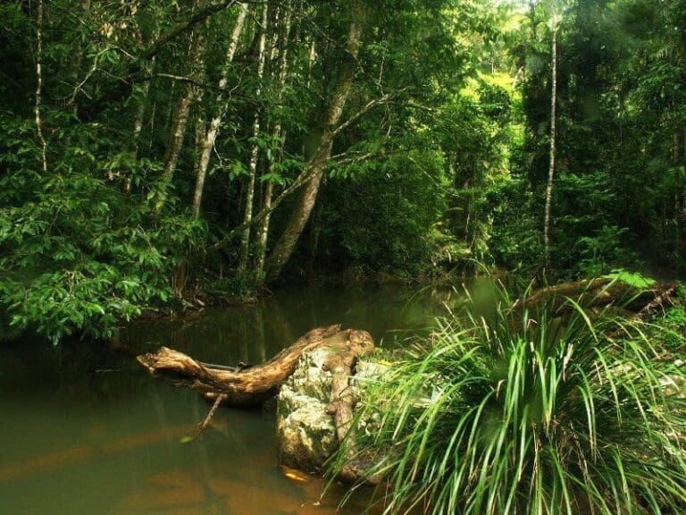
Malanda Falls Rainforest Walk is located within the Malanda Falls Conservation Park on the Atherton Tablelands. Malanda Falls, on the North Johnstone River, tumbles over basalt rock formed by an ancient lava flow that spread from the Mount Hypipamee area 15 kilometres away.
Got some great shots from this hike? Upload your photos here to inspire others and show off the beauty of the trail!
Uploading your photos doesn’t mean you lose ownership. You can be credited for your contributions, and you can request removal at any time.
Please don’t copy GPX files or content from this site to AllTrails or other platforms. Each trail has been personally mapped, documented, and refined to support Australia’s bushwalking and hiking community. While some details come from land managers, every listing reflects significant personal effort. This is a free, community-driven initiative—your respect helps keep it that way.
It looks like I don’t have a GPX file for this trail yet. If you have one to share, please email it to me! I’ll verify it against official maps before adding it to help other hikers have a safer, easier experience. Thanks for contributing to a better hiking resource.
Getting there
Getting to the trailhead: Malanda Falls Conservation Park.
Closest towns to this walk: Atherton, Chifley, La Perouse, Little Bay, Malabar, Malanda, Maroubra, Millaa Millaa, Randwick, Tarzali, Yungaburra
About the region
The Malanda Falls is a cascade waterfall on the North Johnstone River, in the Tablelands Region in the Far North of Queensland, Australia.
The falls are situated on the Atherton Tableland, near the town of Malanda. They are within the Malanda Falls Conservation Park.
The North Johnstone River is prone to significant flooding in the wet season. There are two 20-minute walks in the surrounding rainforest, with a chance of seeing a tree kangaroo. The visitor centre books guided walks with aboriginal guides. It also has displays on the rainforest, geology and history of Malanda. The visitor centre and museum burnt down in 2010 and was rebuilt in 2013.
The swimming pool and associated infrastructure is very popular with locals and tourists. The Malanda Falls Swimming Pool is listed on the Queensland Heritage Register as an early example of tourist infrastructure in North Queensland.
For more information on this hiking trail, please visit Queensland.com
Similar walks nearby
Looking for more walks in or near Malanda Falls Conservation Park? Try these trails with a similar difficulty grade.
Favourite

Danbulla National Park and State Forest
Favourite

Danbulla National Park and State Forest
Favourite

Wooroonooran National Park
Favourite

Jumrum Creek Conservation Park
Track grade
Grade 2 (Easy) - A Gentle Introduction to Inclines: Grade 2 on the
AWTGS represents easy walking tracks that offer a slightly more challenging experience compared to Grade 1. Similar to Grade 1, no prior bushwalking experience is required. The track surface is typically hardened or compacted and may have gentle hill sections or occasional steps. The total distance of a Grade 2 walk is typically no greater than 10 kilometers. These walks are still suitable for families with a bit more experience or those seeking a gentle introduction to some inclines.
Explore safe
Plan ahead and hike safely! Carry enough water, pack layers for changing conditions, and bring safety gear like a torch, PLB, and reliable communication device. Check official sources for trail updates, closures, and access requirements, and review local weather and bushfire advice. Most importantly, share your plans with someone before you go. Being prepared makes for a safer and more enjoyable hike! Stay Safe, Explore More, and Always #ExploreSafe.
Packing checklists
What you carry in your pack depends on factors like weather, terrain, and your adventure type. Not sure what to bring? My free planning, food, and packing checklists are a great starting point, covering day hikes, overnight trips, and multi-day adventures. Use them to customise your kit and always prioritise safety.
Let someone know
Before heading out, take a moment to fill out your trip intentions form. It’s a quick way to share your hike details with family or friends. If something goes wrong, they can notify emergency services, ensuring a faster response and peace of mind. Stay safe and enjoy your adventure
Suggest an edit
Spotted a change on this trail? Maybe there are new features, the route has shifted, or the trail is permanently closed. Whatever the update, I’d love your input. Your feedback helps fellow hikers stay informed and ensures that our trail info stays fresh and reliable.


