Hike at a Glance
Max elevation: 0m
Min elevation: 0m
Total Ascent: 0m
Hike overview
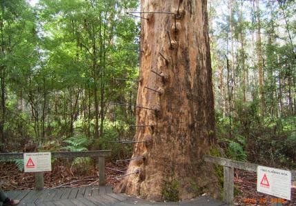
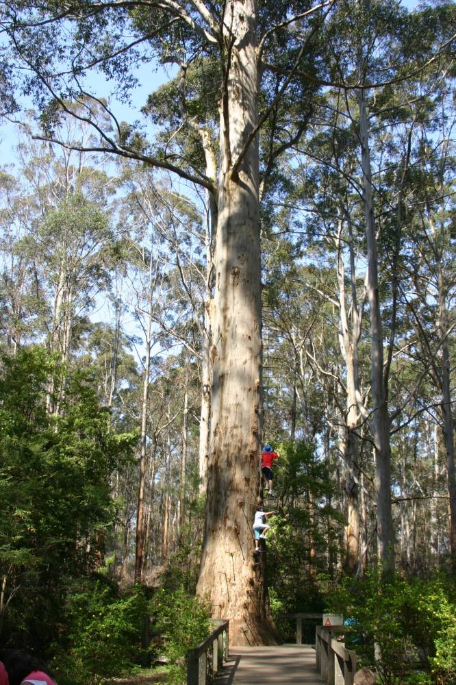
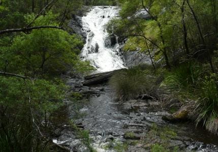
This 12 kilometre return walk starts from the world's tallest climbable tree - the Gloucester Tree and finishes at the Cascades, a series of babbling rapids along Lefroy Brook. It uses the Bibbulmun Track.
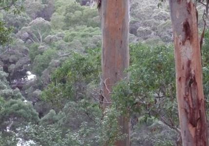
Fill your water flask, don a hat or raincoat (depending on the season) and set off on a half day adventure along a section of the Bibbulmun Track. The track passes through the Gloucester National Park which is a great example of the closed forest ecosytem that extends throughout the Southern Forest region. You start on the 10km Gloucester Route, but when you reach the bitumen road, turn right, cross over the twin bridges, and then right again, following the trail markers back into the forest. From there, you will follow the gurgling East Brook, through the valley. Listen for the stirrings of many different creatures for them, the winding brook is a liquid lifeline. Continue through the forest, following the old railway earthworks. This too, was once a lifeline with heavy logs hauled from the forest on the railway to the Pemberton mill. Listen carefully, you can hear the tram's horn and watch out the tourist trams using the railway line. With time the tell tale scar of the track and the timber harvest on adjacent hillsides is gradually fading as the forest continues its silent regrowth. Timber remains a major industry for Pemberton, as you can see when you look across the town with its weatherboaRoad houses and prominent timber mill. Equally important now, is tourism. Both rely on the same commodity - towering karri forest, now and in the future. Both can continue to exist together, as they do today. Continue to follow the trail markers until you reach the Cascades. Take care! Listen and look out for log trucks when crossing roads.
Tips
Start Point: Gloucester National Park at the Gloucester Tree. Pemberton is 330km (4 hours) south of Perth.
End Point: Gloucester National Park at the Gloucester Tree
Region: Gloucester National Park, South West
For more information, a location map and GPS file please visit Trails WA.
Gallery
Got some great shots from this hike? Upload your photos here to inspire others and show off the beauty of the trail!
Click to view form >>
Submitting your photos doesn’t mean you lose ownership. You can be credited for your contributions, and you can request removal at any time.
Content use
Please don’t copy GPX files or content from this site to AllTrails or other platforms. Each trail has been personally mapped, documented, and refined to support Australia’s bushwalking and hiking community. While some details come from land managers, every listing reflects significant personal effort. This is a free, community-driven initiative—your respect helps keep it that way.
Walk map and GPX file
It looks like I don’t have a GPX file for this trail yet. If you have one to share, please email it to me! I’ll verify it against official maps before adding it to help other hikers have a safer, easier experience. Thanks for contributing to a better hiking resource.
Getting there
Getting to the trailhead: Gloucester National Park.
The Gloucester National Park is accessible via sealed roads from Pemberton.
Closest towns to this walk: Balingup, Bridgetown, Karri Valley, Manjimup, Nannup, Northcliffe, Pemberton
About the region
Only 3km from Pemberton, Gloucester National Park is home to Western Australia's most famous karri tree. The Gloucester Tree was once a fire lookout tree and can now be climbed by the public. Those who do venture up the 153 pegs to the top will be rewarded with commanding views of the karri forest and surrounding farmland. The karri forest is home to many native mammal species such as quenda, quokkas, mardos and dunnarts. These animals are shy and rarely seen. Sit quietly in the forest at Cascades and you may be rewarded with the sight of honeyeaters, wrens, fantails and robins flitting around through the undergrowth.
Similar walks nearby
Looking for more walks in or near Gloucester National Park? Try these trails with a similar difficulty grade.
Track grade
Grade 3 (Moderate) - Walks for Most Fitness Levels: Grade 3 on the AWTGS represents moderate walking tracks. These are ideal for walkers with some fitness who are comfortable with some hills and uneven terrain. While suitable for most ages, some bushwalking experience is recommended to ensure a safe and enjoyable experience. Tracks may have short, steep hill sections, a rough surface, and many steps. The total distance of a Grade 3 walk can be up to 20 kilometers.
Explore safe
Plan ahead and hike safely! Carry enough water, pack layers for changing conditions, and bring safety gear like a torch, PLB, and reliable communication device. Check official sources for trail updates, closures, and access requirements, and review local weather and bushfire advice. Most importantly, share your plans with someone before you go. Being prepared makes for a safer and more enjoyable hike! Stay Safe, Explore More, and Always #ExploreSafe.
Packing checklists
What you carry in your pack depends on factors like weather, terrain, and your adventure type. Not sure what to bring? My free planning, food, and packing checklists are a great starting point, covering day hikes, overnight trips, and multi-day adventures. Use them to customise your kit and always prioritise safety.
Let someone know
Before heading out, take a moment to fill out your trip intentions form. It’s a quick way to share your hike details with family or friends. If something goes wrong, they can notify emergency services, ensuring a faster response and peace of mind. Stay safe and enjoy your adventure
Suggest an edit
Spotted a change on this trail? Maybe there are new features, the route has shifted, or the trail is permanently closed. Whatever the update, I’d love your input. Your feedback helps fellow hikers stay informed and ensures that our trail info stays fresh and reliable.
Acknowledgement of Country
Trail Hiking Australia acknowledges the Traditional Owners of the lands on which we hike and pay respects to their Elders, past and present, and we acknowledge the First Nations people of other communities who may be here today.


