Hike at a Glance
Max elevation: 652m
Min elevation: 632m
Total Ascent: 43m
Hike overview
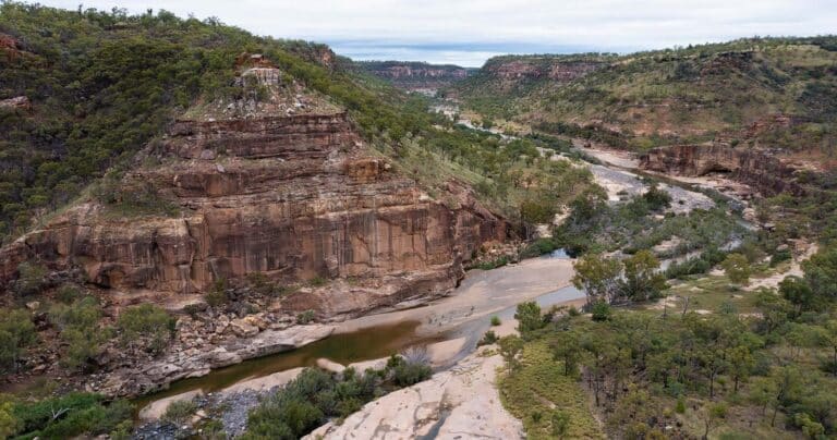
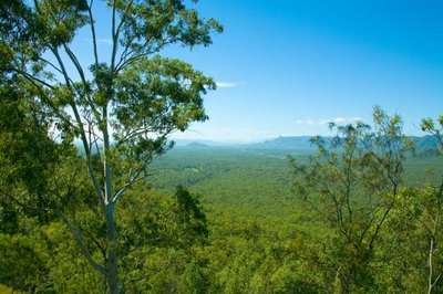
Eagle Lookout Walk is a relatively easy walk through the Porcupine Gorge National Park in rural central northern Queensland. The trail begins from the Pyramid Campground, not too far from the small town of Hughenden in the Shire of Flinders, Queensland. The trail follows a clearly defined, flat, unpaved trail with only a few rocky sections. The unmarked path is through open woodland with little shade but the view of the gorge from the gorge rim at the end of the trail is magnificent.
Camping
Camping is available at the Pyramid camping area. All bookings for camp sites must be made online prior to visiting the park, and well in advance during peak season (April to October). Camping permits are required and fees apply.
Tips
The Pyramid camping area has wheelchair-accessible toilets. Some campsites have wheelchair-accessible picnic tables (assistance maybe required). To see which campsites are suitable for wheelchair access, refer to camping in Porcupine Gorge National Park. The Porcupine Gorge lookout is wheelchair accessible with assistance.
Gallery
Got some great shots from this hike? Upload your photos here to inspire others and show off the beauty of the trail!
Click to view form >>
Submitting your photos doesn’t mean you lose ownership. You can be credited for your contributions, and you can request removal at any time.
Content use
Please don’t copy GPX files or content from this site to AllTrails or other platforms. Each trail has been personally mapped, documented, and refined to support Australia’s bushwalking and hiking community. While some details come from land managers, every listing reflects significant personal effort. This is a free, community-driven initiative—your respect helps keep it that way.
Walk map and GPX file
Max elevation: 652 m
Min elevation: 632 m
Total climbing: 43 m
Total descent: -43 m
Getting there
Getting to the trailhead: Porcupine Gorge National Park.
Access to Porcupine Gorge National Park (including the lookout and camping area) is fully sealed. From Hughenden, follow the Kennedy Developmental Road north for 60km to reach the turn-off to the Gorge lookout. The Gorge lookout carpark is 1.5km from the Kennedy Developmental Road turn-off.
The turn-off to the Pyramid camping area, day-use area and walking track is a further 11.7km north along the Kennedy Developmental Road. From the turn-off, follow the Mount Emu Road for 4.4km, then turn east and follow the road for 2.4km to reach the Pyramid camping and day-use area.
If travelling beyond the park, further north to Blackbraes National Park or the Lynd Junction, please be aware that the Kennedy Developmental Road is unsealed in some sections. When dry, this road is accessible to all vehicle types with care. Travellers should expect to encounter bulldust, corrugations, exposed rocks, creek crossings, other vehicles, native wildlife, cattle and road trains. After storms the road may be temporarily closed or inaccessible to conventional vehicles and caravans.
Closest towns to this walk: Charters Towers, Einasleigh, Ewan, Forsayth, Georgetown, Hughenden, Mareeba, Mount Surprise, Prairie, Richmond, Torrens Creek, Winton
About the region
The impressive Porcupine Gorge National Park extends 25 kilometres along Porcupine Creek, which has carved a breathtaking canyon in its path that reveals strata of sedimentary rocks spanning hundreds of millions of years. In the wider section of the gorge the eroding action of the creek has also created the Pyramid, an isolated monolith of multicoloured sandstone rising from the floor of the gorge, shaped as its name suggests.
Towering cliffs of coloured sandstone, pockets of vine forest and deep permanent waterholes along Porcupine Creek contrast strikingly with the savanna plains surrounding Porcupine Gorge. The gorge lookout is about 60km north of Hughenden. The Pyramid camping and day-use areas and the Pyramid track are another 11km further north. The Yirendali Aboriginal people welcome you to their traditional country and ask that you respect their special place.
The gorge, with its many permanent waterholes, provides an important refuge for and attracts a wide variety of animals. Some are permanent residents, but others only appear in the dry season. Birds are abundant so remember to bring your binoculars and a camera!
Similar walks nearby
Looking for more walks in or near Porcupine Gorge National Park? Try these trails with a similar difficulty grade.
Track grade
Grade 3 (Moderate) - Walks for Most Fitness Levels: Grade 3 on the AWTGS represents moderate walking tracks. These are ideal for walkers with some fitness who are comfortable with some hills and uneven terrain. While suitable for most ages, some bushwalking experience is recommended to ensure a safe and enjoyable experience. Tracks may have short, steep hill sections, a rough surface, and many steps. The total distance of a Grade 3 walk can be up to 20 kilometers.
Explore safe
Plan ahead and hike safely! Carry enough water, pack layers for changing conditions, and bring safety gear like a torch, PLB, and reliable communication device. Check official sources for trail updates, closures, and access requirements, and review local weather and bushfire advice. Most importantly, share your plans with someone before you go. Being prepared makes for a safer and more enjoyable hike! Stay Safe, Explore More, and Always #ExploreSafe.
Packing checklists
What you carry in your pack depends on factors like weather, terrain, and your adventure type. Not sure what to bring? My free planning, food, and packing checklists are a great starting point, covering day hikes, overnight trips, and multi-day adventures. Use them to customise your kit and always prioritise safety.
Let someone know
Before heading out, take a moment to fill out your trip intentions form. It’s a quick way to share your hike details with family or friends. If something goes wrong, they can notify emergency services, ensuring a faster response and peace of mind. Stay safe and enjoy your adventure
Suggest an edit
Spotted a change on this trail? Maybe there are new features, the route has shifted, or the trail is permanently closed. Whatever the update, I’d love your input. Your feedback helps fellow hikers stay informed and ensures that our trail info stays fresh and reliable.
Acknowledgement of Country
Trail Hiking Australia acknowledges the Traditional Owners of the lands on which we hike and pay respects to their Elders, past and present, and we acknowledge the First Nations people of other communities who may be here today.


