Trail Fast Facts
Culgoa Connellys track is an 8km, grade 5 hike in Culgoa National Park, New South Wales. This hike typically takes 4.5 hours to complete.
Hike Overview
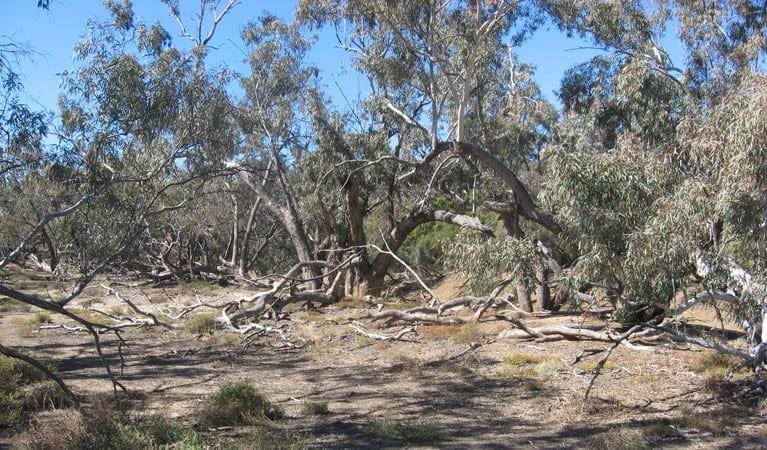
Thanks to the Jolly Swagman and his billabong, coolabah trees are iconic in Australian folklore. Culgoa Connellys track has loads of them - in fact, it threads for 4km through open coolabah woodlands, with birds circling overhead and emus rushing through scrub along the track. After rainy season, the ground blooms with native wildflowers, too.
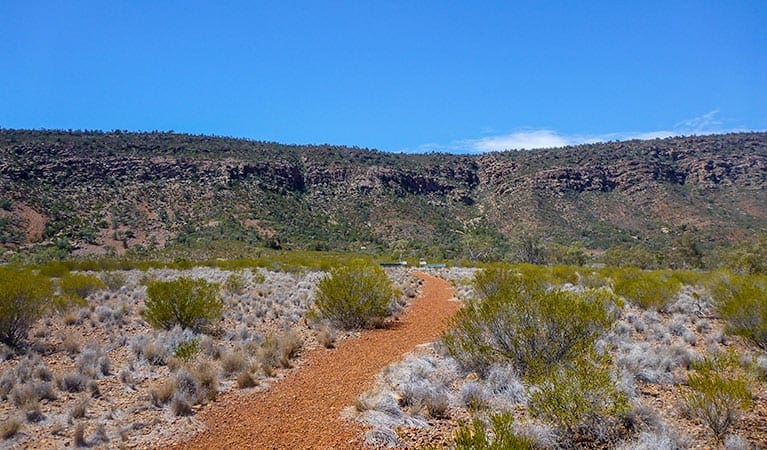
Reached from Culgoa River campground, Culgoa Connellys track is suitable for everybody, from families and grey nomads to experienced bushwalkers. Bring plenty of water, sturdy shoes, and that all-important sense of adventure, and this easy walk delivers plenty of rewards. While it's Grade 5 for not having directional signage, you'll still find this an easy walk for all ages.
If you're river camping, consider bringing a torch as a great deal of wildlife is most active at night. So, follow the track in the evening for a completely different experience to a chorus of frogs and cicadas. You might like to look up for a bit of amateur astronomy while you're at it.
You can even extend the stroll by following the adjoining Yawura Yarun (Sandhill track), which offers a return walk to the campground as well.
Track Grade
Grade 5 (Difficult) - Walks for the Most Experienced: Grade 5 represents the most challenging walking tracks on the AWTGS. These are only recommended for very experienced and fit walkers with specialised skills, including navigation and emergency first aid. Tracks are likely to be very rough, very steep, and unmarked. Walks may be more than 20 kilometers. These challenging walks demand a high level of fitness and experience to navigate difficult terrain, significant elevation changes, and potentially unformed paths.
Tips
The small townships of Weilmoringle, on the south-west side of Culgoa, and Goodooga, on the east side of Culgoa, offer no fuel, so please ensure you have enough before departure.
Remember to take your binoculars if you want to birdwatch
Visit NSW National Parks and Wildlife Service for more information on this trail.
The longitude and latitude of the start and end points are approximately only and should not be used for navigation purposes. Please contact me if you know the correct coordinates.
Map and GPX file
Help fellow hikers navigate with confidence. Share your GPX or KML file for this trail and help build a more comprehensive resource with precise waypoints and elevation profiles. Your contribution will empower adventurers with details they need for a safer and more enjoyable experience. I meticulously verify every file using official maps and surveys, ensuring the highest level of accuracy and reliability. Submit your file now and become a trailblazer for your fellow outdoor enthusiasts.
Trail Location (trailhead)
Sorry, no records were found. Please adjust your search criteria and try again.
Sorry, unable to load the Maps API.
Getting there
Culgoa Connellys track starts from Culgoa River campground in the Burban Grange precinct of Culgoa National Park. To get there:Take the unsealed road north-east of Bourke for 180km, or the unsealed, dry weather road north of Brewarrina for 120km.The campground is 14km from the southern entrance of the park Road quality Check the weather before you set out as the road to Culgoa National Park can become boggy when it rains and the roads are susceptible to flooding. Parking Parking is available at Culgoa River campground.
Photo gallery
If you have any photos from this hike and are happy to share them, please upload your .jpg files here.
Please note: Uploading photos does not transfer ownership of copyright away from you. If requested, you will be credited for any photos you provide and can ask they be deleted at any time.
About the region
Culgoa National Park in the Outback NSW region
Culgoa National Park is always open, but may have to close at times due to poor weather or fire danger.
Similar trails nearby
Explore Safe
While planning your hike, it’s important to check official government sources for updated information, temporary closures and trail access requirements. Before hitting the trail, check local weather and bushfire advice for planned burns and bushfire warnings and let someone know before you go. Plan ahead and hike safely.
Let someone know
Adventure with peace of mind: Fill out your trip intentions form. Before you hit the trail, fill out an online form to privately send important details about your hike to your family or friends. If you don’t return on time, they can easily alert emergency services, preventing worry and ensuring a swift response. Hike with peace of mind and enjoy your outdoor adventure to the fullest. Be smart, be safe: Register your plans here.
Gear to consider
What you carry in your pack will depend on the weather, terrain, time of year, type of adventure, and personal preferences. Having trouble deciding what gear’s right for you? My free planning, food and packing checklists provide an introduction to things your could consider (as well as the Ten Essentials) on your day, overnight and multi-day adventures. Customise your kit according to your personal needs, always considering safety first.
Suggest an edit
Trail changed? New features discovered? Has the route changed? Trail permanently closed? Help fellow hikers by suggesting edits! Click above to update route descriptions, GPX file, trail features (like boardwalks), or access conditions (like parking availability). Help me keep the trails info fresh!
Weather
Acknowledgement of Country
Trail Hiking Australia acknowledges the Traditional Owners of the lands on which we hike and pay respects to their Elders, past and present, and we acknowledge the First Nations people of other communities who may be here today.


