Hike at a Glance
Max elevation: 814m
Min elevation: 314m
Total Ascent: 700m
Important info
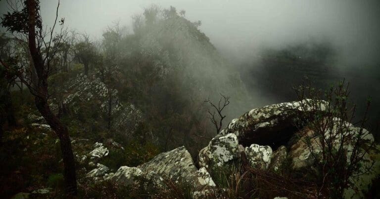
The Cathedral Range is a special place that has a lot to offer hikers, but it should not be underestimated. The terrain is dominated by rocky ridges and outcrops, requiring navigation of steep climbs, uneven surfaces, and potentially slippery sections. Weather conditions can shift rapidly, so trekkers must be prepared for all possibilities.
Hike overview
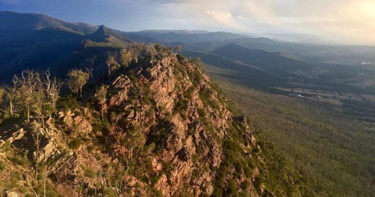
The Cathedral Range is a must-visit destination for hikers. This challenging hike traverses the northern and central sections of the range, offering stunning views along the way.
Start your hike at the Neds Gully Campground car park. Cross the road and follow the marked trail over the bridge. You'll soon reach a junction leading to Neds Gully Track on your right. Initially, the track is gentle but eventually becomes steeper. You'll arrive at Neds Saddle, a vantage point with sweeping views.
Consider an optional side trip to Neds Peak. Allocate about 20-30 minutes to ascend, enjoy the view, and head back. Next, take the Cathedral Track to the left. This section is very steep but short, leading to a saddle along the ridge.
Another optional side trip is Cathedral Peak. Head right and ascend to the summit, savoring the breathtaking views before returning to the saddle.
From the saddle, follow the Ridge Track south. The first 1-1.5 kilometers are challenging, requiring scrambling over rocks. Keep a keen eye out for frequent markers. Enjoy the panoramic views as you progress.
Near the 2-kilometer mark from the saddle, you'll encounter a junction with the North Jawbone Track. Take this to the left and gently descend to the trail ascending to the peak. Ascend the peak, explore the viewpoints, and then descend back down.
At the junction again, head left. At the next junction, veer right towards The Farmyard. Ascend South Jawbone Peak from The Farmyard and admire the spectacular views. Once finished, return to The Farmyard and follow the trail back to the junction you passed when coming from North Jawbone Peak.
Head right and descend into the valley. The trail is steep but easy to follow. After about 1 kilometer, you'll reach the Jawbone Carpark.
Keep an eye out for the entrance to the Saint Bernards Track on your left. It's often obscured by parked vehicles. Take this track for about 1 kilometer to arrive at Cooks Mill.
Near the campsite, veer slightly left to find the Little River Track. Initially, the trail meanders through trees before emerging onto a dirt road for about ¾ kilometers. The path then re-enters the bush, guiding you on a pleasant walk back to the Neds Gully Carpark.
Camping in the Cathedral Range State Park
Cathedral Range State Park offers several camping options to suit different preferences.
Cooks Mill campground provides a scenic riverside location with shade and a variety of sites suitable for tents, campervans, and a limited number of caravans. Amenities include pit toilets, fireplaces, picnic tables, and shelters.
For a more secluded experience, Neds Gully campground is accessible by a short walk across a swing bridge. This campground is limited to tents only and offers basic amenities like pit toilets and fireplaces.
The Farmyard, designed for experienced hikers, provides a remote overnight camping option directly on the range. This location is accessible only on foot and has no facilities. Campers must bring their own drinking water, gas stove for cooking, and firewood (purchased from nearby towns as collecting firewood within the park is prohibited).
Regardless of your chosen campsite, remember to book online in advance for Neds Gully and Cooks Mill (bookings can be made through parks.vic.gov.au or by calling 13 1963). Specific campsites cannot be reserved, so selection happens upon arrival. Additionally, bring your own cooking plates and drinking water for all locations. Campfires are only permitted in designated fireplaces using purchased firewood, not collected from the park.
Tips
- The Cathedral Range should not be underestimated.
- The terrain is dominated by rocky ridges and outcrops, requiring navigation of steep climbs, uneven surfaces, and potentially slippery sections.
- Weather conditions can shift rapidly, so walkers must be prepared for all possibilities.
- Be aware that many trails are steep and rocky, and can become slippery after rain or in misty weather.
- Only attempt to summit Sugarloaf Peak if you are comfortable with heights and exposed sections requiring scrambling.
- Follow the orange trail markers provided in designated areas.
- Plan for slower progress due to the rugged terrain. Expect to cover 1.5-2km per hour in some sections.
- Hiking poles are highly recommended for certain sections of the trails.
- Let someone know where you are hiking and when you expect to return.
Content use
Please don’t copy GPX files or content from this site to AllTrails or other platforms. Each trail has been personally mapped, documented, and refined to support Australia’s bushwalking and hiking community. While some details come from land managers, every listing reflects significant personal effort. This is a free, community-driven initiative—your respect helps keep it that way.
Walk map and GPX file
Max elevation: 814 m
Min elevation: 314 m
Total climbing: 700 m
Total descent: -700 m
Getting there
Getting to the trailhead: Cathedral Range State Park.
Cathedral Range State Park is 2 hrs 15 min from the Melbourne CBD. From Melbourne follow the Maroondah Highway to Buxton. Continue past Buxton for 9.5km and turn right into Cathedral Lane to find the park entrance 2.5km on your right. Turn right again on to Little River Road, continue for 2.5km and Neds Gully Camping Area is on your right.
Closest towns to this walk: Acheron, Buxton, Eildon, Marysville, Narbethong, Taggerty, Thornton, Yarra Glen
About the region
Cathedral Range State Park boasts a dramatic landscape with jagged ridges offering stunning views and hiking trails. Hikers of all levels can explore the park's amazing and rugged beauty. The Friends Nature Trail provides a gentle introduction for families, while experienced walkers can traverse the challenging Razorback or longer circuit routes. All trails reward hikers with breathtaking views of the surrounding forests and valleys.
Camping allows visitors to experience the park under the starry night sky, sharing the environment with native wildlife like kangaroos and lyrebirds. Cooks Mill campground offers historical charm, while The Farmyard provides a secluded escape accessible only by foot.
Beyond hiking, the park caters to rock climbing enthusiasts. The Boulders offer a perfect training ground for beginners, whereas Sugarloaf Saddle and North Jawbone present a steeper challenge. Sugarloaf Saddle also boasts a stand of Mountain Ash, one of the world's tallest flowering trees, with some specimens reaching an astonishing 90 meters.
The Cathedral Range's rugged beauty demands respect. Hikers should be aware of the prevalent rocky terrain with steep climbs, uneven surfaces, and potential for slippery conditions. Weather changes rapidly, so be prepared for all possibilities.
The park holds significance for the Taungurung Traditional Owners, and their ongoing connection to this land is acknowledged and respected.
Similar walks nearby
Looking for more walks in or near Cathedral Range State Park? Try these trails with a similar difficulty grade.
Track grade
Grade 4 (Hard) - Challenging Walks for Experienced Walkers: Grade 4 on the AWTGS signifies challenging walking tracks. Bushwalking experience is recommended for these tracks, which may be long, rough, and very steep. Directional signage may be limited, requiring a good sense of navigation. These walks are suited for experienced walkers who are comfortable with steeper inclines, rougher terrain, and potentially longer distances.
Explore safe
Plan ahead and hike safely! Carry enough water, pack layers for changing conditions, and bring safety gear like a torch, PLB, and reliable communication device. Check official sources for trail updates, closures, and access requirements, and review local weather and bushfire advice. Most importantly, share your plans with someone before you go. Being prepared makes for a safer and more enjoyable hike! Stay Safe, Explore More, and Always #ExploreSafe.
Packing checklists
What you carry in your pack depends on factors like weather, terrain, and your adventure type. Not sure what to bring? My free planning, food, and packing checklists are a great starting point, covering day hikes, overnight trips, and multi-day adventures. Use them to customise your kit and always prioritise safety.
Let someone know
Before heading out, take a moment to fill out your trip intentions form. It’s a quick way to share your hike details with family or friends. If something goes wrong, they can notify emergency services, ensuring a faster response and peace of mind. Stay safe and enjoy your adventure
Suggest an edit
Spotted a change on this trail? Maybe there are new features, the route has shifted, or the trail is permanently closed. Whatever the update, I’d love your input. Your feedback helps fellow hikers stay informed and ensures that our trail info stays fresh and reliable.
Acknowledgement of Country
Trail Hiking Australia acknowledges the Traditional Owners of the lands on which we hike and pay respects to their Elders, past and present, and we acknowledge the First Nations people of other communities who may be here today.
/Cathedral-Range-Cathedral-&-Jawbones-Hike_7.jpg)
/Cathedral-Range-Cathedral-&-Jawbones-Hike_3.jpg)
/Cathedral-Range-Cathedral-&-Jawbones-Hike_2.jpg)
/Cathedral-Range-Cathedral-&-Jawbones-Hike_21.jpg)
/Cathedral-Range-Cathedral-&-Jawbones-Hike_5.jpg)
/Cathedral-Range-Cathedral-&-Jawbones-Hike_19.jpg)
/Cathedral-Range-Cathedral-&-Jawbones-Hike_6.jpg)
/Cathedral-Range-Cathedral-&-Jawbones-Hike_18.jpg)
/Cathedral-Range-Cathedral-&-Jawbones-Hike_20.jpg)
/Cathedral-Range-Cathedral-&-Jawbones-Hike_1.jpg)
/Cathedral-Range-Cathedral-&-Jawbones-Hike_8.jpg)
/Cathedral-Range-Cathedral-&-Jawbones-Hike_17.jpg)
/Cathedral-Range-Cathedral-&-Jawbones-Hike_9.jpg)
/Cathedral-Range-Cathedral-&-Jawbones-Hike_22.jpg)
/Cathedral-Range-Cathedral-&-Jawbones-Hike_12.jpg)


6 Reviews on “Cathedral Range: Cathedral & Jawbones Hike (13km)”
A fantastic hike with sensational views. Note, the trail to Neds Gully is rated as Grade 4 and the Farmyard/Ridge Track to Jawbone Creek Track is rated as Grade 5.