Hike at a Glance
Max elevation: 0m
Min elevation: 0m
Total Ascent: 0m
Important info
This hike is classified as Grade 4 (Hard) primarily due to its distance exceeding 20km. The terrain itself is relatively easy and suitable for most abilities. However, the long distance requires a good level of fitness and preparation. Feel free to turn back at any point for a shorter adventure.
Hike overview
The Bellarine Rail Trail is a 35 km walking and cycling track on the Bellarine Peninsula, in Victoria, Australia, that follows the route of the former South Geelong to Queenscliff branch line. It runs from South Geelong to Queenscliff, passing through the towns of Leopold and Drysdale. The rails have been removed from the western section between South Geelong and Drysdale.
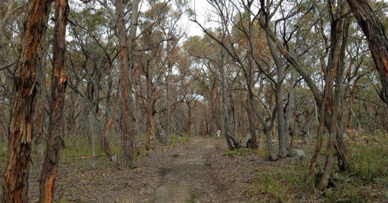
The Bellarine Railway operates a tourist railway between Drysdale and Queenscliff, and the walking track runs parallel to the railway in this 16 km eastern section. The route traverses farmland with scattered patches and strips of native vegetation, mainly eucalypt woodland. The line was opened from Geelong to Queenscliff in 1879 to carry soldiers and materials to assist in the defence of Port Phillip Bay from possible attack by the Russians. It also carried holiday makers to the popular seaside resort of Queenscliff. The line was closed in 1976, but the section from Drysdale to Queenscliff was reopened as a tourist railway in 1981. It officially became the Bellarine Rail Trail in 2000.
Access Points
- Strong Street at Swanston Street near South Geelong railway station
- South Geelong - Breakwater Rd opposite the Geelong showgrounds, 1km from the railway station along Carr St
- Drysdale - At the railway station, which is the half way point where the tourist railway terminates.
- Queenscliff - opposite the station towards the carriage sidings
Tips
The gradient is mostly easy and flat with a gradual climb in some places. Families with young children often choose to avoid the return uphill climb from Queenscliff to Mannerim by either hopping on the steam train or arranging other transport.
Gallery
Got some great shots from this hike? Upload your photos here to inspire others and show off the beauty of the trail!
Click to view form >>
Submitting your photos doesn’t mean you lose ownership. You can be credited for your contributions, and you can request removal at any time.
Content use
Please don’t copy GPX files or content from this site to AllTrails or other platforms. Each trail has been personally mapped, documented, and refined to support Australia’s bushwalking and hiking community. While some details come from land managers, every listing reflects significant personal effort. This is a free, community-driven initiative—your respect helps keep it that way.
Walk map and GPX file
It looks like I don’t have a GPX file for this trail yet. If you have one to share, please email it to me! I’ll verify it against official maps before adding it to help other hikers have a safer, easier experience. Thanks for contributing to a better hiking resource.
Getting there
Getting to the trailhead: Bellarine Peninsula.
Closest towns to this walk: Barwon Heads, Drysdale, Geelong, Ocean Grove, Point Lonsdale, Portarlington, Queenscliff
About the region
The Bellarine Peninsula is a peninsula located south-west of Melbourne in Victoria, Australia, surrounded by Port Phillip, Corio Bay and Bass Strait. The peninsula, together with the Mornington Peninsula separates Port Phillip from Bass Strait. The peninsula itself was originally occupied by Indigenous Australian clans of the Wathaurong nation, prior to European settlement in the early 19th century.[1] Early European settlements were initially centred on wheat and grain agriculture, before the area became a popular tourist destination with most visitors arriving by paddle steamer on Port Phillip in the late 19th century.
Similar walks nearby
Looking for more walks in or near Bellarine Peninsula? Try these trails with a similar difficulty grade.
Track grade
Grade 4 (Hard) - Challenging Walks for Experienced Walkers: Grade 4 on the AWTGS signifies challenging walking tracks. Bushwalking experience is recommended for these tracks, which may be long, rough, and very steep. Directional signage may be limited, requiring a good sense of navigation. These walks are suited for experienced walkers who are comfortable with steeper inclines, rougher terrain, and potentially longer distances.
Explore safe
Plan ahead and hike safely! Carry enough water, pack layers for changing conditions, and bring safety gear like a torch, PLB, and reliable communication device. Check official sources for trail updates, closures, and access requirements, and review local weather and bushfire advice. Most importantly, share your plans with someone before you go. Being prepared makes for a safer and more enjoyable hike! Stay Safe, Explore More, and Always #ExploreSafe.
Packing checklists
What you carry in your pack depends on factors like weather, terrain, and your adventure type. Not sure what to bring? My free planning, food, and packing checklists are a great starting point, covering day hikes, overnight trips, and multi-day adventures. Use them to customise your kit and always prioritise safety.
Let someone know
Before heading out, take a moment to fill out your trip intentions form. It’s a quick way to share your hike details with family or friends. If something goes wrong, they can notify emergency services, ensuring a faster response and peace of mind. Stay safe and enjoy your adventure
Suggest an edit
Spotted a change on this trail? Maybe there are new features, the route has shifted, or the trail is permanently closed. Whatever the update, I’d love your input. Your feedback helps fellow hikers stay informed and ensures that our trail info stays fresh and reliable.
Acknowledgement of Country
Trail Hiking Australia acknowledges the Traditional Owners of the lands on which we hike and pay respects to their Elders, past and present, and we acknowledge the First Nations people of other communities who may be here today.


8 Reviews on “Bellarine Rail Trail Walk (35 km)”
Maddison Ruggiero
Deb Dark
Craig Tilley Michelle Toniolo-Jacgung Sandra Rogers Helen Panayi