Hike at a Glance
Max elevation: 35m
Min elevation: 8m
Total Ascent: 203m
Hike overview
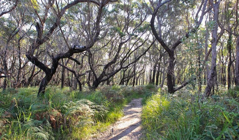
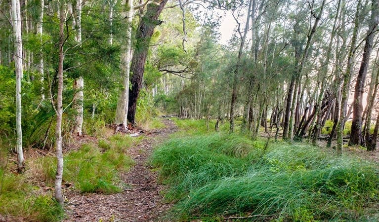
Discover the rich Aboriginal cultural heritage along the Giriwa walking track in Meroo National Park, near Ulladulla. This 3 km track, just a 10-minute drive from Ulladulla and 35 minutes from Batemans Bay, offers a unique blend of natural beauty and cultural history. Starting at the Burrill Lake East picnic area, the track follows the southern shore of Burrill Lake, leading to the Western Arm picnic area.
The name ‘Giriwa’ means goanna, and as you walk, you may spot the track’s namesake along with honeyeaters and crimson rosellas amongst the tallowwood and flowering black wattle trees. Informative signs along the way highlight over 20,000 years of continuous Aboriginal culture in this region, offering insights into the deep connection the Aboriginal people have with this land. Learn about traditional bush medicines, edible native plants like the native cherry, and the cabbage tree palms used for basket weaving.
With picnic areas at both ends of the track, it's an ideal spot to pause and enjoy a meal by the lakeshore. The serene waters of Burrill Lake are also perfect for swimming, kayaking, stand-up paddleboarding, or fishing.
This track is part of the longer Giriwa Bagan ‘goanna country’ walking trail, which also includes the Gari walking track. ‘Gari,’ meaning snake, is a 1 km extension from the lake’s East picnic area to an Aboriginal rock shelter, offering further exploration of the area’s cultural heritage.
Tips
- Giriwa walking track: This track can be walked in either direction. For families with young children, consider using two cars to shuttle between the trailheads for a shorter walk.
- Gari walking track extension: The Gari walking track, which leads to the Burrill Lake Rock Shelter, is managed by Shoalhaven City Council.
Gallery
Got some great shots from this hike? Upload your photos here to inspire others and show off the beauty of the trail!
Click to view form >>
Submitting your photos doesn’t mean you lose ownership. You can be credited for your contributions, and you can request removal at any time.
Content use
Please don’t copy GPX files or content from this site to AllTrails or other platforms. Each trail has been personally mapped, documented, and refined to support Australia’s bushwalking and hiking community. While some details come from land managers, every listing reflects significant personal effort. This is a free, community-driven initiative—your respect helps keep it that way.
Walk map and GPX file
Max elevation: 35 m
Min elevation: 8 m
Total climbing: 203 m
Total descent: -203 m
Getting there
Getting to the trailhead: Meroo National Park.
Accessing the Giriwa Walking Track: The Giriwa walking track is located in the northern section of Meroo National Park. To reach the trailhead, drive to Burrill Lake. From Ulladulla, head south on the Princes Highway and turn right onto Romney Park Road after crossing the bridge. From Batemans Bay, travel north on the Princes Highway and turn left onto Wheelbarrow Road before reaching Burrill Lake. Follow signs to either Burrill Lake’s East or Western Arm picnic area. Please note that the roads leading to the picnic areas are unsealed and may be challenging for some vehicles, especially in wet weather. Four-wheel drive vehicles are recommended. Parking is limited at both picnic areas.
Closest towns to this walk: Adaminaby, Batemans Bay, Bawley Point, Berridale, Berry, Bomaderry, Cooma, Jindabyne, Kangaroo Valley, Meroo, Meroo Meadow, Milton, Moruya, Nelligen, Nowra, Termeil, Ulladulla
About the region
Discover Meroo National Park, a pristine coastal sanctuary nestled between Ulladulla and Batemans Bay on the New South Wales South Coast. This idyllic park offers a wealth of experiences for visitors of all ages and interests. Immerse yourself in nature as you explore the park's diverse landscapes. Enjoy fishing, swimming, walking, bushwalking, hiking, and cycling amidst stunning coastal scenery. For those seeking tranquillity, the park's peaceful lakes provide opportunities for kayaking and birdwatching.
Meroo National Park is also a haven for camping enthusiasts. Pitch your tent at Meroo Head campground and wake up to the sound of waves crashing on the shore. This beachfront location offers easy access to swimming, snorkelling, surfing, and fishing, as well as breathtaking views. Whether you're planning a family getaway, a romantic escape, or a solo adventure, Meroo National Park promises an unforgettable experience.
Similar walks nearby
Looking for more walks in or near Meroo National Park? Try these trails with a similar difficulty grade.
Track grade
Grade 3 (Moderate) - Walks for Most Fitness Levels: Grade 3 on the AWTGS represents moderate walking tracks. These are ideal for walkers with some fitness who are comfortable with some hills and uneven terrain. While suitable for most ages, some bushwalking experience is recommended to ensure a safe and enjoyable experience. Tracks may have short, steep hill sections, a rough surface, and many steps. The total distance of a Grade 3 walk can be up to 20 kilometers.
Explore safe
Plan ahead and hike safely! Carry enough water, pack layers for changing conditions, and bring safety gear like a torch, PLB, and reliable communication device. Check official sources for trail updates, closures, and access requirements, and review local weather and bushfire advice. Most importantly, share your plans with someone before you go. Being prepared makes for a safer and more enjoyable hike! Stay Safe, Explore More, and Always #ExploreSafe.
Packing checklists
What you carry in your pack depends on factors like weather, terrain, and your adventure type. Not sure what to bring? My free planning, food, and packing checklists are a great starting point, covering day hikes, overnight trips, and multi-day adventures. Use them to customise your kit and always prioritise safety.
Let someone know
Before heading out, take a moment to fill out your trip intentions form. It’s a quick way to share your hike details with family or friends. If something goes wrong, they can notify emergency services, ensuring a faster response and peace of mind. Stay safe and enjoy your adventure
Suggest an edit
Spotted a change on this trail? Maybe there are new features, the route has shifted, or the trail is permanently closed. Whatever the update, I’d love your input. Your feedback helps fellow hikers stay informed and ensures that our trail info stays fresh and reliable.
Acknowledgement of Country
Trail Hiking Australia acknowledges the Traditional Owners of the lands on which we hike and pay respects to their Elders, past and present, and we acknowledge the First Nations people of other communities who may be here today.


