Hike at a Glance
Max elevation: 412m
Min elevation: 398m
Total Ascent: 22m
Hike overview
The Franklin Nature Trail offers a short, easy walk that serves as an ideal break when travelling between Tasmania's east and west. Situated within the Franklin-Gordon Wild Rivers National Park, this 1.2 km, grade 2 trail typically takes about 30 minutes to complete.
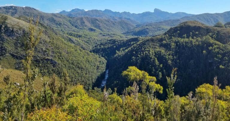
The partially boardwalked track winds through lush, moss-covered rainforest, where, in late summer, the air is often filled with the fragrant scent of leatherwood flowers. The trail is best enjoyed in an anti-clockwise direction, leading to a serene spot along the banks of the Franklin River. This river, once threatened by a controversial dam project, now stands as a testament to successful conservation efforts, offering visitors a peaceful setting to appreciate the natural beauty of the wilderness.
The Franklin River is one of the most prominent rivers flowing through the Franklin-Gordon Wild Rivers National Park. Walking along its banks and through the cool temperate rainforest, visitors gain insight into the unique landscape that defines this protected area. Interpretation signs along the trail provide further information about the park's ecological and historical significance.
The trailhead is located at the Franklin River Picnic Area, just off the Lyell Highway (A10), approximately 60 km east of Queenstown.
Tips
- This area is designated as Fuel Stove Only. Open fires are strictly prohibited. For further details, please visit our Fuel Stove Only Areas webpage.
- The toilets at Franklin River Nature Trail are currently closed. Alternative facilities are available at Nelson Falls and Derwent Bridge.
- Even for a short walk, carry a light pack with essentials like a weatherproof jacket, warm hat, water, high-energy food, and a first aid kit with an emergency space blanket.
- Prepare for varying conditions by bringing a sunhat, sunglasses, sunscreen, and insect repellent.
- Carry a rubbish bag and take all your rubbish out with you.
- If your mobile phone has a signal, bring it along and limit its use to conserve the battery.
- For remote areas, consider packing extra food and an emergency shelter.
Gallery
Got some great shots from this hike? Upload your photos here to inspire others and show off the beauty of the trail!
Click to view form >>
Submitting your photos doesn’t mean you lose ownership. You can be credited for your contributions, and you can request removal at any time.
Content use
Please don’t copy GPX files or content from this site to AllTrails or other platforms. Each trail has been personally mapped, documented, and refined to support Australia’s bushwalking and hiking community. While some details come from land managers, every listing reflects significant personal effort. This is a free, community-driven initiative—your respect helps keep it that way.
Walk map and GPX file
Max elevation: 412 m
Min elevation: 398 m
Total climbing: 22 m
Total descent: -22 m
Getting there
Getting to the trailhead: Franklin-Gordon Wild Rivers National Park.
The Franklin Nature Trailhead is conveniently located at the Franklin River Picnic Area, just off the Lyell Highway (A10), approximately 60 km east of Queenstown. The Lyell Highway, which connects Hobart in south-east Tasmania to Queenstown in the west, passes directly through the Franklin-Gordon Wild Rivers National Park. From Hobart, the trailhead can be reached by travelling west for about 2.5 hours via the Lyell Highway. If coming from Launceston, the journey involves heading south via Longford and Poatina on the Highland Lakes Road (A5) to Miena, then taking the B11 to Bronte Park, before rejoining the A5.
The eastern boundary of the park is marked by King William Saddle, located just west of Derwent Bridge, with Nelson Falls marking the western boundary 56 km further along the highway, approximately a 3-hour drive from Hobart. For those approaching from the west, the park is also accessible via the lower Gordon River on one of the daily cruise boats from Strahan. During winter, be mindful that the Lyell Highway may occasionally be closed due to snow. Additionally, where possible, avoid driving through the park at night to protect the native wildlife, and remember to drive slowly and stay alert for animals on the road.
Closest towns to this walk: Derwent Bridge, Hamilton, Macquarie Plains, Maydena, Mount Field, Ouse, Queenstown, Rosebery, Strathgordon, Tullah, Tyenna
About the region
Franklin-Gordon Wild Rivers National Park, located in western Tasmania, offers a dramatic landscape of rugged mountains, deep gorges, and pristine rivers. The park, situated approximately an hour’s drive from Strahan, is part of the Tasmanian Wilderness World Heritage Area. The Lyell Highway provides convenient access to short walks with scenic views of the Franklin River, while cruises from Strahan explore the impressive Macquarie Harbour and Gordon River.
The park is historically significant for its role in the major conservation battle of the 1980s, which successfully protected the Franklin River from hydro-electric development. With more than 1900mm of annual rainfall, the park features lush vegetation, including wet temperate rainforest, buttongrass moorland, and eucalypt forest. This diverse environment supports a range of native wildlife, including the Tasmanian devil, spotted-tail quoll, and platypus.
The park also holds cultural importance with several Aboriginal sites, reflecting the southernmost extent of human occupation during the last ice age. The colonial history includes the grim penal settlement on Sarah Island and convict logging operations, which lasted over 150 years. The old Linda Track and the Lyell Highway were crucial for accessing the region’s resources.
To visit, drive west from Hobart for about 2.5 hours via the Lyell Highway or take a cruise from Strahan. Note that the highway may be closed due to snow in winter.
Want to find the best tracks and trails for an adventurous hike, casual walk, or a family trip? Trail Hiking Australia has the best trails for walking, hiking, running, and more.
Similar walks nearby
Looking for more walks in or near Franklin-Gordon Wild Rivers National Park? Try these trails with a similar difficulty grade.
Track grade
Grade 2 (Easy) - A Gentle Introduction to Inclines: Grade 2 on the AWTGS represents easy walking tracks that offer a slightly more challenging experience compared to Grade 1. Similar to Grade 1, no prior bushwalking experience is required. The track surface is typically hardened or compacted and may have gentle hill sections or occasional steps. The total distance of a Grade 2 walk is typically no greater than 10 kilometers. These walks are still suitable for families with a bit more experience or those seeking a gentle introduction to some inclines.
Explore safe
Plan ahead and hike safely! Carry enough water, pack layers for changing conditions, and bring safety gear like a torch, PLB, and reliable communication device. Check official sources for trail updates, closures, and access requirements, and review local weather and bushfire advice. Most importantly, share your plans with someone before you go. Being prepared makes for a safer and more enjoyable hike! Stay Safe, Explore More, and Always #ExploreSafe.
Packing checklists
What you carry in your pack depends on factors like weather, terrain, and your adventure type. Not sure what to bring? My free planning, food, and packing checklists are a great starting point, covering day hikes, overnight trips, and multi-day adventures. Use them to customise your kit and always prioritise safety.
Let someone know
Before heading out, take a moment to fill out your trip intentions form. It’s a quick way to share your hike details with family or friends. If something goes wrong, they can notify emergency services, ensuring a faster response and peace of mind. Stay safe and enjoy your adventure
Suggest an edit
Spotted a change on this trail? Maybe there are new features, the route has shifted, or the trail is permanently closed. Whatever the update, I’d love your input. Your feedback helps fellow hikers stay informed and ensures that our trail info stays fresh and reliable.
Acknowledgement of Country
Trail Hiking Australia acknowledges the Traditional Owners of the lands on which we hike and pay respects to their Elders, past and present, and we acknowledge the First Nations people of other communities who may be here today.


11 Reviews on “Franklin Nature Trail (1.2km)”
A fantastic short walk with plenty to offer. The site includes a picnic area and toilets, making it a convenient spot to enjoy nature. Take your time as you explore, as there’s an abundance of beautiful flora growing on the trees and fallen logs. This short yet lovely loop follows the river for half of the walk, surrounded by gorgeous plant life in a beautiful forest. Flora and fungi are abundant, and informative signs provide insights into the river and its unique charms. It’s a lovely, short stroll along an extremely well-formed path that meanders through the rainforest and follows the edge of the Franklin River.