Hike at a Glance
Max elevation: 169m
Min elevation: 67m
Total Ascent: 183m
Hike overview
The Forts Walk is one of Magnetic Island’s most well-loved tracks, offering a mix of natural beauty, local wildlife and fascinating wartime history, all within a relatively short and accessible hike. At around four kilometres return, the walk usually takes about an hour and a half to complete, with a gentle climb that steadily reveals more of the island’s character as you go.
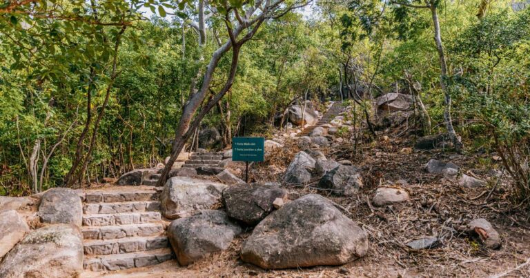
The trail begins by winding through dry woodland dominated by eucalypts and acacias. It’s a good idea to slow your pace and keep an eye on the treetops here, as koalas are often spotted nestled in the branches, especially in the more stunted trees common to this part of the island. The track itself is well-formed and easy to follow, with interpretive signs along the way sharing insight into the area’s flora, fauna and wartime significance.
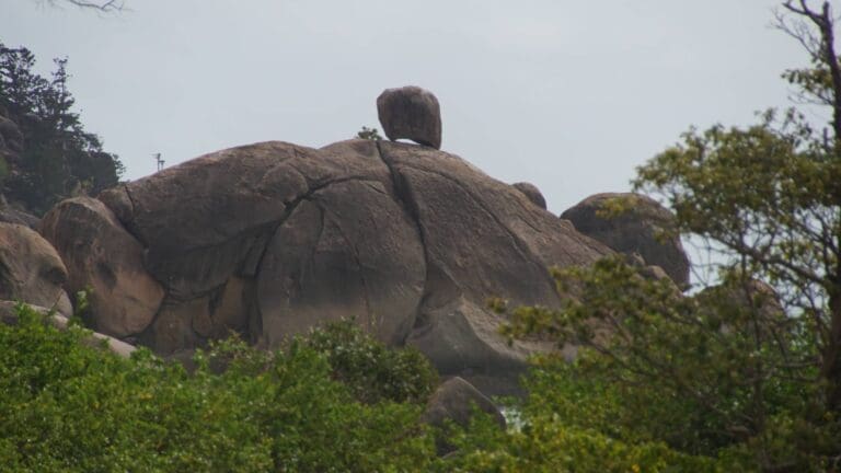
As you gain elevation, the path leads through a landscape shaped by time and geology. Granite boulders sit quietly among hoop pines, framing sections of the walk with a kind of understated drama. Near the top, the remains of World War II fortifications come into view. These concrete structures, now weathered but still solid, once played a role in Australia’s coastal defence network. They are among the best preserved in Queensland and are now heritage-listed. Information displays around the site help paint a picture of life here during the war, giving voice to the men and women who once served on the island.
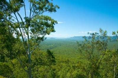
The real payoff comes at the summit, where the views open up in all directions. On a clear day, you can see across to Bowling Green Bay National Park in the south and, to the north, the Palm Islands and Hinchinbrook Island National Park. It’s a place to linger, take in the scene and appreciate the contrast between the island’s quiet present and its active past. Whether you're drawn by the chance of seeing a koala, the history, or the far-reaching ocean views, the Forts Walk offers a rich and memorable experience that captures the essence of Magnetic Island.
Tips
- Start your walk early in the day to enjoy cooler temperatures, better chances of spotting wildlife like koalas, and easier access to parking.
- Take care on the final section of the walk, where the Forts circuit becomes steep with numerous steps and uneven surfaces. Proper footwear and a steady pace are recommended.
Gallery
Got some great shots from this hike? Upload your photos here to inspire others and show off the beauty of the trail!
Click to view form >>
Submitting your photos doesn’t mean you lose ownership. You can be credited for your contributions, and you can request removal at any time.
Content use
Please don’t copy GPX files or content from this site to AllTrails or other platforms. Each trail has been personally mapped, documented, and refined to support Australia’s bushwalking and hiking community. While some details come from land managers, every listing reflects significant personal effort. This is a free, community-driven initiative—your respect helps keep it that way.
Walk map and GPX file
Max elevation: 169 m
Min elevation: 67 m
Total climbing: 183 m
Total descent: -183 m
Getting there
Getting to the trailhead: Magnetic Island National Park.
To reach Magnetic Island National Park, take a 20-minute ferry from Townsville, departing near Breakwater Marina. Once on the island, the Forts Walk begins at the Forts Junction, which sits on the main road between Arcadia and Horseshoe Bay. The junction is a central point in the island’s walking trail network and is accessible by car, bus or on foot. While there is a small car park off the sealed access road, spaces fill quickly, especially during peak times, so walking or taking the island bus is often the best option. You can also access the Forts Junction via scenic walking trails: it’s 6.4 km from Nelly Bay, 3 km from Arcadia, or 2.3 km from Horseshoe Bay.
Closest towns to this walk: Arcadia, Geoffrey Bay, Horseshoe Bay, Nelly Bay, Picnic Bay
About the region
Magnetic Island, known traditionally as Yunbenun, is a striking mix of granite headlands, open woodland, and coral-fringed beaches just offshore from Townsville. Once connected to the mainland, it became an island around 7,500 years ago when sea levels rose. Today, about 78% of its 5,184 hectares is protected as national or conservation park, preserving its distinctive natural and cultural heritage.
The island’s vegetation is mostly open eucalypt woodland, with bloodwoods, stringybarks, and ironbarks dominating the landscape. Hoop pines rise from rocky headlands, vine-thickets cluster in gullies, and the coastline is fringed with mangroves, seagrass beds, and coral reefs. These diverse habitats support a wide range of wildlife. Sea turtles nest on sandy beaches, dugongs and green turtles feed in the seagrass, and rock wallabies shelter among the granite tors. Koalas are often spotted in the trees, and the calls of bush stone curlews echo through the woodland.
The Wulgurukaba people, the ‘canoe people,’ have long maintained a deep connection to Yunbenun. Evidence of their presence, including middens, tools, and art sites, can still be found. Since being named by Lieutenant James Cook in 1770, Magnetic Island has had a layered history involving logging, agriculture, wartime defences, and tourism. The World War II fortifications remain among Queensland’s best preserved examples.
The island’s landscape tells a much older story. Around 275 million years ago, granite pushed to the surface and slowly weathered into the dramatic boulders and tors we see today. Fault lines formed gullies and valleys, shaping the island’s rugged topography. Combined with its shallow surrounding seas and rich biodiversity, Magnetic Island offers a unique blend of geology, ecology, and history, making it a compelling destination for hikers and nature lovers alike.
Similar walks nearby
Looking for more walks in or near Magnetic Island National Park? Try these trails with a similar difficulty grade.
Track grade
Grade 3 (Moderate) - Walks for Most Fitness Levels: Grade 3 on the AWTGS represents moderate walking tracks. These are ideal for walkers with some fitness who are comfortable with some hills and uneven terrain. While suitable for most ages, some bushwalking experience is recommended to ensure a safe and enjoyable experience. Tracks may have short, steep hill sections, a rough surface, and many steps. The total distance of a Grade 3 walk can be up to 20 kilometers.
Explore safe
Plan ahead and hike safely! Carry enough water, pack layers for changing conditions, and bring safety gear like a torch, PLB, and reliable communication device. Check official sources for trail updates, closures, and access requirements, and review local weather and bushfire advice. Most importantly, share your plans with someone before you go. Being prepared makes for a safer and more enjoyable hike! Stay Safe, Explore More, and Always #ExploreSafe.
Packing checklists
What you carry in your pack depends on factors like weather, terrain, and your adventure type. Not sure what to bring? My free planning, food, and packing checklists are a great starting point, covering day hikes, overnight trips, and multi-day adventures. Use them to customise your kit and always prioritise safety.
Let someone know
Before heading out, take a moment to fill out your trip intentions form. It’s a quick way to share your hike details with family or friends. If something goes wrong, they can notify emergency services, ensuring a faster response and peace of mind. Stay safe and enjoy your adventure
Suggest an edit
Spotted a change on this trail? Maybe there are new features, the route has shifted, or the trail is permanently closed. Whatever the update, I’d love your input. Your feedback helps fellow hikers stay informed and ensures that our trail info stays fresh and reliable.
Acknowledgement of Country
Trail Hiking Australia acknowledges the Traditional Owners of the lands on which we hike and pay respects to their Elders, past and present, and we acknowledge the First Nations people of other communities who may be here today.


11 Reviews on “Forts Walk - Magnetic Island (4km)”
Love it 😍