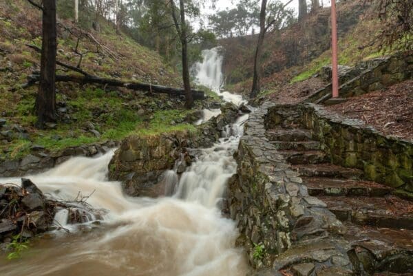
See some of the nicest parts of Devonport by walking or cycling the rail trail. Parts of the trail run parallel with the railway to Burnie and the Don River tourist railway. Part also follows the route of a former tramway. You can follow the trail from the Don Railway Station to central Devonport, with the option of a loop trail along the opposite bank of the Don River. The loop trail is shown in green on the map.
Don River Railway
Don to Devonport in Northern Tasmania
Devonport, 277km from Hobart
Sealed
Flat
Photo credit: Rail Trails Australia. For more information and a location map please visit RailTrails Australia.
Grade 2 (Easy) - A Gentle Introduction to Inclines: Grade 2 on the
AWTGS represents easy walking tracks that offer a slightly more challenging experience compared to Grade 1. Similar to Grade 1, no prior bushwalking experience is required. The track surface is typically hardened or compacted and may have gentle hill sections or occasional steps. The total distance of a Grade 2 walk is typically no greater than 10 kilometers. These walks are still suitable for families with a bit more experience or those seeking a gentle introduction to some inclines.
Do you have a GPX file for this hike? Feel free to email it to me so I can add it to this hikes info.
Click to add your file >>
Content use
Please don’t copy GPX files or content from this site to AllTrails or other platforms. Each trail has been personally mapped, documented, and refined to support Australia’s bushwalking and hiking community. While some details come from land managers, every listing reflects significant personal effort. This is a free, community-driven initiative—your respect helps keep it that way.
Gallery
Got any photos from this hike? Your photos can help others plan. Share shots from along the trail so fellow hikers know what to expect.
Click to add your photos >>
About the region
Nurture your soul with boundless experiences and leave behind life as you know it. From scenic drives through cool-climate vineyards to soft adventure nestled in the Tasmanian wilderness, unveil the best that the region has to offer.
Find a place to stay
Wondering where to stay near this hike? Find accommodation close to the trailhead — hotels, cabins and campgrounds nearby. Click the button to view the interactive map.
Closest towns to this walk: Bridport, Campbell Town, Deloraine, Exeter, George Town, Invermay, Kings Meadows, Launceston, Longford, Ravenswood, Scottsdale, Westbury
Let someone know
Heading out? Fill in a trip intentions form so someone knows your plans. If things go wrong, they can raise the alarm fast, giving you peace of mind on the trail.
Similar walks nearby
Looking for more walks in or near Northern Tasmania? Try these trails with a similar difficulty grade.
Favourite

Favourite

Favourite

Favourite

Suggest an edit
Notice something different about this trail? Whether it’s a new feature, a route change, or a closure, share your update so we can keep our info accurate and helpful for fellow hikers.
Click to suggest edits >>
Explore safe
Plan ahead and hike safely! Carry enough water, pack layers for changing conditions, and bring safety gear like a torch, PLB, and reliable communication device. Check official sources for trail updates, closures, and access requirements, and review local weather and bushfire advice. Most importantly, share your plans with someone before you go. Being prepared makes for a safer and more enjoyable hike! Stay Safe, Explore More, and Always #ExploreSafe.
Packing checklists
What you carry in your pack depends on factors like weather, terrain, and your adventure type. Not sure what to bring? My free planning, food, and packing checklists are a great starting point, covering day hikes, overnight trips, and multi-day adventures. Use them to customise your kit and always prioritise safety.


