Hike at a Glance
Max elevation: 1869m
Min elevation: 1734m
Total Ascent: 370m
Hike overview
The Derrick Hut via Mount Loch hike is a 10km trail located in the heart of Alpine National Park in Victoria. This grade 3 walk typically takes about four hours to complete and offers an excellent opportunity to explore the natural beauty of the region. The route is an out-and-back trail that rewards hikers with breathtaking views of the Victorian Alps, making it a must-do for outdoor enthusiasts visiting Mount Hotham. Along the way, you’ll reach the summit of Mount Loch, which stands at an impressive 1,837 metres above sea level. Even if you don’t complete the full hike, the scenery from the lower sections is still worth experiencing.
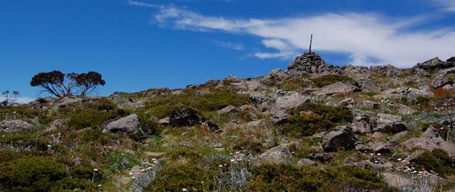
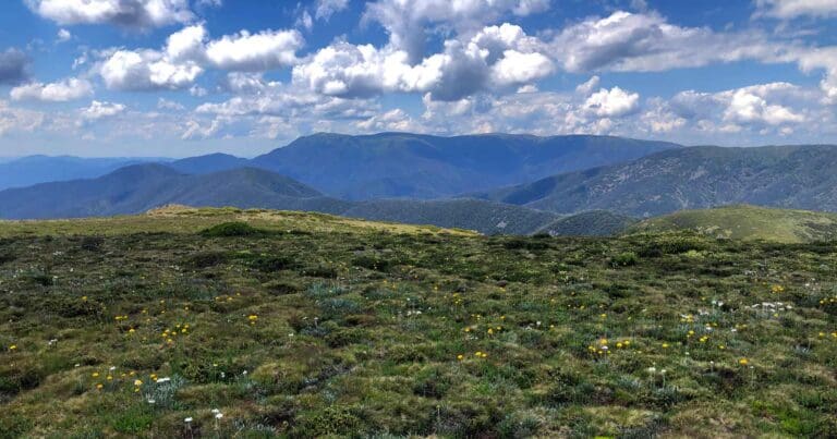
The trail begins by guiding you through alpine meadows, across rocky terrain, and eventually to the summit. From this elevated vantage point, you can enjoy panoramic views stretching in all directions. The rugged east face of Mount Feathertop looms large to the north, while the Bogong High Plains roll out to the west, both offering a stunning contrast to the alpine environment. While the full walk leads to the summit of Mount Loch, you can still soak in these magnificent views by simply completing part of the trail.
To reach the summit, follow the Australian Alpine Walking Track from Loch Car Park for the first 3.5km until you reach pole 60. From there, leave the pole line and follow a vehicle track north, passing basalt columns along the way for about 0.5km. The final stretch takes you up to the summit via a track that skirts the north-western side of Mount Loch. Once you’ve reached the summit, take a moment to appreciate the 360-degree views before retracing your steps back to the Australian Alpine Walking Track junction. From here, continue towards Derrick Hut.
Derrick Hut, your final destination, is a small, charming timber shelter built in 1967 by the Wangaratta Ski Club. Originally constructed as a day shelter for ski tourers, the hut is also a memorial to Charles Derrick, a cross-country skier who tragically lost his life in a blizzard in 1965 while attempting to ski from Mount Bogong to Mount Hotham. After spending some time at the hut and soaking in the atmosphere, return the way you came, retracing your steps down the mountain to the Loch Car Park. This hike offers a perfect blend of adventure and history, making it a memorable experience for all who take it on.
Gallery
Got some great shots from this hike? Upload your photos here to inspire others and show off the beauty of the trail!
Uploading your photos doesn’t mean you lose ownership. You can be credited for your contributions, and you can request removal at any time.
Content use
Please don’t copy GPX files or content from this site to AllTrails or other platforms. Each trail has been personally mapped, documented, and refined to support Australia’s bushwalking and hiking community. While some details come from land managers, every listing reflects significant personal effort. This is a free, community-driven initiative—your respect helps keep it that way.
Walk map and GPX file
Max elevation: 1869 m
Min elevation: 1734 m
Total climbing: 370 m
Total descent: -370 m
Getting there
Getting to the trailhead: Alpine National Park.
To reach the trailhead for the Derrick Hut via Mount Loch hike, drive to Mount Hotham via the Hume Highway, passing through Wangaratta, Myrtleford, and Harrietville. Once you arrive, stop at the Mount Loch car park, which is located about 2km before you reach the Hotham Heights village. The trailhead is conveniently situated at the Mt Loch car park, just off the Great Alpine Road, near the Mt Hotham Alpine Resort. This multi-level car park is part of the Hotham Alpine Gateway, a visitor facility that also serves as the starting point for several outdoor activities, including the popular Falls to Hotham Alpine Crossing.
Closest towns to this walk: Benalla, Bright, Dinner Plain, Falls Creek, Harrietville, Hotham Heights, Mansfield, Mitta Mitta, Mount Beauty, Mount Hotham, Myrtleford, Omeo, Porepunkah, Tawonga South, Wangaratta
About the region
The Alpine National Park is a paradise for adventure enthusiasts. Set within the heart of Victoria's highest mountain ranges, the park offers a wealth of activities that showcase the raw beauty and diverse landscapes of the region. Whether you're hiking through alpine meadows, exploring wildflower-clad terrain on horseback, or navigating world-class mountain bike trails, the possibilities for outdoor exploration are endless. For those seeking more thrill, there’s the option to run wild rapids on white-water rafting trips or take a four-wheel drive through the park’s secluded areas. The park also presents a unique opportunity to experience cross-country skiing through the tangled snow gum forests, offering a true sense of isolation and serenity.
One of the most popular ways to experience the park’s rugged beauty is by tackling the Falls to Hotham Alpine Crossing, a hike that takes you over towering alpine ridgelines, through lush river valleys, and into landscapes that remain etched in memory long after the journey. For those interested in exploring the area's history, the Wonnangatta Four-wheel Drive is a fascinating route, winding through rugged bushland and revealing the rich heritage of the High Country, all framed by unforgettable mountain views. The park also offers the chance to take in panoramic vistas from the Razorback, leading you to Victoria's second-highest peak, Mount Feathertop, or to conquer the summit of Mount Bogong, the state’s highest peak.
Throughout the Bogong High Plains, you'll find historic huts once inhabited by legendary cattlemen, offering a glimpse into the past. If you’re after some excitement, a white-water rafting trip on the Mitta Mitta River is sure to get your heart racing. The Alpine National Park is also home to some of the best ski touring opportunities in Victoria, with a variety of terrain that suits both beginners and seasoned skiers alike, from well-defined downhill runs to remote cross-country trails and challenging backcountry terrain.
The park lies within the traditional Country of the Taungurung and Gunaikurnai Peoples, and their deep connection to the land is honoured by Parks Victoria. The Traditional Owners continue to play an integral role in the care of these lands and waters, with their cultural heritage enriching the experience of all who visit.
Just a 4.5-hour drive from Melbourne, Hotham is nestled within the Victorian Alps, offering stunning views and an array of activities. The resort features an airport, 320 hectares of ski terrain, and a wide range of slopes suitable for all levels of skiers. Whether you’re new to skiing or an expert, Hotham has something for everyone. Known as the 'Powder Capital' of Australia, it’s the only resort in the Southern Hemisphere where the village is perched atop the mountain, providing continuous, awe-inspiring views and convenient ski-in, ski-out access from anywhere in the village.
With 13 chairlifts, three terrain parks, and 35km of cross-country skiing trails, Hotham has all the essentials for an exciting winter adventure. Off the slopes, there’s plenty of family-friendly activities, including tobogganing, dog sled tours, and snowmobile rides. With a selection of restaurants and bars to choose from, there’s no shortage of things to enjoy when you're not out on the snow. Whether you’re here for the adrenaline rush or simply to take in the scenery, Hotham offers a memorable escape into the heart of the Alps.
Similar walks nearby
Looking for more walks in or near Alpine National Park? Try these trails with a similar difficulty grade.
Track grade
Grade 3 (Moderate) - Walks for Most Fitness Levels: Grade 3 on the AWTGS represents moderate walking tracks. These are ideal for walkers with some fitness who are comfortable with some hills and uneven terrain. While suitable for most ages, some bushwalking experience is recommended to ensure a safe and enjoyable experience. Tracks may have short, steep hill sections, a rough surface, and many steps. The total distance of a Grade 3 walk can be up to 20 kilometers.
Explore safe
Plan ahead and hike safely! Carry enough water, pack layers for changing conditions, and bring safety gear like a torch, PLB, and reliable communication device. Check official sources for trail updates, closures, and access requirements, and review local weather and bushfire advice. Most importantly, share your plans with someone before you go. Being prepared makes for a safer and more enjoyable hike! Stay Safe, Explore More, and Always #ExploreSafe.
Packing checklists
What you carry in your pack depends on factors like weather, terrain, and your adventure type. Not sure what to bring? My free planning, food, and packing checklists are a great starting point, covering day hikes, overnight trips, and multi-day adventures. Use them to customise your kit and always prioritise safety.
Let someone know
Before heading out, take a moment to fill out your trip intentions form. It’s a quick way to share your hike details with family or friends. If something goes wrong, they can notify emergency services, ensuring a faster response and peace of mind. Stay safe and enjoy your adventure
Suggest an edit
Spotted a change on this trail? Maybe there are new features, the route has shifted, or the trail is permanently closed. Whatever the update, I’d love your input. Your feedback helps fellow hikers stay informed and ensures that our trail info stays fresh and reliable.
Acknowledgement of Country
Trail Hiking Australia acknowledges the Traditional Owners of the lands on which we hike and pay respects to their Elders, past and present, and we acknowledge the First Nations people of other communities who may be here today.


3 Reviews on “Derrick Hut via Mount Loch Hike (10km)”
It’s only a short way to include Mt Loch summit to this walk. Fantastic 360degree views
Deb Kahn that’s a great suggestion for a side trip. I should include that in the description. Thank you.
Trail Hiking Australia my pleasure. We always have morning tea at the hut and the lunch with views on Mt Loch.
Deb Kahn oh that sounds lovely. By the way. I’ve just updated that hike to include Mount Loch summit. Thanks for the suggestion.
One of my favourite places!!
Beans Cazz totally agree, it is pretty special. Something about the Vic high country that gives me peace.
Trail Hiking Australia blessed to live on the High Country doorstep, Darren.
The absolute best therapy available, in every way.
Beans Cazz absolutely. By the way. I’ve just updated that hike to include Mount Loch summit.
was her just yesterday, what a great hut this one is!
Can’t wait to go there now!
Karen Malloch lets do it
Luke Deards
Longing for lockdown to be over. Now another 6 weeks ?
Zita Garner
Fiona Blakeway might have some good ideas for your hiking adventures