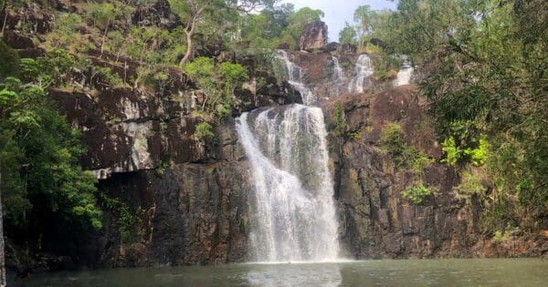
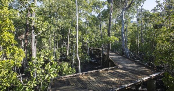
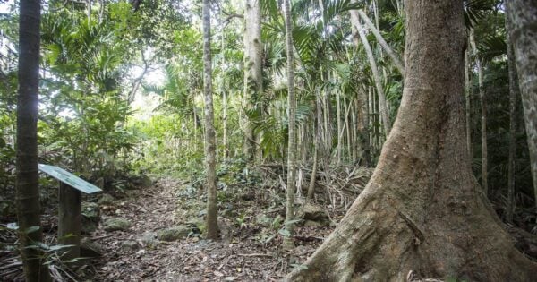
This Coastal Fringe and Hayward Gully hike wanders through lowland rainforest and cross a small tidal creek next to mangroves and cottonwoods. Keep an eye or ear out for conway's ' Big-foot' birds.Australian brush turkeys dutifully rake about in the leaf litter or you may hear the strange call of the shy and rarely seen orange footed scrub-fowl.
The walk is extended by branching of the coastal Fringe circuit to hayward gully continue through lowland forest and cross small rocky creek beds.
Hayward gully begins on a plateau high in the Conway range. A small patch of mangroves and associated wildlife adds diversity to the walk.
Use a good quality insect repellent. Circuit best done early morning before heat of the day
Grade 2 (Easy) - A Gentle Introduction to Inclines: Grade 2 on the
AWTGS represents easy walking tracks that offer a slightly more challenging experience compared to Grade 1. Similar to Grade 1, no prior bushwalking experience is required. The track surface is typically hardened or compacted and may have gentle hill sections or occasional steps. The total distance of a Grade 2 walk is typically no greater than 10 kilometers. These walks are still suitable for families with a bit more experience or those seeking a gentle introduction to some inclines.
Total distance: 3019 m
Max elevation: 23 m
Min elevation: 3 m
Total climbing: 89 m
Total descent: -87 m
Content use
Please don’t copy GPX files or content from this site to AllTrails or other platforms. Each trail has been personally mapped, documented, and refined to support Australia’s bushwalking and hiking community. While some details come from land managers, every listing reflects significant personal effort. This is a free, community-driven initiative—your respect helps keep it that way.
Gallery
Got any photos from this hike? Your photos can help others plan. Share shots from along the trail so fellow hikers know what to expect.
Click to add your photos >>
Getting there
Getting to the trailhead: Conway National Park.
The Conway Coastal Fringe Circuit at the Conway Picnic area. The track is just past the Airport on the right hand side when heading towards Shute Harbour. There is a car park, drop toilets, electric BBQ’s and picnic tables at the trail head.
Need a rental car to get you to the hike? Find one here.
Let someone know
Heading out? Fill in a trip intentions form so someone knows your plans. If things go wrong, they can raise the alarm fast, giving you peace of mind on the trail.
About the region
Conway National Park spans approximately 75km of coastline, taking in the entire Cape Conway peninsula. The park includes the rainforest-clad Conway Range, which protects the largest area of lowland tropical rainforest in Queensland outside Tropical North Queensland. Hoop pines grow on coastal ridges and in damp gullies, emerging above the rainforest canopy. Rugged, steep, rocky cliffs provide a spectacular 35km-long backdrop to the Whitsunday Passage and islands.
Dry vine thicket, mangroves, open forests with a grasstree understorey, paperbark and pandanus woodlands, and patches of lowland rainforest with twisted vines grow in the park. It is home to 2 of Australia's mound-building birds, the Australian brush-turkey and the orange-footed scrubfowl.
Rising steeply behind busy coastal settlements, the Conway Range appears impenetrable. Through climate fluctuations over tens of thousands of years, the rainforest has persisted here, providing a continuous refuge for wildlife.
The park's vegetation is very similar to that on the Whitsunday islands because thousands of years ago the sea level rose, drowning coastal valleys and creating the islands. For thousands of years, the Ngaro and Gia people roamed these forests, harvesting riches of the land and the adjoining sea country. Today the adjacent waters are protected in the Great Barrier Reef Marine Park
Similar walks nearby
Looking for more walks in or near Conway National Park? Try these trails with a similar difficulty grade.
Favourite

Molle Islands National Park
Favourite

Favourite

Cape Hillsborough National Park
Favourite

Cape Hillsborough National Park
Explore safe
Plan ahead and hike safely! Carry enough water, pack layers for changing conditions, and bring safety gear like a torch, PLB, and reliable communication device. Check official sources for trail updates, closures, and access requirements, and review local weather and bushfire advice. Most importantly, share your plans with someone before you go. Being prepared makes for a safer and more enjoyable hike! Stay Safe, Explore More, and Always #ExploreSafe.
Packing checklists
What you carry in your pack depends on factors like weather, terrain, and your adventure type. Not sure what to bring? My free planning, food, and packing checklists are a great starting point, covering day hikes, overnight trips, and multi-day adventures. Use them to customise your kit and always prioritise safety.
Suggest an edit
Notice something different about this trail? Whether it’s a new feature, a route change, or a closure, share your update so we can keep our info accurate and helpful for fellow hikers.
Click to suggest edits >>


