Hike at a Glance
Max elevation: 919m
Min elevation: 719m
Total Ascent: 266m
Important info
Track Closure Notice: This circuit is currently closed indefinitely due to major storm damage (Charles Darwin Walk, closed since 2020) and safety risks (National Pass, closed since 2017 after a fatal rockfall). There are currently no plans to reopen these sections. If you are planning to hike in the Blue Mountains, please always check the official NSW National Parks track closures before your trip. For other great hikes in the Blue Mountains area, find other walks nearby here.
Hike overview
Note: This walk remains listed here as a reference only, since it still appears on other websites. I’ve updated it to highlight the closure so hikers are not misled.
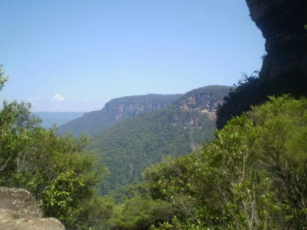
This is a wonderful circuit walk that starting at Wentworth Falls Train Station. You kick off with a lovely stroll down Charles Darwin walk to Weeping Rock where you soon come to Queen's Cascades and the wonderful views in to the valley. Now we walk partway down the cliff on the Grand Stairway to follow the Historic National Pass exploring more amazing views and then some wonderful waterfalls on the way out of the Valley Of the Waters. Before following the Nature Track back towards the station there is a optional side trip to Conservation Hut if you want a lovely cafe lunch. This walk has a lot of steps so you do need to be fairly fit to enjoy it.
This walk description was provided by wildwalks.com. For more information, visit Charles Darwin National Pass and Nature Track walk.
Track grade
Grade 4 (Hard) - Challenging Walks for Experienced Walkers: Grade 4 on the AWTGS signifies challenging walking tracks. Bushwalking experience is recommended for these tracks, which may be long, rough, and very steep. Directional signage may be limited, requiring a good sense of navigation. These walks are suited for experienced walkers who are comfortable with steeper inclines, rougher terrain, and potentially longer distances.
Walk map and GPX file
Max elevation: 918 m
Min elevation: 675 m
Total climbing: 1025 m
Total descent: -1025 m
Content use
Please don’t copy GPX files or content from this site to AllTrails or other platforms. Each trail has been personally mapped, documented, and refined to support Australia’s bushwalking and hiking community. While some details come from land managers, every listing reflects significant personal effort. This is a free, community-driven initiative—your respect helps keep it that way.
Gallery
Got any photos from this hike? Your photos can help others plan. Share shots from along the trail so fellow hikers know what to expect.
Click to add your photos >>
Getting there
Getting to the trailhead: Blue Mountains National Park.
Need a rental car to get you to the hike? Find one here.
About the region
Katoomba area in Blue Mountains National Park
Katoomba area is the heart of Blue Mountains National Park. This popular day trip from Sydney is home of the iconic Three Sisters as well as Grand Cliff Top Walk. It's packed with world-class views and waterfalls, including Wentworth Falls. The dazzling natural beauty of the Wentworth Falls, Leura, and Katoomba areas has drawn visitors to Gundungurra County for over 100 years. Why not immerse yourself in the best of the Blue Mountains and hike 19km over 2 days between these villages on the Grand Cliff Top Walk?
Echo Point is a Blue Mountains favourite where you can marvel at famous views of the Three Sisters rock formation, Mount Solitary, and the dramatic sandstone cliffs towering above the Jamison Valley.
From family-friendly strolls to challenging descents into World Heritage-listed wilderness, Katoomba area is a walker’s paradise. Take in ever changing views along Prince Henry Cliff walk which boasts over 20 lookouts and 3 waterfalls between Katoomba and Leura. Swap cliff top for cool rainforest on Round walking track which is easily combined with a Scenic World ride. The historic Giant Stairway will test your legs as it zig zags down the cliff face to meet the heart-pumping Federal Pass.
Find a place to stay
Wondering where to stay near this hike? Find accommodation close to the trailhead — hotels, cabins and campgrounds nearby. Click the button to view the interactive map.
Closest towns to this walk: Blackheath, Bullaburra, Hazelbrook, Katoomba, Lawson, Leura, Lithgow, Mount Victoria, Springwood, Wentworth Falls, Woodford
Let someone know
Heading out? Fill in a trip intentions form so someone knows your plans. If things go wrong, they can raise the alarm fast, giving you peace of mind on the trail.
Similar walks nearby
Looking for more walks in or near Blue Mountains National Park? Try these trails with a similar difficulty grade.
Suggest an edit
Notice something different about this trail? Whether it’s a new feature, a route change, or a closure, share your update so we can keep our info accurate and helpful for fellow hikers.
Click to suggest edits >>
Explore safe
Plan ahead and hike safely! Carry enough water, pack layers for changing conditions, and bring safety gear like a torch, PLB, and reliable communication device. Check official sources for trail updates, closures, and access requirements, and review local weather and bushfire advice. Most importantly, share your plans with someone before you go. Being prepared makes for a safer and more enjoyable hike! Stay Safe, Explore More, and Always #ExploreSafe.
Packing checklists
What you carry in your pack depends on factors like weather, terrain, and your adventure type. Not sure what to bring? My free planning, food, and packing checklists are a great starting point, covering day hikes, overnight trips, and multi-day adventures. Use them to customise your kit and always prioritise safety.
Acknowledgement of Country
Trail Hiking Australia acknowledges the Traditional Owners of the lands on which we hike and pay respects to their Elders, past and present, and we acknowledge the First Nations people of other communities who may be here today.


