Hike at a Glance
Max elevation: 864m
Min elevation: 417m
Total Ascent: 469m
Important info
Carrow Brook walking track is a remote walk into the valleys of Mount Royal National Park, near Singleton. A challenging loop hike, it’s best suited to fit, experienced bushwalkers.
Hike overview
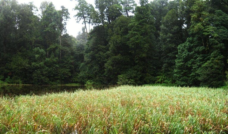
Carrow Brook walking track offers a rewarding challenge for those seeking a more strenuous hike. Beginning at Youngville campground, the trail descends through towering forests toward the serene waters of Mulgowrie Creek and Carrow Brook. This scenic water's edge provides an ideal spot to rest and enjoy lunch before facing the steep ascent back to the starting point. Spanning 6 kilometres, the Carrow Brook walking track is classified as a grade 4 hike, typically requiring about three hours to complete.
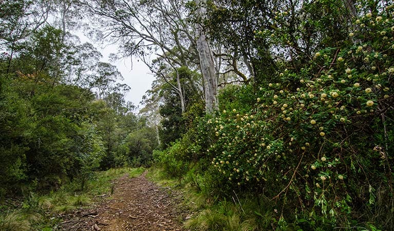
This hike allows participants to experience a sense of remoteness while breathing in the fresh mountain air, surrounded by tall eucalypts, giant blue gums, and critically endangered scrub turpentine. The trail offers opportunities to observe the local wildlife; glossy black cockatoos, varied sitellas, and scarlet robins are often spotted flying through the forest canopy. Additionally, keen eyes may catch glimpses of long-nosed potoroos and parma wallabies among the understory.
Spring is particularly favourable for this walk, as temperatures are mild and wildflowers, such as white paper daisies, are in bloom.
As a circuit track, Carrow Brook walking track begins at Youngville campground. Signage at the campground indicates the route leads to the tranquil waters of Carrow Brook, located on the edge of the Barrington Wilderness Area. It is important to note that this is a long and strenuous walk with several steep sections, intended for those with a high fitness level.
The trail is well signposted at significant points. A large picnic table is located at the bottom of the gully, near the creek. Upon reaching the creek, hikers must continue past the uphill track to access the water, requiring a brief return walk to reconnect with the circuit track.
Tips
- This trail features a steep descent and ascent of 450 metres, requiring a high level of fitness. Previous bushwalking experience is strongly recommended.As this is a remote walking track, it is advisable to carry a topographic map, GPS device, and a comprehensive first-aid kit.
- Weather conditions in this area can change rapidly and unexpectedly; therefore, ensure that you are well prepared for varying conditions.
- The track is notably steep and may have numerous fallen trees and potential tripping hazards, so hikers should exercise caution.
- Be aware of the presence of leeches, particularly near the creek.
Gallery
Got some great shots from this hike? Upload your photos here to inspire others and show off the beauty of the trail!
Click to view form >>
Submitting your photos doesn’t mean you lose ownership. You can be credited for your contributions, and you can request removal at any time.
Content use
Please don’t copy GPX files or content from this site to AllTrails or other platforms. Each trail has been personally mapped, documented, and refined to support Australia’s bushwalking and hiking community. While some details come from land managers, every listing reflects significant personal effort. This is a free, community-driven initiative—your respect helps keep it that way.
Walk map and GPX file
Max elevation: 864 m
Min elevation: 417 m
Total climbing: 469 m
Total descent: -469 m
Getting there
Getting to the trailhead: Mount Royal National Park.
Carrow Brook walking track begins at Youngville campground within Mount Royal National Park. To reach the trailhead, travel north on the New England Highway, passing through Singleton. At Dunolly, turn right onto Bridgeman Road and continue for 16 kilometres, which will lead you to Carrowbrook Road. Follow Carrowbrook Road for 25 kilometres before turning left onto Mount Royal Road. Continue on Mount Royal Road for another 13 kilometres until you arrive at Youngville campground. The road quality may vary depending on weather conditions, so be prepared for both sealed and unsealed sections, adjusting your driving accordingly. Ample parking is available at Youngville campground for visitors.
Closest towns to this walk: Broke, Bulga, Cessnock, Mount View, Rouchel, Singleton, Wollombi
About the region
Mount Royal National Park is situated in a World Heritage-listed Gondwana rainforest, near Barrington Tops National Park. This park features a rich natural environment, showcasing a diverse array of flora and fauna. As part of the Gondwana Rainforests of Australia World Heritage Area, it is home to various bird and animal species that have remained remarkably similar to their fossilised ancestors. Notably, the park hosts several threatened and vulnerable wildlife species, including the Hastings River mouse, parma wallaby, rufous scrub-bird, paradise riflebird, and the glossy black-cockatoo.
Youngville campground serves as an ideal base for visitors wishing to explore the park. From this location, a network of challenging walking tracks leads to stunning rock formations, such as Pieries Peak, making sturdy hiking boots essential. The park is characterised by a variety of forest and vegetation types, including shrubland, tall open forest, wet eucalypt forest, mid-altitude grassy forest, and lush rainforest.
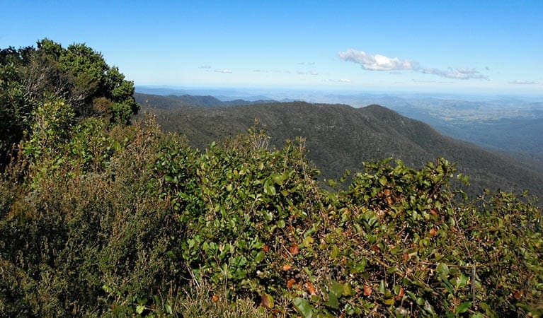
The park offers unique experiences throughout the year. Spring is an excellent time to hike to Pieries Peak, providing rewarding views of the landscape. In summer, visitors can enjoy a shaded barbecue at the Youngville picnic area, while winter brings the blooming of orchids, making a walk to Carrow Brook particularly enjoyable.
Mount Royal National Park offers numerous opportunities for camping, hiking, and picnicking, catering to outdoor enthusiasts and nature lovers alike.
Similar walks nearby
Looking for more walks in or near Mount Royal National Park? Try these trails with a similar difficulty grade.
Track grade
Grade 4 (Hard) - Challenging Walks for Experienced Walkers: Grade 4 on the AWTGS signifies challenging walking tracks. Bushwalking experience is recommended for these tracks, which may be long, rough, and very steep. Directional signage may be limited, requiring a good sense of navigation. These walks are suited for experienced walkers who are comfortable with steeper inclines, rougher terrain, and potentially longer distances.
Explore safe
Plan ahead and hike safely! Carry enough water, pack layers for changing conditions, and bring safety gear like a torch, PLB, and reliable communication device. Check official sources for trail updates, closures, and access requirements, and review local weather and bushfire advice. Most importantly, share your plans with someone before you go. Being prepared makes for a safer and more enjoyable hike! Stay Safe, Explore More, and Always #ExploreSafe.
Packing checklists
What you carry in your pack depends on factors like weather, terrain, and your adventure type. Not sure what to bring? My free planning, food, and packing checklists are a great starting point, covering day hikes, overnight trips, and multi-day adventures. Use them to customise your kit and always prioritise safety.
Let someone know
Before heading out, take a moment to fill out your trip intentions form. It’s a quick way to share your hike details with family or friends. If something goes wrong, they can notify emergency services, ensuring a faster response and peace of mind. Stay safe and enjoy your adventure
Suggest an edit
Spotted a change on this trail? Maybe there are new features, the route has shifted, or the trail is permanently closed. Whatever the update, I’d love your input. Your feedback helps fellow hikers stay informed and ensures that our trail info stays fresh and reliable.
Acknowledgement of Country
Trail Hiking Australia acknowledges the Traditional Owners of the lands on which we hike and pay respects to their Elders, past and present, and we acknowledge the First Nations people of other communities who may be here today.


