Hike at a Glance
Max elevation: 0m
Min elevation: 0m
Total Ascent: 0m
Hike overview
For an awe-inspiring ride to the edge of the magnificent Grose Wilderness, Burramoko cycle trail leads along a ridge to a dramatic rocky bluff. A trail of medium difficulty, it's an ideal nature day trip in Blue Mountains National Park, near Blackheath. With scenic valley views and crisp mountain air, it's a sublime ride for adventurous cyclists and bushwalkers.
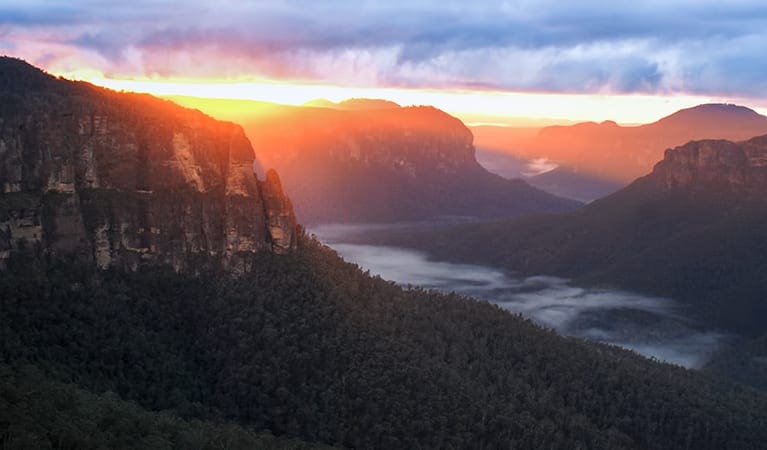
Meandering through heathlands and open forests, look for the distinctive grass trees, with creamy coloured flowers in the spring. Ending at Baltzers lookout, also known as Hanging Rock, you'll feel on top of the world as you gaze across the scenic tree-lined gorge fringed by golden cliffs.
With all that crisp mountain air and exercise, enjoy a picnic lunch with million dollar views. If you love the thrill of cycling check out Mount Banks road cycling route.
Tips
This attraction is in the Grose Wilderness, where cycling and walking groups are limited to eight people.
Check the weather before you set out and ensure you're well prepared. Weather can be unpredictable and extreme in this area and the track can become boggy when it rains.
It's a good idea to fill in the free trip intention form and hire a PLB before you set out. Bring a topographic map and compass or GPS.
There is limited mobile reception in this park.
Visit NSW National Parks and Wildlife Service for more information on this trail.
The longitude and latitude of the start and end points are approximately only and should not be used for navigation purposes. Please contact me if you know the correct coordinates.
Gallery
Got some great shots from this hike? Upload your photos here to inspire others and show off the beauty of the trail!
Click to view form >>
Submitting your photos doesn’t mean you lose ownership. You can be credited for your contributions, and you can request removal at any time.
Content use
Please don’t copy GPX files or content from this site to AllTrails or other platforms. Each trail has been personally mapped, documented, and refined to support Australia’s bushwalking and hiking community. While some details come from land managers, every listing reflects significant personal effort. This is a free, community-driven initiative—your respect helps keep it that way.
Walk map and GPX file
It looks like I don’t have a GPX file for this trail yet. If you have one to share, please email it to me! I’ll verify it against official maps before adding it to help other hikers have a safer, easier experience. Thanks for contributing to a better hiking resource.
Getting there
Getting to the trailhead: Blue Mountains National Park.
Burramoko Ridge (Hanging Rock) fire trail is in the Blackheath precinct of Blue Mountains National Park. To get there:Take the train to Blackheath, or drive along Great Western Highway to Blackheath.Turn onto Ridgewell Road about 1 kilometre west of BlackheathFollow Ridgewell Road to the locked gate that marks the beginning of the Burramoko Ridge (Hanging Rock) fire trail Parking Parking is available near the locked gate. It can be a busy place on the weekend, so parking might be limited.
Closest towns to this walk: Blackheath, Bullaburra, Hazelbrook, Katoomba, Lawson, Leura, Lithgow, Mount Victoria, Springwood, Wentworth Falls, Woodford
About the region
Blue Mountains National Park in the Sydney and surrounds and Country NSW regions
Blue Mountains National Park is always open but may have to close at times due to poor weather or fire danger. Some parts of the park close overnight; details are provided for specific attractions.
9am to 4.30pm daily. Closed Christmas Day.
Similar walks nearby
Looking for more walks in or near Blue Mountains National Park? Try these trails with a similar difficulty grade.
Track grade
Grade 3 (Moderate) - Walks for Most Fitness Levels: Grade 3 on the AWTGS represents moderate walking tracks. These are ideal for walkers with some fitness who are comfortable with some hills and uneven terrain. While suitable for most ages, some bushwalking experience is recommended to ensure a safe and enjoyable experience. Tracks may have short, steep hill sections, a rough surface, and many steps. The total distance of a Grade 3 walk can be up to 20 kilometers.
Explore safe
Plan ahead and hike safely! Carry enough water, pack layers for changing conditions, and bring safety gear like a torch, PLB, and reliable communication device. Check official sources for trail updates, closures, and access requirements, and review local weather and bushfire advice. Most importantly, share your plans with someone before you go. Being prepared makes for a safer and more enjoyable hike! Stay Safe, Explore More, and Always #ExploreSafe.
Packing checklists
What you carry in your pack depends on factors like weather, terrain, and your adventure type. Not sure what to bring? My free planning, food, and packing checklists are a great starting point, covering day hikes, overnight trips, and multi-day adventures. Use them to customise your kit and always prioritise safety.
Let someone know
Before heading out, take a moment to fill out your trip intentions form. It’s a quick way to share your hike details with family or friends. If something goes wrong, they can notify emergency services, ensuring a faster response and peace of mind. Stay safe and enjoy your adventure
Suggest an edit
Spotted a change on this trail? Maybe there are new features, the route has shifted, or the trail is permanently closed. Whatever the update, I’d love your input. Your feedback helps fellow hikers stay informed and ensures that our trail info stays fresh and reliable.
Acknowledgement of Country
Trail Hiking Australia acknowledges the Traditional Owners of the lands on which we hike and pay respects to their Elders, past and present, and we acknowledge the First Nations people of other communities who may be here today.


