Hike at a Glance
Max elevation: 1023m
Min elevation: 982m
Total Ascent: 60m
Hike overview
Unveiling a hidden gem of Barrington Tops National Park, the Burraga Swamp walking track offers a fascinating glimpse into a remote wilderness area. This 2-kilometer return hike, classified as grade 4, takes approximately 1.25 hours to complete and is ideal for nature enthusiasts seeking adventure.
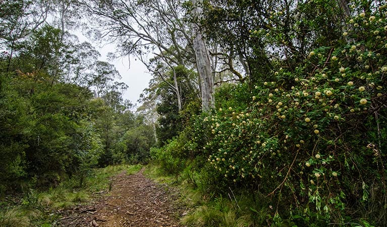
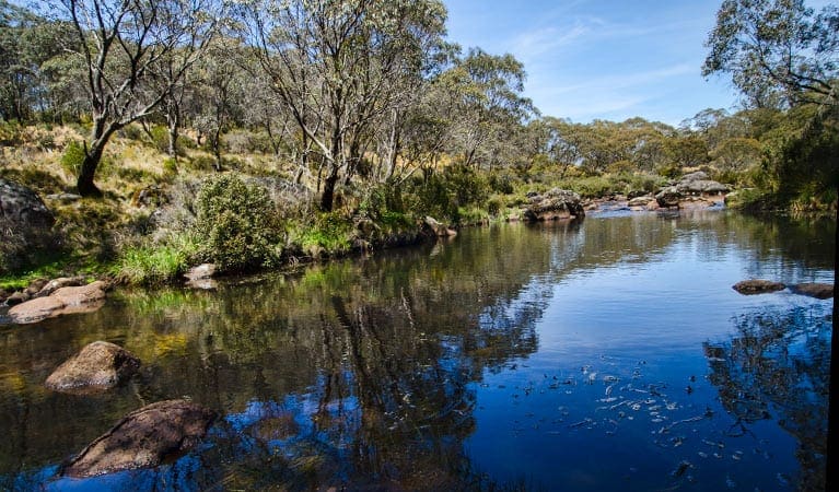
The star attraction is the namesake Burraga Swamp, a unique hanging swamp formed thousands of years ago by a massive landslip on Mount Lumeah's western slopes. Over time, the resulting ledge filled with sediment, creating a haven for delicate grasses and sedges that stand in stark contrast to the surrounding ancient Antarctic beech rainforest.
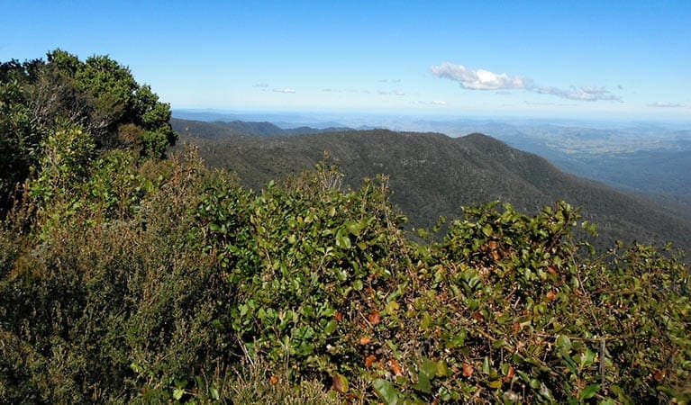
The organic matter nestled within the swamp serves as a valuable historical record, offering scientists insights into past climate and vegetation patterns. The walking track itself provides a gentle ascent through the beech forest, leading across a small saddle before descending to the swamp's southern edge. This secluded location is perfect for a tranquil picnic amidst breathtaking scenery, providing ample opportunities for photography enthusiasts to capture the swamp's unique beauty.
After immersing yourself in the serenity of Burraga Swamp, retrace your steps and consider exploring the nearby Williams River region, including a visit to the Williams River picnic area.
Tips
- Enhance your wildlife spotting: Bring binoculars to identify the park's abundant birdlife.
- Be weather aware: Review the forecast before your visit, as the road to Burraga Swamp walking track can become boggy after rain. Additionally, the track may be closed due to weather events or fire hazards. For the latest information, contact the Gloucester National Parks and Wildlife Service office on 02 6538 5300.
- Prepare for the elements: The weather in this area can be unpredictable, so pack appropriate clothing and gear for your visit.
- Restroom and picnic facilities: While not available directly at the trailhead, toilets and picnic facilities can be found at the Williams River picnic area and Allyn River State Forest campgrounds.
Gallery
Got some great shots from this hike? Upload your photos here to inspire others and show off the beauty of the trail!
Click to view form >>
Submitting your photos doesn’t mean you lose ownership. You can be credited for your contributions, and you can request removal at any time.
Content use
Please don’t copy GPX files or content from this site to AllTrails or other platforms. Each trail has been personally mapped, documented, and refined to support Australia’s bushwalking and hiking community. While some details come from land managers, every listing reflects significant personal effort. This is a free, community-driven initiative—your respect helps keep it that way.
Walk map and GPX file
Max elevation: 1023 m
Min elevation: 982 m
Total climbing: 60 m
Total descent: -60 m
Getting there
Getting to the trailhead: Barrington Tops National Park.
Reaching the Burraga Swamp walking track is straightforward. Situated within the southern precinct of Barrington Tops National Park, the trailhead lies at the Burraga Swamp picnic area.
If you’re travelling from Gresford or Dungog, navigate along Allyn River Road. Keep an eye out for the turnoff onto Mount Allyn Road and follow the signs directing you to the Burraga Swamp picnic area. Luckily, parking is available right at the trailhead, allowing you to conveniently begin your exploration of this unique hanging swamp.
Closest towns to this walk: Dungog, Ebor, Gloucester, Merriwa, Moonan Brook, Moonan Flat, Murrurundi, Muswellbrook, Nabiac, Scone, Singleton, Stroud, Wingen, Wingham
About the region
The Barrington Tops National Park offers a diverse range of experiences for every visitor. Immerse yourself in the World Heritage-listed Gondwana Rainforests, teeming with ancient walking trails, cascading waterfalls, and breathtaking lookouts. Explore the park's extensive network of walking tracks, catering to all levels, from gentle strolls to challenging overnight hikes. Scenic picnic areas and cycling trails provide perfect options for day trips.
Carved by ancient volcanic flows, the park boasts one of mainland Australia's largest temperate rainforests. Rising from near sea level to over 1,500 metres, it encompasses diverse habitats teeming with birdlife and animals. Camping enthusiasts can find designated spots for an unforgettable evening under the stars.
For those seeking adventure, options abound. Kayak across serene waters, challenge yourself with abseiling, or explore the terrain on a mountain bike. At the foothills, Chichester State Forest offers stunning scenery along the Allyn River, with campsites even welcoming your canine companions.
Beyond the park, discover the charming towns of Dungog and Gloucester. Gloucester, nicknamed the "basecamp for Barrington Tops," provides a welcoming gateway to your Gondwana adventures. Enjoy a refreshing dip in Ladies Well on a hot day, or venture further for hiking and picnicking opportunities in nearby Mount Royal National Park. Trout fishing enthusiasts can cast their lines in the Gloucester River between October and June.
Barrington Tops National Park, a magnificent region near the Hunter Valley and Upper Hunter, is easily accessible. Just a few hours' drive north of Sydney or a short trip from Newcastle and Port Stephens, this World Heritage wonder awaits exploration.
Similar walks nearby
Looking for more walks in or near Barrington Tops National Park? Try these trails with a similar difficulty grade.
Track grade
Grade 4 (Hard) - Challenging Walks for Experienced Walkers: Grade 4 on the AWTGS signifies challenging walking tracks. Bushwalking experience is recommended for these tracks, which may be long, rough, and very steep. Directional signage may be limited, requiring a good sense of navigation. These walks are suited for experienced walkers who are comfortable with steeper inclines, rougher terrain, and potentially longer distances.
Explore safe
Plan ahead and hike safely! Carry enough water, pack layers for changing conditions, and bring safety gear like a torch, PLB, and reliable communication device. Check official sources for trail updates, closures, and access requirements, and review local weather and bushfire advice. Most importantly, share your plans with someone before you go. Being prepared makes for a safer and more enjoyable hike! Stay Safe, Explore More, and Always #ExploreSafe.
Packing checklists
What you carry in your pack depends on factors like weather, terrain, and your adventure type. Not sure what to bring? My free planning, food, and packing checklists are a great starting point, covering day hikes, overnight trips, and multi-day adventures. Use them to customise your kit and always prioritise safety.
Let someone know
Before heading out, take a moment to fill out your trip intentions form. It’s a quick way to share your hike details with family or friends. If something goes wrong, they can notify emergency services, ensuring a faster response and peace of mind. Stay safe and enjoy your adventure
Suggest an edit
Spotted a change on this trail? Maybe there are new features, the route has shifted, or the trail is permanently closed. Whatever the update, I’d love your input. Your feedback helps fellow hikers stay informed and ensures that our trail info stays fresh and reliable.
Acknowledgement of Country
Trail Hiking Australia acknowledges the Traditional Owners of the lands on which we hike and pay respects to their Elders, past and present, and we acknowledge the First Nations people of other communities who may be here today.


