Hike at a Glance
Max elevation: 402m
Min elevation: 344m
Total Ascent: 131m
Hike overview
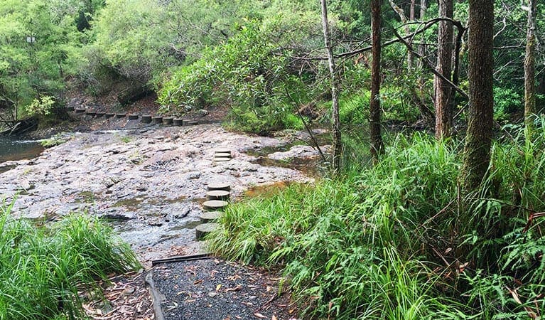
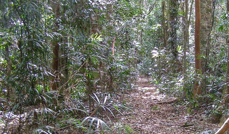
Tucked away in the lush Whian Whian State Conservation Area on the NSW North Coast, the Boggy Creek walk is a peaceful and rewarding experience that gently traces the path of the creek between Minyon Falls and Rummery Park campground. This short, easy track winds through a diverse and thriving forest, with tall blackbutts, brush box, turpentine, and water gums forming a rich canopy above. The ever-present sound of flowing water follows you along much of the route, creating a calming rhythm that enhances the sense of being deeply immersed in nature.
Despite its accessibility, the track feels wonderfully secluded—particularly during the cooler months, when the crowds thin out and you may find yourself alone with the birdsong and the rustling of leaves. The walk is well-suited to families and those looking for a slower pace, offering plenty of opportunities to pause, take in your surroundings, and enjoy a picnic or a dip in one of the creek’s inviting swimming holes. These natural pools are scattered along the walk, especially in the lower-lying sections, and their clear, cool waters offer the perfect spot to refresh and linger a while.
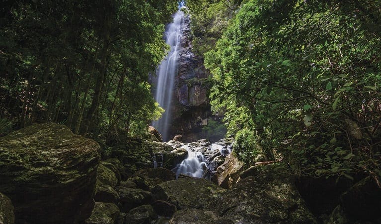
From Rummery Park campground, you can enjoy a relaxed lunch under the trees before making your way back along the track. Alternatively, if you're starting or ending your walk at Minyon Falls, don’t miss the lookout. Here, Repentance Creek drops dramatically over a sheer escarpment more than 100 metres high—an awe-inspiring reminder of the ancient volcanic origins of this landscape. For those still feeling energetic, the nearby Minyon Falls walking track provides a more extended hiking option and a closer look at the falls from different vantage points.
Whether you're seeking a tranquil morning wander or a shaded retreat from the summer heat, the Boggy Creek walk offers a chance to slow down and reconnect with nature, just a short drive from the bustle of Byron Bay and Lismore.
Tips
- It's a good idea to put sunscreen on before you set out and remember to take a hat and drinking water
Gallery
Got some great shots from this hike? Upload your photos here to inspire others and show off the beauty of the trail!
Click to view form >>
Submitting your photos doesn’t mean you lose ownership. You can be credited for your contributions, and you can request removal at any time.
Content use
Please don’t copy GPX files or content from this site to AllTrails or other platforms. Each trail has been personally mapped, documented, and refined to support Australia’s bushwalking and hiking community. While some details come from land managers, every listing reflects significant personal effort. This is a free, community-driven initiative—your respect helps keep it that way.
Walk map and GPX file
Max elevation: 402 m
Min elevation: 344 m
Total climbing: 131 m
Total descent: -130 m
Getting there
Getting to the trailhead: Whian Whian State Conservation Area.
The Boggy Creek walk begins at Minyon Falls lookout, located in the eastern section of Nightcap National Park. There are two main approaches, depending on your direction of travel. From the east, via the village of Rosebank, follow Minyon Drive until you reach the Minyon Falls picnic area. From the south, coming through Dunoon, take Nightcap Range Road north along the ridge, then follow the signs to Rummery Park campground. Continue along Minyon Drive, crossing the causeway after Peates Mountain Road, until you arrive at the picnic area. From the carpark, it’s just a short stroll to the lookout and the start of the trail. While parking is available at the picnic area, it’s worth noting that it can fill up quickly on weekends and during school or public holidays, so arriving early is a good idea if you’re hoping for a quieter visit.
Closest towns to this walk: Bangalow, Byron Bay, Clunes, Dunoon, Federal, Kyogle, Lismore, Mullumbimby, Nimbin
About the region
Located just 30 kilometres north of Lismore in northern New South Wales—around 730 kilometres from Sydney—Whian Whian State Conservation Area is a rewarding destination for walks, bushwalks, and hikes. Bordering Nightcap National Park, it offers a variety of all trails through ancient rainforests, creeks, and ridgelines, with options for walking, mountain biking, and horse riding.
Trails wind through towering kauri, bunya and hoop pines, offering chances to spot native wildlife like goannas, kookaburras, and brushtail possums. The area also supports threatened species including the spotted-tailed quoll, koalas, and Albert’s lyrebird, whose calls often echo through the forest during cooler months.
For longer adventures, Rummery Park campground is a great base. Once a forestry camp, it now welcomes overnight bushwalkers tackling routes like the Historic Nightcap Track from Mount Nardi, 18 kilometres to the west. Day walkers will find plenty of trails suitable for a quick forest escape or longer hikes with scenic stops for swimming or a picnic.
Each season offers something special. In autumn and winter, the cooler weather suits longer bushwalks. Spring brings wildflowers and the Freedom Marathon. Summer is best spent swimming in Boggy Creek’s clear pools. With over 520 plant species and 10 broad ecosystems, the biodiversity here is striking.
This is also a place of deep cultural significance. The Widjabal people of the Bundjalung Nation have lived in and cared for this land for at least 4,000 years. Timber-getters arrived in the 1830s, and many of today’s walking tracks follow routes originally cleared for the red cedar trade.
Similar walks nearby
Looking for more walks in or near Whian Whian State Conservation Area? Try these trails with a similar difficulty grade.
Track grade
Grade 3 (Moderate) - Walks for Most Fitness Levels: Grade 3 on the AWTGS represents moderate walking tracks. These are ideal for walkers with some fitness who are comfortable with some hills and uneven terrain. While suitable for most ages, some bushwalking experience is recommended to ensure a safe and enjoyable experience. Tracks may have short, steep hill sections, a rough surface, and many steps. The total distance of a Grade 3 walk can be up to 20 kilometers.
Explore safe
Plan ahead and hike safely! Carry enough water, pack layers for changing conditions, and bring safety gear like a torch, PLB, and reliable communication device. Check official sources for trail updates, closures, and access requirements, and review local weather and bushfire advice. Most importantly, share your plans with someone before you go. Being prepared makes for a safer and more enjoyable hike! Stay Safe, Explore More, and Always #ExploreSafe.
Packing checklists
What you carry in your pack depends on factors like weather, terrain, and your adventure type. Not sure what to bring? My free planning, food, and packing checklists are a great starting point, covering day hikes, overnight trips, and multi-day adventures. Use them to customise your kit and always prioritise safety.
Let someone know
Before heading out, take a moment to fill out your trip intentions form. It’s a quick way to share your hike details with family or friends. If something goes wrong, they can notify emergency services, ensuring a faster response and peace of mind. Stay safe and enjoy your adventure
Suggest an edit
Spotted a change on this trail? Maybe there are new features, the route has shifted, or the trail is permanently closed. Whatever the update, I’d love your input. Your feedback helps fellow hikers stay informed and ensures that our trail info stays fresh and reliable.
Acknowledgement of Country
Trail Hiking Australia acknowledges the Traditional Owners of the lands on which we hike and pay respects to their Elders, past and present, and we acknowledge the First Nations people of other communities who may be here today.


