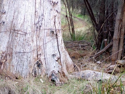
Take a short stroll through Mary Knoll Reserve, beneath the last stand of black gums in Blackmans Bay. Once overrun with blackberry and other weeds, this gully has been cleared by the Council with the help of volunteers. It now offers a delightful winding walk to the beach alongside one of the few natural watercourses remaining in the suburb.
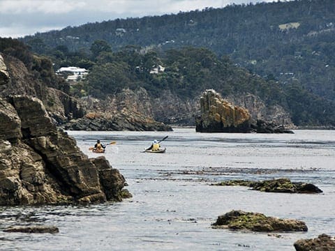
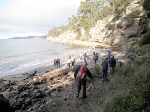
The track crosses the road and continues around the wooded coastal headland, passing the blowhole. This area was once a popular coastal route and gathering place for Tasmanian Aboriginal people, and you can still see shell pieces in the large midden on the headland. Today, the coastline is cared for by the Blackmans Bay Coastcare Group.
The Blowhole Track is a 1 km, grade 3 hike in Blackmans Bay, Tasmania. The hike takes about 45 minutes to complete. Access the track from Blowhole Road (off Roslyn Avenue) in Blackmans Bay, and follow it through to Talone Road.
Mostly level with a few steps.
Got some great shots from this hike? Upload your photos here to inspire others and show off the beauty of the trail!
Submitting your photos doesn’t mean you lose ownership. You can be credited for your contributions, and you can request removal at any time.
Please don’t copy GPX files or content from this site to AllTrails or other platforms. Each trail has been personally mapped, documented, and refined to support Australia’s bushwalking and hiking community. While some details come from land managers, every listing reflects significant personal effort. This is a free, community-driven initiative—your respect helps keep it that way.
Total distance: 650 m
Max elevation: 30 m
Min elevation: 12 m
Total climbing: 26 m
Total descent: -26 m
For more information on this trail, visit Greater Hobart Trails
Getting there
Getting to the trailhead: Blackmans Bay.
The Blowhole track is accessed from Blowhole Rd (off Roslyn Ave) in Blackmans Bay and links through to Talone Rd.
Closest towns to this walk: Howden, Kingston, Margate, Snug, Taroona
About the region
Blackmans Bay is a beachside suburb of Hobart, Tasmania, Australia. Blackmans Bay south of Hobart was named after a James Blackman who occupied land there in the 1820s while another "Blackman Bay", near Dunalley (also in Tasmania) was so named in 1642 because of the presence of Aboriginal people. The town is located adjacent to Kingston, and is approximately fourteen kilometres south of Hobart.
Similar walks nearby
Looking for more walks in or near Blackmans Bay? Try these trails with a similar difficulty grade.
Favourite

Favourite

Favourite

Favourite

Track grade
Grade 3 (Moderate) - Walks for Most Fitness Levels: Grade 3 on the
AWTGS represents moderate walking tracks. These are ideal for walkers with some fitness who are comfortable with some hills and uneven terrain. While suitable for most ages, some bushwalking experience is recommended to ensure a safe and enjoyable experience. Tracks may have short, steep hill sections, a rough surface, and many steps. The total distance of a Grade 3 walk can be up to 20 kilometers.
Explore safe
Plan ahead and hike safely! Carry enough water, pack layers for changing conditions, and bring safety gear like a torch, PLB, and reliable communication device. Check official sources for trail updates, closures, and access requirements, and review local weather and bushfire advice. Most importantly, share your plans with someone before you go. Being prepared makes for a safer and more enjoyable hike! Stay Safe, Explore More, and Always #ExploreSafe.
Packing checklists
What you carry in your pack depends on factors like weather, terrain, and your adventure type. Not sure what to bring? My free planning, food, and packing checklists are a great starting point, covering day hikes, overnight trips, and multi-day adventures. Use them to customise your kit and always prioritise safety.
Let someone know
Before heading out, take a moment to fill out your trip intentions form. It’s a quick way to share your hike details with family or friends. If something goes wrong, they can notify emergency services, ensuring a faster response and peace of mind. Stay safe and enjoy your adventure
Suggest an edit
Spotted a change on this trail? Maybe there are new features, the route has shifted, or the trail is permanently closed. Whatever the update, I’d love your input. Your feedback helps fellow hikers stay informed and ensures that our trail info stays fresh and reliable.


