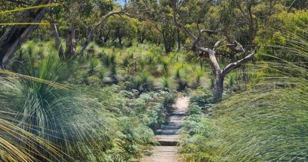
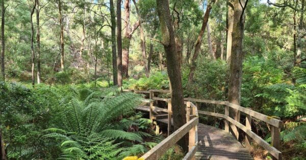
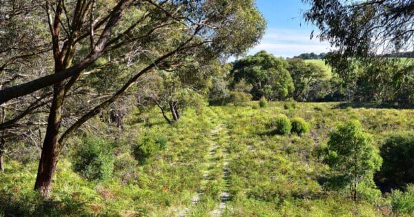
The George Bass Coastal Walk and Rail Trail and Rail Trail is a combination of the popular George Bass Coastal Walk and a section of the Bass Coast Rail Trail.
The popular Bass Coast Walk and Rail Trail is a cliff top hike that stretches from the outskirts of San Remo at Punchbowl Road, to the Bass Highway (just opposite the hall at Peppermint Road) in Kilcunda. The final 12km is along the Bass Coast rail trail from Kilcunda to Wonthaggi. The Trail ends in Graham Street Wonthaggi where you will collect your cars and return to the start point.
Rugged Cliffs, crashing surf, remote beaches, rural pastures and a rich coal mining history all form part of this hike.
The hike offers spectacular views of the coastline and follows the route of the explorer George Bass' epic voyage of discovery along the southern edge of the Anderson Peninsula, over 200 years ago.
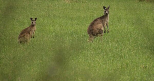
The walk dips through coastal gullies and takes in a secluded beach, climbing again high above the sea. Keep an eye out for whales making their annual pilgrimage (May - November). You might be in luck and get a glimpse of a local kangaroo mob feeding in knee-high grass.
Grade 3 (Moderate) - Walks for Most Fitness Levels: Grade 3 on the
AWTGS represents moderate walking tracks. These are ideal for walkers with some fitness who are comfortable with some hills and uneven terrain. While suitable for most ages, some bushwalking experience is recommended to ensure a safe and enjoyable experience. Tracks may have short, steep hill sections, a rough surface, and many steps. The total distance of a Grade 3 walk can be up to 20 kilometers.
Total distance: 22815 m
Max elevation: 62 m
Min elevation: 4 m
Total climbing: 379 m
Total descent: -399 m
Content use
Please don’t copy GPX files or content from this site to AllTrails or other platforms. Each trail has been personally mapped, documented, and refined to support Australia’s bushwalking and hiking community. While some details come from land managers, every listing reflects significant personal effort. This is a free, community-driven initiative—your respect helps keep it that way.
Gallery
Got any photos from this hike? Your photos can help others plan. Share shots from along the trail so fellow hikers know what to expect.
Click to add your photos >>
Getting there
Getting to the trailhead: Bass Coast.
Punchbowl Road trailhead: The walk is situated 100 kilometres south east of Melbourne between San Remo and Wonthaggi. The walk commences at the southern end of the Punchbowl Road, off the Phillip Island Tourist Road. You may also start the walk from the Wonthaggi end.
Wonthaggi trail head: Several entry points, with South Dudley Rd the one for horse riders heading west. The restored railway station off Biggs Drive further east has a large reserve on one side and ample parking on the other. The trailhead in Bent St is opposite the Centennial Centre and information office (opening hours are limited).
Need a rental car to get you to the hike? Find one here.
Let someone know
Heading out? Fill in a trip intentions form so someone knows your plans. If things go wrong, they can raise the alarm fast, giving you peace of mind on the trail.
About the region
Bass Coast is home to a thriving arts community. The beauty of its natural environment, and the close proximity to Melbourne, attracts the creative spirit. Discover all that our region has to offer below, from cultural venues to public art, opportunities for artists and becoming involved.
Similar walks nearby
Looking for more walks in or near Bass Coast? Try these trails with a similar difficulty grade.
Favourite

Mornington Peninsula National Park
Favourite

Mornington Peninsula National Park
Favourite

Mornington Peninsula National Park
Favourite

Mornington Peninsula National Park
Explore safe
Plan ahead and hike safely! Carry enough water, pack layers for changing conditions, and bring safety gear like a torch, PLB, and reliable communication device. Check official sources for trail updates, closures, and access requirements, and review local weather and bushfire advice. Most importantly, share your plans with someone before you go. Being prepared makes for a safer and more enjoyable hike! Stay Safe, Explore More, and Always #ExploreSafe.
Packing checklists
What you carry in your pack depends on factors like weather, terrain, and your adventure type. Not sure what to bring? My free planning, food, and packing checklists are a great starting point, covering day hikes, overnight trips, and multi-day adventures. Use them to customise your kit and always prioritise safety.
Suggest an edit
Notice something different about this trail? Whether it’s a new feature, a route change, or a closure, share your update so we can keep our info accurate and helpful for fellow hikers.
Click to suggest edits >>


