Hike at a Glance
Max elevation: 514m
Min elevation: 155m
Total Ascent: 652m
Hike overview
Tucked into the forested hills surrounding Warburton, Victoria, the Backstairs Track – Little Joe Loop – Tramway circuit is a 12 kilometre, grade 4 hike that offers a solid half-day out with a rewarding blend of natural beauty, local history, and a decent physical challenge. Typically taking around four hours to complete, this loop appeals to those chasing a quick summit, a solid hill session, or simply a scenic escape that doesn’t require a full pack or a full day.
The route begins gently enough, heading west out of Warburton along the Lilydale-Warburton Rail Trail. It’s an easy, relaxed start that offers a good warm-up for what’s to come, so there’s no need to rush. This section is one of the most charming parts of the loop, especially in the softer morning or late afternoon light. Before long, you’ll reach Scotchmans Creek, where the trail branches off and begins to climb. This creek, named after a Scottish prospector who once searched for gold here, was one of the richest goldfields in the Upper Yarra Valley following its discovery in 1859. The stories of those gold rush days still linger quietly in the landscape.
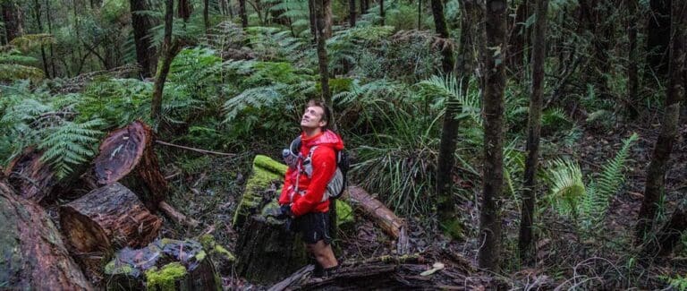
Passing through Dolly Grey Park, a historic patch of greenery nestled at the edge of the climb, the trail begins to rise more steeply. The Backstairs Track, once known as Blackstairs, is a reminder of Warburton’s past, a packhorse route that linked Old Warburton with the newer township. Today, it’s a shaded and sometimes slippery climb through lush fern gullies and tall trees, especially in the cooler, wetter months.
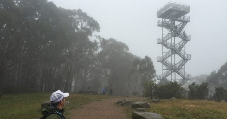
At the top of Backstairs Track, the route swings around the rear of Mount Little Joe, a 469 metre hill that sits between Warburton and Millgrove. Named after Portuguese Joe, a packer and companion of the colourful local figure Yankee Jim (James McAvoy), this small but punchy peak has a wide trail that pushes directly to the summit. The climb is steep and sustained, cutting straight through a recovering forest that bears the legacy of Black Friday and Ash Wednesday. From the top, there are filtered views across the valley through gaps in the trees, offering a quiet spot to pause before descending.
Rather than retracing your steps, the loop curves beneath the northern slope of Mount Little Joe and continues back toward Warburton. If your legs are calling it a day, there’s an option to return via the Backstairs Track for a shorter, 9 kilometre version of the loop. Otherwise, the full circuit continues with a scenic diversion through Old Warburton, where a repurposed tramway track picks up the final leg. This benched trail winds gently along the hillside, crossing a few small gullies and offering a peaceful finish to the walk before dropping back down into town.
The hike is possible year-round, though after heavy rain, sections of the Backstairs Track, the slopes of Mount Little Joe, and the tramway trail can become muddy and slippery. Good footwear and some caution on the steeper sections go a long way. If you’re looking to skip the steeper part of the loop entirely, it’s easy to cut out Mount Little Joe and return down the Backstairs Track, saving around 4 kilometres and 312 metres of elevation gain.
Standout features include the fern-filled gullies of Backstairs Track, the historical touches throughout the route, and the sweeping forests that stretch across the flanks of Little Joe. Whether you’re training for something bigger or simply keen for a few hours in the bush with a good mix of scenery and sweat, this loop offers a compact yet rewarding experience just minutes from Warburton’s cafés.
Tips
- Can be done any time of the year, although Backstairs Track, Little Joe and Tramways Trail can get muddy and slippery in winter.
Content use
Please don’t copy GPX files or content from this site to AllTrails or other platforms. Each trail has been personally mapped, documented, and refined to support Australia’s bushwalking and hiking community. While some details come from land managers, every listing reflects significant personal effort. This is a free, community-driven initiative—your respect helps keep it that way.
Walk map and GPX file
Full Route (12km)
Max elevation: 514 m
Min elevation: 155 m
Total climbing: 652 m
Total descent: -652 m
Alternative Route (9km)
Max elevation: 514 m
Min elevation: 155 m
Total climbing: 534 m
Total descent: -534 m
Getting there
Getting to the trailhead: Yarra State Forest.
From Melbourne City to Yarra Valley (via Eastlink Tollway) – Make your way onto the Eastern Freeway and travel towards Ringwood. The Eastern Freeway turns into the Eastlink Toolway after Springvale Road. If you have an Eastlink or Citylink pass, continue on the Eastlink Tollway and go through the Mullum Mullum tunnel – make sure to stay in the left lane as the turnoff is straight after the tunnel ends. Turn left after exiting the tunnel towards Ringwood. Turn left onto the Maroondah Highway towards Lilydale. Once past Lilydale, turn right at the Warburton Highway turnoff to explore the Warburton Valley. Continue on Station Rd. Drive to Highfield Rd.
By Public Transport Public Transport Victoria has regular trains heading to Lilydale Station. From Lilydale Station, catch a Martyrs bus to travel to Warburton .
Closest towns to this walk: Gladysdale, Launching Place, Millgrove, Reefton, Warburton, Wesburn, Woori Yallock, Yarra Junction
About the region
Just 80 kilometres east of Melbourne, Yarra State Forest is an easily accessible destination for those looking to explore Victoria’s tall forests and native bushland. Managed by the Department of Sustainability and Environment, the forest offers a range of well-maintained walks, drives, picnic areas and campgrounds suitable for day trips or weekend escapes.
Powelltown and its surrounds are known for their towering Mountain Ash trees, among the tallest flowering plants on Earth. These forests form part of one of the most productive ecosystems in the world. Alongside the Mountain Ash, the region supports a mix of vegetation types including Mountain Grey Gum, Messmate, Myrtle Beech and Southern Sassafras, depending on elevation and moisture levels.
This diverse environment is home to native wildlife such as wallabies, wombats, echidnas and gliders. Birdwatchers may be rewarded with a sighting—or the sound—of the Superb Lyrebird, famous for its mimicry of other bird calls, including kookaburras and currawongs.
Gravel roads throughout the forest provide access to all walking tracks and picnic areas. While usually suitable for most vehicles, drivers should take extra care in wet or snowy conditions, especially near higher areas like Starlings Gap and the Ada Tree.
Latrobe River and Starlings Gap are the main campgrounds, both offering basic facilities and operating on a first-come, first-served basis. Picnic areas are also available at several spots including Big Pats Creek and Seven Acre Rock, making Yarra State Forest an ideal spot to enjoy the cooler, greener side of Victoria.
Similar walks nearby
Looking for more walks in or near Yarra State Forest? Try these trails with a similar difficulty grade.
Track grade
Grade 4 (Hard) - Challenging Walks for Experienced Walkers: Grade 4 on the AWTGS signifies challenging walking tracks. Bushwalking experience is recommended for these tracks, which may be long, rough, and very steep. Directional signage may be limited, requiring a good sense of navigation. These walks are suited for experienced walkers who are comfortable with steeper inclines, rougher terrain, and potentially longer distances.
Explore safe
Plan ahead and hike safely! Carry enough water, pack layers for changing conditions, and bring safety gear like a torch, PLB, and reliable communication device. Check official sources for trail updates, closures, and access requirements, and review local weather and bushfire advice. Most importantly, share your plans with someone before you go. Being prepared makes for a safer and more enjoyable hike! Stay Safe, Explore More, and Always #ExploreSafe.
Packing checklists
What you carry in your pack depends on factors like weather, terrain, and your adventure type. Not sure what to bring? My free planning, food, and packing checklists are a great starting point, covering day hikes, overnight trips, and multi-day adventures. Use them to customise your kit and always prioritise safety.
Let someone know
Before heading out, take a moment to fill out your trip intentions form. It’s a quick way to share your hike details with family or friends. If something goes wrong, they can notify emergency services, ensuring a faster response and peace of mind. Stay safe and enjoy your adventure
Suggest an edit
Spotted a change on this trail? Maybe there are new features, the route has shifted, or the trail is permanently closed. Whatever the update, I’d love your input. Your feedback helps fellow hikers stay informed and ensures that our trail info stays fresh and reliable.
Acknowledgement of Country
Trail Hiking Australia acknowledges the Traditional Owners of the lands on which we hike and pay respects to their Elders, past and present, and we acknowledge the First Nations people of other communities who may be here today.
/0eszOrioTc0f-IMG_2754.jpg)
/eyJidWNrZXQiOiJhc3NldHMuYWxsdHJhaWxzLmNvbSIsImtleSI6InVwbG9hZHMvcGhvdG8vaW1hZ2UvMzAzODk1NjkvZTgyZTI2ZmEwN2M0ZTUxM2I2YzRhZmNiMDQ2MmRmZGQuanBnIiwi.jpg)
/eyJidWNrZXQiOiJhc3NldHMuYWxsdHJhaWxzLmNvbSIsImtleSI6InVwbG9hZHMvcGhvdG8vaW1hZ2UvNTI4NDMzNTAvNTY2OGI2OTQyM2EzODA1ZmFjYTg0NjljMTA0Y2RjOWIuanBnIiwiZWR.jpg)
/Backstairs-Track-Little-Joe-Loop-Tramway.jpg)
/qG6tViKypWVh-IMG_2744.jpg)
/eyJidWNrZXQiOiJhc3NldHMuYWxsdHJhaWxzLmNvbSIsImtleSI6InVwbG9hZHMvcGhvdG8vaW1hZ2UvMzk3Mzk1MTAvM2VmNWU2Y2Q1ZTNiOGFjZDc2OTI5OWQ1ZWJkYjU4NWIuanBnIiwiZWRp.jpg)
/warburton-backstairs-track-littlejoe.jpg)
/eyJidWNrZXQiOiJhc3NldHMuYWxsdHJhaWxzLmNvbSIsImtleSI6InVwbG9hZHMvcGhvdG8vaW1hZ2UvNDQxMzI2ODMvMzg3ODI5ZDY3MGJiY2Q1ZjRmNjNlYmFhN2JlYzYyNzguanBnIiwiZWRp.jpg)
/Backstairs-Track.jpg)


