Hike at a Glance
Max elevation: 0m
Min elevation: 0m
Total Ascent: 0m
Hike overview
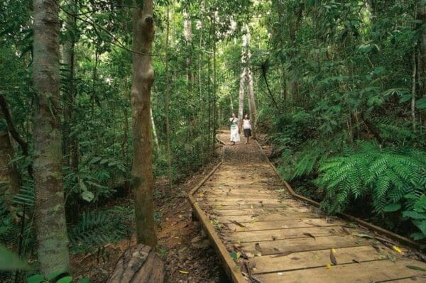
The Atherton-Walkamin rail trail begins at Platypus Park, at the southern end of Atherton township. It skirts around the centre of Atherton, and includes the Atherton Mountain Bike Skills Park and mountain bike trailhead which now has two trails that connect the township with the Atherton Forest Mountain Bike Park. The rail trail heads north to Tolga, passing just east of the Tolga Scrub, a small remnant of Mabi forest which once covered most of the Atherton Tablelands. From Tolga the trail heads to Rocky Creek which housed the largest military hospital complex in the southern hemisphere during World War 2. Between 1942-5, approximately 60,000 Australian soldiers were treated here for war-related conditions. The rail trail passes beside the Rocky Creek igloo, one of the military complex's remaining buildings which is now being restored by the local Rotary Club. Across the road from the igloo, is the Rocky Creek campground and war memorial park, on the site of what used to be the general hospitals' laundry and medical stores. The memorial park has a number of military unit plaques representing units that had a connection with the Rocky Creek Australian Army hospital, or that trained or provided unit support on the Atherton Tablelands during World War 2. The park is regularly visited throughout the year and becomes the focus of Victory in the Pacific celebrations each year. The rail trail currently ends at the Rocky Creek bridge, however work is continuing a further six kilometres northward to Walkamin (Figure 1B).
Atherton Tablelands Rail Trail
Tablelands Regional Council
Atherton-Herberton Historical Railway Inc
Janurary 2017
The Mareeba to Atherton section of the Cairns to Ravenshoe railway line opened in 1903. The railway line extending to Herberton to transport tin ore to the coast was officially opened in October 1910, and the line eventually reached south to Ravenshoe in 1916. As Queensland's rail traffic decreased due to improved road networks and increased car ownership, Queensland Rail began closing branch railways that were no longer economical to operate. The rail service beyond Atherton ended in 1988 and the last train to Atherton ran in 2004. A tourist railway train operating between Atherton and Herberton ceased operations in 2003.
The Friends of Atherton Tablelands Rail Trail Inc. (FATRT) was formed in 2007 and one of its early initiatives was to assess and develop the rail trail potential on the Tablelands. A feasibility study was commissioned in 2008, and with the support of the Tablelands Regional Council, the last six kilometres of the 20km rail trail between Atherton and Walkamin is now nearing completion. The 14km trail which is open between Atherton and Rocky Creek has proved to be extremely popular with walkers, joggers, bike riders and horse riders
Tips
Atherton to Walkamin in North Queensland
Atherton Tablelands, 88km south west of Cairns, 1730km from Brisbane
Compacted earth
Photo credit: Rail Trails Australia. For more information and a location map please visit RailTrails Australia.
Track grade
Grade 3 (Moderate) - Walks for Most Fitness Levels: Grade 3 on the AWTGS represents moderate walking tracks. These are ideal for walkers with some fitness who are comfortable with some hills and uneven terrain. While suitable for most ages, some bushwalking experience is recommended to ensure a safe and enjoyable experience. Tracks may have short, steep hill sections, a rough surface, and many steps. The total distance of a Grade 3 walk can be up to 20 kilometers.
Walk map and GPX file
Do you have a GPX file for this hike? Feel free to email it to me so I can add it to this hikes info.
Click to add your file >>
Content use
Please don’t copy GPX files or content from this site to AllTrails or other platforms. Each trail has been personally mapped, documented, and refined to support Australia’s bushwalking and hiking community. While some details come from land managers, every listing reflects significant personal effort. This is a free, community-driven initiative—your respect helps keep it that way.
Gallery
Got any photos from this hike? Your photos can help others plan. Share shots from along the trail so fellow hikers know what to expect.
Click to add your photos >>
Getting there
Getting to the trailhead: North Queensland.
Need a rental car to get you to the hike? Find one here.
Let someone know
Heading out? Fill in a trip intentions form so someone knows your plans. If things go wrong, they can raise the alarm fast, giving you peace of mind on the trail.
About the region
Starting just south-west of Cairns and rising more than 700m above sea level, the Atherton Tablelands is a lush, fertile region of rainforest, wetland and savannah. An ancient coral reef has eroded over centuries to form rugged limestone caves in Chillagoe and nearby volcanic crater lakes sit amongst a series of tumbling waterfalls.
Similar walks nearby
Looking for more walks in or near North Queensland? Try these trails with a similar difficulty grade.
Explore safe
Plan ahead and hike safely! Carry enough water, pack layers for changing conditions, and bring safety gear like a torch, PLB, and reliable communication device. Check official sources for trail updates, closures, and access requirements, and review local weather and bushfire advice. Most importantly, share your plans with someone before you go. Being prepared makes for a safer and more enjoyable hike! Stay Safe, Explore More, and Always #ExploreSafe.
Packing checklists
What you carry in your pack depends on factors like weather, terrain, and your adventure type. Not sure what to bring? My free planning, food, and packing checklists are a great starting point, covering day hikes, overnight trips, and multi-day adventures. Use them to customise your kit and always prioritise safety.
Suggest an edit
Notice something different about this trail? Whether it’s a new feature, a route change, or a closure, share your update so we can keep our info accurate and helpful for fellow hikers.
Click to suggest edits >>
Acknowledgement of Country
Trail Hiking Australia acknowledges the Traditional Owners of the lands on which we hike and pay respects to their Elders, past and present, and we acknowledge the First Nations people of other communities who may be here today.


