Hike at a Glance
Max elevation: 0m
Min elevation: 0m
Total Ascent: 0m
Hike overview
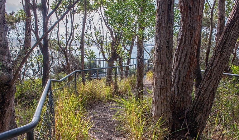
One short walk is all it takes to acquaint yourself with the best of Corramy Regional Park. Anabranch loop track twists through spotted gum forest, wetlands, and along the tranquil edge of Wandandian Creek, which is popular for fishing and kayaking. The bushland it passes is largely undisturbed, making this a terrific opportunity to enjoy unadulterated nature and the best place to start any visit to the area.
At only 1km along gentle formed track, Anabranch loop track is accessible to nearly everyone, requiring no experience though it features several steps and can be slippery after heavy rain. Closer to the creek, the track graduates onto purpose-built boardwalk, allowing you to get right near Wandandian Creek and enjoy the native birdlife.
Consider having lunch in the picnic area and then using Anabranch loop track to stretch your legs with a pair of binoculars in tow. A slightly longer and more difficult walk, Delta track, also leaves from the picnic area. Add the two together for an active day by the cool retreat of the water. Take a virtual tour of Anabranch loop track captured with Google Street View Trekker.
Tips
Strong currents and submerged hazards may be present in the creek. Take care in the water and please supervise children at all times. This area is not patrolled by lifeguards.
A current NSW recreational fishing licence is required when fishing in all waters
Drinking water is limited or not available in this area, so it's a good idea to bring your own.
There is limited mobile reception in this park
It's a good idea to put sunscreen on before you set out and remember to take a hat and drinking water
Remember to take your binoculars if you want to go birdwatching
Visit NSW National Parks and Wildlife Service for more information on this trail.
The longitude and latitude of the start and end points are approximately only and should not be used for navigation purposes. Please contact me if you know the correct coordinates.
Gallery
Got some great shots from this hike? Upload your photos here to inspire others and show off the beauty of the trail!
Click to view form >>
Submitting your photos doesn’t mean you lose ownership. You can be credited for your contributions, and you can request removal at any time.
Content use
Please don’t copy GPX files or content from this site to AllTrails or other platforms. Each trail has been personally mapped, documented, and refined to support Australia’s bushwalking and hiking community. While some details come from land managers, every listing reflects significant personal effort. This is a free, community-driven initiative—your respect helps keep it that way.
Walk map and GPX file
It looks like I don’t have a GPX file for this trail yet. If you have one to share, please email it to me! I’ll verify it against official maps before adding it to help other hikers have a safer, easier experience. Thanks for contributing to a better hiking resource.
Getting there
Getting to the trailhead: Corramy Regional Park.
Anabranch loop track is in the Wandandian Creek precinct of Corramy Regional Park. To get there:Travel south on Princes Highway from NowraTurn left (east) onto The Wool Road, just north of Bewong.Turn right (south) after approximately 1km to enter Corramy Regional ParkFollow the unsealed road to the Wandandian Creek picnic area car park Parking Parking is available at Wandandian Creek picnic area. It’s a busy place on the weekend, so parking might be limited then.
Closest towns to this walk: Adaminaby, Borenore, Bredbo, Cooma, Dunedoo, Gulgong, Jindabyne, Mudgee, Nimmitabel, Wellington
About the region
Corramy Regional Park in the South Coast region
Corramy Regional Park is always open but may have to close at times due to poor weather or fire danger.
Similar walks nearby
Looking for more walks in or near Corramy Regional Park? Try these trails with a similar difficulty grade.
Track grade
Grade 2 (Easy) - A Gentle Introduction to Inclines: Grade 2 on the AWTGS represents easy walking tracks that offer a slightly more challenging experience compared to Grade 1. Similar to Grade 1, no prior bushwalking experience is required. The track surface is typically hardened or compacted and may have gentle hill sections or occasional steps. The total distance of a Grade 2 walk is typically no greater than 10 kilometers. These walks are still suitable for families with a bit more experience or those seeking a gentle introduction to some inclines.
Explore safe
Plan ahead and hike safely! Carry enough water, pack layers for changing conditions, and bring safety gear like a torch, PLB, and reliable communication device. Check official sources for trail updates, closures, and access requirements, and review local weather and bushfire advice. Most importantly, share your plans with someone before you go. Being prepared makes for a safer and more enjoyable hike! Stay Safe, Explore More, and Always #ExploreSafe.
Packing checklists
What you carry in your pack depends on factors like weather, terrain, and your adventure type. Not sure what to bring? My free planning, food, and packing checklists are a great starting point, covering day hikes, overnight trips, and multi-day adventures. Use them to customise your kit and always prioritise safety.
Let someone know
Before heading out, take a moment to fill out your trip intentions form. It’s a quick way to share your hike details with family or friends. If something goes wrong, they can notify emergency services, ensuring a faster response and peace of mind. Stay safe and enjoy your adventure
Suggest an edit
Spotted a change on this trail? Maybe there are new features, the route has shifted, or the trail is permanently closed. Whatever the update, I’d love your input. Your feedback helps fellow hikers stay informed and ensures that our trail info stays fresh and reliable.
Acknowledgement of Country
Trail Hiking Australia acknowledges the Traditional Owners of the lands on which we hike and pay respects to their Elders, past and present, and we acknowledge the First Nations people of other communities who may be here today.


