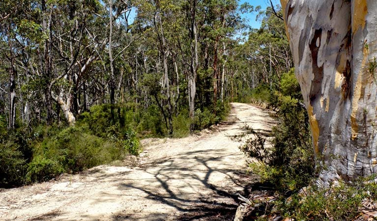
Woodford - Oaks trail is a 27km, grade 3 hike located in Blue Mountains National Park, New South Wales. The hike should take around 7 hours to complete.
Hike overview
For an invigorating ride or walk that will work your muscles and clear your head, try Woodford - Oaks trail in Blue Mountains National Park. The track leads from Woodford to Glenbrook and makes a great day out in the mountains for friends or family looking for heart pumping adventure and fresh mountain air.
Take in the expansive scenic views as the medium trail winds through heath, gradually giving way to open forest. Arriving at The Oaks picnic area, named for the nearby casuarinas, enjoy a well-earned lunch. From here, the track continues as a dedicated cycle track with a steep ride up Glenbrook Gorge to the station.
In the warmer months, the aroma of wildflowers and eucalypts mingle to create a heady perfume. It's also a very popular track for cyclists and runners, and attracts over 850 participants for the annual Woodford to Glenbrook Classic.
Take a virtual tour of Woodford - Oaks trail captured with Google Street View Trekker.
Route and GPX file
Help fellow hikers navigate with confidence. Share your GPX or KML file for this trail and help build a more comprehensive resource with precise waypoints and elevation profiles. Your contribution will empower adventurers with details they need for a safer and more enjoyable experience. I meticulously verify every file using official maps and surveys, ensuring the highest level of accuracy and reliability. Submit your file now and become a trailblazer for your fellow outdoor enthusiasts.
Tips
Check the weather before you set out as this cycling trail can become boggy when it rains.
Drinking water is available just inside the gate to this trail, at a tap installed by NPWS. Please use this tap to fill your water bottles rather than the neighbours' garden taps.
There is limited mobile reception in this park
The weather in this area can be extreme and unpredictable, please ensure you are well prepared for your visit.
Visit NSW National Parks and Wildlife Service for more information on this trail.
The longitude and latitude of the start and end points are approximately only and should not be used for navigation purposes. Please contact me if you know the correct coordinates.
Trail location
Sorry, no records were found. Please adjust your search criteria and try again.
Sorry, unable to load the Maps API.
Getting there
To Glenbrook Gorge carpark. Woodford - Oaks trail is in the Glenbrook precinct of Blue Mountains National Park. To get there from Woodford Railway Station:The station ramp leads to Railway Parade which you follow (towards Sydney) for 300m. At the junction, turn right into Appian Way for 100m, then left into Parker Street for 80m, then left into Taylor Road. After 50m you'll see a dirt road on the right with a locked gate.There are signs to identify the park and the trail commences here, however you'll have to lift your bike over the low fence. Park entry points Glenbrook Gorge carpark See on map Woodford Oaks Trail carpark See on map Parking Parking is available. Helpful note: many riders park their cars at Glenbrook Railway Station (where the trail ends) and catch the train up to Woodford.
Gallery
If you have any photos from this hike and are happy to share them, please upload your .jpg files here.
Please note: Uploading photos does not transfer ownership of copyright away from you. If requested, you will be credited for any photos you provide and can ask they be deleted at any time.
About the region
Blue Mountains National Park in the Sydney and surrounds and Country NSW regions
Blue Mountains National Park is always open but may have to close at times due to poor weather or fire danger. Some parts of the park close overnight; details are provided for specific attractions.
9am to 4.30pm daily. Closed Christmas Day.
Similar trails nearby
Explore Safe
While planning your hike, it’s important to check official government sources for updated information, temporary closures and trail access requirements. Before hitting the trail, check local weather and bushfire advice for planned burns and bushfire warnings and let someone know before you go. Plan ahead and hike safely.
Let someone know
Adventure with peace of mind: Fill out your trip intentions form. Before you hit the trail, fill out an online form to privately send important details about your hike to your family or friends. If you don’t return on time, they can easily alert emergency services, preventing worry and ensuring a swift response. Hike with peace of mind and enjoy your outdoor adventure to the fullest. Be smart, be safe: Register your plans here.
Gear to consider

My free planning, food and packing checklists provide an introduction to things your could consider (as well as the Ten Essentials) on your day, overnight and multi-day adventures. Customise your kit according to your personal needs, always considering safety first.
Suggest an edit
Does this hikes information need updating? Sometimes the route, trail features or access conditions change.
Acknowledgement of Country
Trail Hiking Australia acknowledges the Traditional Owners of the lands on which we hike and pay respects to their Elders, past and present, and we acknowledge the First Nations people of other communities who may be here today.


