Hike at a Glance
Max elevation: 1715m
Min elevation: 564m
Total Ascent: 1803m
Important info
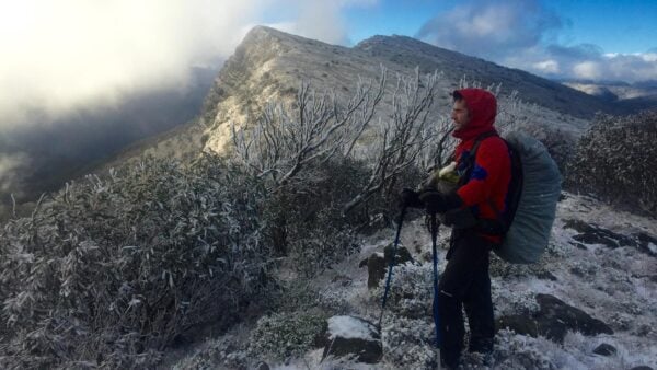
This is a challenging route involving steep rock scrambling and exposed alpine ridgelines. Weather conditions on The Bluff can deteriorate rapidly, resulting in whiteouts, high winds, and freezing temperatures even in summer. There is no reliable water on the Day 1 ascent along Eight Mile Spur, consider carrying of 3–4 litres per person to reach Bluff Hut. Navigation skills and self-sufficiency are essential.
Hike overview
This challenging yet rewarding 28km circuit in the Alpine National Park offers some of the most spectacular views in the Victorian High Country. Starting from the banks of the Howqua River, the route climbs steadily up Eight Mile Spur to the dramatic escarpment of The Bluff. Hikers are treated to sweeping panoramic views stretching from Mount Buller to Lake Eildon before traversing alpine meadows to the historic Bluff Hut. The descent follows Sixteen Mile Spur back to the river valley, passing Ritchies Hut on the return to the trailhead.
The hike is rated Grade 5 due to the steep, rugged ascent on day one and the remote, exposed nature of the alpine plateau. It is best suited for experienced bushwalkers with good fitness and navigation skills.
Day 1: Eight Mile Flat to Bluff Hut (13km)
Your journey begins at Eight Mile Flat, a pleasant grassy camping area beside the Howqua River. From here, locate the track heading south-east to begin the ascent of Eight Mile Spur. The path climbs steadily through dry open forest, gaining elevation consistently.
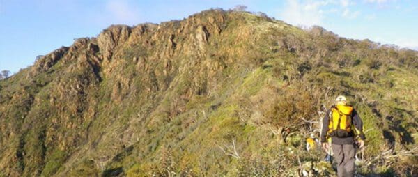
As you ascend, the ridge narrows and becomes rockier as you traverse Rocky Ridge. Be prepared for a physically demanding climb; the final section approaching the escarpment is particularly steep and requires scrambling up the rugged natural ramparts of The Bluff.
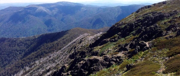
Upon reaching the top, you are rewarded with breathtaking 360-degree views. From the treeless 1,725-metre summit of The Bluff, the panorama extends north to Mount Buller and west toward Lake Eildon. In early summer, the alpine meadows here are carpeted with brilliant wildflowers.
The trail continues east, traversing the high plateau. You will skirt the edge of The Blowhole and pass the slopes of Mount Eadley Stoney (1664m). Continue along the defined track until you reach Bluff Hut, nestled among snow gums near the intersection with the Bluff Track.
- Campsite: Camp near Bluff Hut. This is a well-known high country hut offering shelter and a flat area for pitching tents among the snow gums.
- Water: A tank is usually available at Bluff Hut, but it is untreated—always boil or filter. If the tank is dry, you may need to source water from nearby soaks, though these can be unreliable in late summer.
Day 2: Bluff Hut to Eight Mile Flat (15km)
Departing Bluff Hut, the route joins the Bluff Track briefly before turning north onto Sixteen Mile Spur. The descent here follows a 4WD track, winding its way down from the high country back toward the valley floor. The gradient is consistent but can be hard on the knees, so trekking poles are highly recommended.
Eventually, you will reach the bottom of the spur at Pike Flat and reconnect with the Howqua River. Turn left (west) to follow the track along the river valley. This section is scenic and lush, contrasting sharply with the dry ridges of Day 1.
The trail meanders alongside the river, eventually leading you to Ritchies Hut, another iconic structure in the area and a great spot for a lunch break. From Ritchies Hut, continue following the river track downstream. The path may involve river crossings; depending on water levels, you may be able to rock-hop, but be prepared for wet feet if the river is high.
Continue west along the river until you return to your starting point at Eight Mile Flat.
Water Points:
- Ritchies Hut: Reliable water source (river). Always treat river water before drinking.
- Howqua River: Water is available at various points along the valley floor section. Always treat river water before drinking.
Essential Information
- Best Time: Summer and Autumn. (Winter attempts require alpine experience, snowshoes/crampons, and are not recommended for general hiking due to snow coverage on the plateau).
- Water Safety: Carry sufficient water (3-4L) for the steep ascent on Day 1, as there is no reliable water on Eight Mile Spur until you reach Bluff Hut.
- Navigation: While the track is generally defined, carrying a topographical map and a compass/GPS is essential. The rocky summit area can be disorienting if fog or low cloud rolls in.
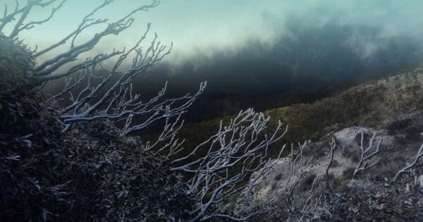
- Weather: The Bluff is an exposed alpine environment. Weather can change rapidly, bringing high winds, plummeting temperatures, and snow even in summer. Carry appropriate warm and waterproof layers.
Tips
Weather conditions can change rapidly in alpine areas at any time of year. Snowfalls can be experienced at any time, so please be prepared with:
- warm clothing
- windproof and waterproof jacket
- gloves and hat
- strong footwear
- energy food and water
- compass and relevant topographical map
- personal locator beacon
Track grade
Grade 5 (Difficult) - Walks for the Most Experienced: Grade 5 represents the most challenging walking tracks on the AWTGS. These are only recommended for very experienced and fit walkers with specialised skills, including navigation and emergency first aid. Tracks are likely to be very rough, very steep, and unmarked. Walks may be more than 20 kilometers. These challenging walks demand a high level of fitness and experience to navigate difficult terrain, significant elevation changes, and potentially unformed paths.
Walk map and GPX file
Max elevation: 1715 m
Min elevation: 564 m
Total climbing: 1803 m
Total descent: -1803 m
Content use
Please don’t copy GPX files or content from this site to AllTrails or other platforms. Each trail has been personally mapped, documented, and refined to support Australia’s bushwalking and hiking community. While some details come from land managers, every listing reflects significant personal effort. This is a free, community-driven initiative—your respect helps keep it that way.
Getting there
Getting to the trailhead: Alpine National Park.
To get to the trailhead, travel from Melbourne to Mansfield (approximately 195km), then head east on the Mount Buller Road for 20.6km until you reach the small settlement of Merrijig. Turn right onto the Howqua Track, signposted for the Howqua Hills Historic Area, and follow the unsealed road for 16.4km to Sheepyard Flats.
From here, drive through the camping area and continue along Brocks Road for a further 13km to Eight Mile Flat. Turn left at the junction into the Eight Mile Flat camping area and follow the track to the carpark at the end. Note that while the road to Sheepyard Flats is generally 2WD accessible, the stretch along Brocks Road is rougher and an SUV or 4WD is recommended, particularly in wet conditions. Be aware that this road is subject to seasonal closures between June and November, so always check current track conditions with Parks Victoria before you depart.
Need a rental car to get you to the hike? Find one here.
Find a place to stay
Wondering where to stay near this hike? Find accommodation close to the trailhead — hotels, cabins and campgrounds nearby. Click the button to view the interactive map.
Closest towns to this walk: Benalla, Bright, Dinner Plain, Falls Creek, Harrietville, Hotham Heights, Mansfield, Mitta Mitta, Mount Beauty, Mount Hotham, Myrtleford, Omeo, Porepunkah, Tawonga South, Wangaratta
Let someone know
Heading out? Fill in a trip intentions form so someone knows your plans. If things go wrong, they can raise the alarm fast, giving you peace of mind on the trail.
About the region
The Alpine National Park is the crown jewel of Victoria’s natural landscape, spanning over 646,000 hectares across the state’s Central Highlands and Alpine regions. Located northeast of Melbourne, it stands as the largest national park in Victoria, protecting the rugged heart of the Great Dividing Range. The park is home to the state’s most dramatic topography, including its highest peak, Mount Bogong, which rises to 1,986 metres, and the expansive, wildflower-strewn Bogong High Plains. To the northeast, the park forms a continuous wilderness corridor across the state border, where it abuts New South Wales' Kosciuszko National Park.
For hikers on the Bluff Trail, the park offers a distinct transition from the lush, fern-lined banks of the Howqua River to the stark, windswept beauty of the subalpine "High Country." This region is defined by its iconic snow gum forests and resilient alpine grasslands that have survived millions of years of extreme weather. Beyond its natural beauty, the area is steeped in cultural history, preserving the heritage of the traditional owners and the later era of mountain cattlemen, whose historic timber huts still provide essential shelter for trekkers today.
Similar walks nearby
Looking for more walks in or near Alpine National Park? Try these trails with a similar difficulty grade.
Explore safe
Plan ahead and hike safely! Carry enough water, pack layers for changing conditions, and bring safety gear like a torch, PLB, and reliable communication device. Check official sources for trail updates, closures, and access requirements, and review local weather and bushfire advice. Most importantly, share your plans with someone before you go. Being prepared makes for a safer and more enjoyable hike! Stay Safe, Explore More, and Always #ExploreSafe.
Packing checklists
What you carry in your pack depends on factors like weather, terrain, and your adventure type. Not sure what to bring? My free planning, food, and packing checklists are a great starting point, covering day hikes, overnight trips, and multi-day adventures. Use them to customise your kit and always prioritise safety.
Suggest an edit
Notice something different about this trail? Whether it’s a new feature, a route change, or a closure, share your update so we can keep our info accurate and helpful for fellow hikers.
Click to suggest edits >>
Acknowledgement of Country
Trail Hiking Australia acknowledges the Traditional Owners of the lands on which we hike and pay respects to their Elders, past and present, and we acknowledge the First Nations people of other communities who may be here today.
/The-Bluff-Trail-Circuit-Hike_1.jpg)
/The-Bluff-Trail-Circuit-Hike_23.jpg)
/The-Bluff-Trail-Circuit-Hike_77.jpg)
/The-Bluff-Trail-Circuit-Hike_58.jpg)
/The-Bluff-Trail-Circuit-Hike_67.jpg)
/The-Bluff-Trail-Circuit-Hike_18.jpg)
/The-Bluff-Trail-Circuit-Hike_45.jpg)
/The-Bluff-Trail-Circuit-Hike_17.jpg)
/The-Bluff-Trail-Circuit-Hike_35.jpg)
/The-Bluff-Trail-Circuit-Hike_70.jpg)
/The-Bluff-Trail-Circuit-Hike_22.jpg)
/The-Bluff-Trail-Circuit-Hike_7.jpg)
/The-Bluff-Trail-Circuit-Hike_12.jpg)
/The-Bluff-Trail-Circuit-Hike_15.jpg)
/The-Bluff-Trail-Circuit-Hike_52.jpg)


6 Reviews on “The Bluff Trail Circuit Hike (28km)”
I love this hike. Nice steep section waking up 8-mile spur