Hike at a Glance
Max elevation: 265m
Min elevation: 169m
Total Ascent: 326m
Hike overview
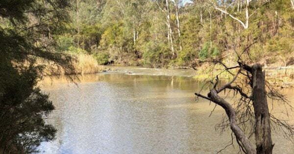
The Sugarloaf and Christmas Hills Circuit is a 15 kilometre, grade 3 hike within Sugarloaf Reservoir Park, Victoria. On average, it takes around four hours to complete the circuit, making it a solid half-day walk with plenty of variety along the way. The route threads past Mount Graham, Rosella Spur, Eagle Point, Cockatoo Knoll, Plover Point, Finger Ridge, Sugarloaf Hill and the Sugarloaf Dam Wall. Some of the higher points along the trail provide views across the Yarra Valley and, on a clear day, even glimpses of the city skyline. For much of the circuit the water remains in sight, creating a constant backdrop as you move between open bushland and more heavily timbered sections.
Beginning at the Saddle Dam Picnic Area, the walk sets off across the dam wall with sweeping views over the reservoir on one side and the wooded slopes of the park on the other. From here, the trail bends left and follows the southern shoreline. You’ll pass the access road leading to the Power Station, where the cleared land contrasts sharply with the surrounding bush. It’s one of the few places on the circuit where the influence of infrastructure is more noticeable, but before long the track pulls you back into quieter country.
The path rises gently as it heads east through bushland towards the Reservoir Lookout. This is an ideal place to pause, catch your breath, and take in the view over the broad expanse of water. The circuit then continues northwards around Eagle Point, the highest point in the park. The track narrows through this section, winding between trees with occasional openings that reveal the shoreline. Keep an eye out for birdlife here, as the varied terrain provides habitat for many species.
From Eagle Point the trail swings west along the northern edge of the lake. This stretch feels more remote, with small inlets and side tracks leading down to the water. The walking here is mostly flat and easy underfoot, alternating between shaded forest and more open ground where you can look across the reservoir to the southern hills.
The circuit eventually brings you to Finger Ridge, a distinctive peninsula that juts into the lake and provides broad views across the water towards the dam wall. After skirting the inlet, the track runs parallel with the main access road for a time. It’s straightforward walking, heading gradually back towards the western side of the park.
The final stage loops you southwards to re-cross the Saddle Dam wall, returning you to the picnic area where the circuit began. By the time you finish, you’ll have traced the full shoreline, experienced the quiet charm of inlets and ridges, and enjoyed elevated viewpoints that give a true sense of the park’s scale.
This hike offers a balanced mix of flat shoreline paths and gentle climbs, making it accessible while still providing a sense of exploration. There are plenty of natural pauses along the way, whether at lookouts, points along the water’s edge, or shaded spots in the forest. For walkers looking to combine a good physical outing with constant views of both bush and water, the Sugarloaf and Christmas Hills Circuit delivers an experience that is both rewarding and memorable.
Tips
- The park is open every day of the year.
- Gates open at 8.30am and close at 7.00pm during daylight saving.
- Outside of daylight savings, the park closes at 5.00pm.
Track grade
Grade 3 (Moderate) - Walks for Most Fitness Levels: Grade 3 on the AWTGS represents moderate walking tracks. These are ideal for walkers with some fitness who are comfortable with some hills and uneven terrain. While suitable for most ages, some bushwalking experience is recommended to ensure a safe and enjoyable experience. Tracks may have short, steep hill sections, a rough surface, and many steps. The total distance of a Grade 3 walk can be up to 20 kilometers.
Walk map and GPX file
Max elevation: 265 m
Min elevation: 169 m
Total climbing: 326 m
Total descent: -326 m
Content use
Please don’t copy GPX files or content from this site to AllTrails or other platforms. Each trail has been personally mapped, documented, and refined to support Australia’s bushwalking and hiking community. While some details come from land managers, every listing reflects significant personal effort. This is a free, community-driven initiative—your respect helps keep it that way.
Getting there
Getting to the trailhead: Sugarloaf Reservoir Park.
To reach Sugarloaf Reservoir Park from Melbourne, make your way through Doncaster and Eltham, then continue on towards Reservoir, Kangaroo Ground and Watsons Creek. From there, follow the Eltham–Yarra Glen Road until you reach Simpson Road, which marks the entrance to Sugarloaf. Continue along this road and you will soon arrive at the Saddle Dam Car Park, located just past the dam wall on the left-hand side.
Need a rental car to get you to the hike? Find one here.
Find a place to stay
Wondering where to stay near this hike? Find accommodation close to the trailhead — hotels, cabins and campgrounds nearby. Click the button to view the interactive map.
Closest towns to this walk: Diamond Creek, Doreen, Hurstbridge, Whittlesea, Yarrambat
Let someone know
Heading out? Fill in a trip intentions form so someone knows your plans. If things go wrong, they can raise the alarm fast, giving you peace of mind on the trail.
About the region
Sugarloaf Reservoir Park lies within the traditional Country of the Wurundjeri Peoples and forms part of an important Aboriginal cultural landscape. Set among the Christmas Hills, just 8 kilometres from Yarra Glen and about 45 kilometres north-east of Melbourne, Victoria, the park is a popular destination for people looking to enjoy the outdoors without having to travel too far from the city.
The park offers something for everyone, whether you are drawn to short walks, longer bushwalks, or full-day hikes. It is also a great place for picnics, bird watching, sailing and shoreline fishing, making it an accessible and versatile spot for families and groups of friends. Saddle Dam Picnic Area is a favourite for its outlook across the reservoir, while Ridge Picnic Area provides shelter and gas barbecues for those who prefer to cook up a meal after exploring the trails.
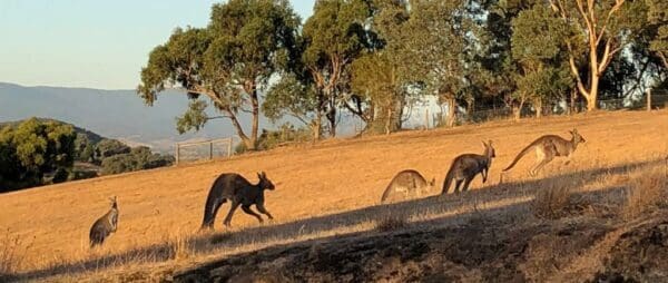
Once you’ve settled in, there are plenty of ways to spend your time. A series of well-marked walking trails loop around the reservoir, taking you through open bushland and shaded forests with the water never far from view. Along the way, you may spot wedge-tailed eagles circling overhead, echidnas rustling through the undergrowth, or kangaroos grazing at the edges of the track. The park is alive with wildlife, which adds another layer of interest to both casual walks and more committed hikes.
For those who enjoy water-based activities, sailing at Sugarloaf can be exciting and refreshing. Access to the water is provided through the Sugarloaf Sailing and Boating Club, which opens its facilities to visitors on Sundays and public holidays. Launching is subject to a fee, and it’s important to note that only certain types of watercraft are permitted, excluding sailboards, canoes, kayaks and boats with cabins or cooking facilities.
Sugarloaf Reservoir Park is open daily from 8.30am to 5pm, with extended hours until 7pm during daylight savings. Its mix of trails, picnic areas, and wildlife viewing opportunities makes it an easy choice for anyone searching for quality walks close to Melbourne. Whether you are exploring all trails in the park, setting out on bushwalks with friends, or planning a solo hike, Sugarloaf offers a rewarding outdoor experience.
Similar walks nearby
Looking for more walks in or near Sugarloaf Reservoir Park? Try these trails with a similar difficulty grade.
Explore safe
Plan ahead and hike safely! Carry enough water, pack layers for changing conditions, and bring safety gear like a torch, PLB, and reliable communication device. Check official sources for trail updates, closures, and access requirements, and review local weather and bushfire advice. Most importantly, share your plans with someone before you go. Being prepared makes for a safer and more enjoyable hike! Stay Safe, Explore More, and Always #ExploreSafe.
Packing checklists
What you carry in your pack depends on factors like weather, terrain, and your adventure type. Not sure what to bring? My free planning, food, and packing checklists are a great starting point, covering day hikes, overnight trips, and multi-day adventures. Use them to customise your kit and always prioritise safety.
Suggest an edit
Notice something different about this trail? Whether it’s a new feature, a route change, or a closure, share your update so we can keep our info accurate and helpful for fellow hikers.
Click to suggest edits >>
Acknowledgement of Country
Trail Hiking Australia acknowledges the Traditional Owners of the lands on which we hike and pay respects to their Elders, past and present, and we acknowledge the First Nations people of other communities who may be here today.
/Sugarloaf%20&%20Christmas%20Hills%20Circuit%20(4).jpg)
/Sugarloaf%20&%20Christmas%20Hills%20Circuit%20(3).jpg)
/Sugarloaf%20&%20Christmas%20Hills%20Circuit%20(5).jpg)
/Sugarloaf%20&%20Christmas%20Hills%20Circuit%20(2).jpg)
/Sugarloaf%20&%20Christmas%20Hills%20Circuit%20(1)_1.jpg)
/Sugarloaf%20&%20Christmas%20Hills%20Circuit%20(1).jpg)


11 Reviews on “Sugarloaf & Christmas Hills Circuit Hike (15km)”
MaxandJanet Wiggins
MaxandJanet Wiggins I’d like to! Just went to sign up and it’s already full ?
MaxandJanet Wiggins on that
Our backyard! This is a lovely spot.
Rhiannon Riches this is close
Wait list???
I did it last year and it was a lot harder than we expected…. it was also about 25 degrees and hot!!! Not many kangaroos out. Saw more kangaroos at lysterfield lake
A lovely, fairly easy hike around the reservoir with numerous trail markers to keep you from getting lost. There’s a fair few different terrains you get to walk in. We had beautiful weather the day we went and were lucky enough to see a group of wallabies feeding just off the track.
Fiona
Great hike! Watch out for Magpies if going in September! I got swooped A LOT and had to carry a stick for safety – at least 7 or 8 different magpies wanted a piece!
Great hike. Recommend a packed lunch and to stop at the top of the “big†climb and enjoy the views. About 4hrs total walk time if you hustle.
Kerrie Battisson our this on our list