Hike at a Glance
Max elevation: 349m
Min elevation: 318m
Total Ascent: 49m
Hike overview
The Moonlight Creek picnic area provides a good base from which to explore the Mount Worth State Park . There are a number of walks available to people of all levels of experience.
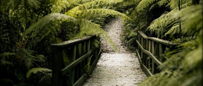
Commencing at the Moonlight Creek picnic area the Mount Worth Giant's Circuit trail follows the route of a timber tramway through Mountain Ash Forest and fern filled gullies. This walk includes the Standing Giant, a huge Mountain Ash with a girth of 14 metres.
OPTIONAL WALK - Maslins Mill 800 metres One-way, 40 minutes return
Commencing at the far end of the Moonlight Creek picnic area this track meanders through forest of Mountain Ash and Blackwood to Maslins's Mill site. Suitable for people with limited mobility.
Location
The Mount Worth State Park protects some 1000 hectares of natural forest in the Western Strzelecki Ranges. It provides an opportunity to view the forest that once covered Gippsland. Before the arrival of European settlers, most of the area was covered with tall, wet forest of mountain ash, manna gum, blue gum and mountain grey gum with an understorey of blackwood, silver wattle, sassafras and dense fern filled gullies. The park is also rich in bird and animal life; lyrebirds are common in gullies and crimson rosellas and grey butcher birds too. Wallabies, wombats and echidnas may also be seen.
Content use
Please don’t copy GPX files or content from this site to AllTrails or other platforms. Each trail has been personally mapped, documented, and refined to support Australia’s bushwalking and hiking community. While some details come from land managers, every listing reflects significant personal effort. This is a free, community-driven initiative—your respect helps keep it that way.
Walk map and GPX file
Max elevation: 349 m
Min elevation: 318 m
Total climbing: 49 m
Total descent: -49 m
Getting there
Getting to the trailhead: Mount Worth State Park.
From Melbourne follow Princes Hwy south-east for 112kms to Darnum. This is a small town 7km east of Warragul. Turn right and follow the Darnum-Allambee Road south, following the ‘Mount Worth State Park’ signs for 12kms along narrow country lanes up into the Strzelecki Ranges. Turn left at the junction with McDonalds Track, continue 1km then bear right along Allambee Estate Road to Mount Worth State Park. Moonlight Creek Picnic Area lies beyond a gate on the right immediately after the sharp hairpin bend across Moonlight Creek.
What to Take
Please pack enough food and water, and wear appropriate footwear. Additional information on how to prepare for a day hike can be found here
Best Season to go
Spring, Summer and autumn
Further Information
Closest towns to this walk: Drouin, Jindivick, Longwarry, Moe, Neerim South, Tarra Bulga, Tarragal, Warragul, Yarragon
About the region
Situated on the western rim of the Strzelecki Ranges, Mount Worth State Park encompasses 1040 hectares of Mountain Ash forest and regenerating native bush. There are a number of walks within Mount Worth State Park that range is distance and difficulty level. The walks explore a variety of native vegetation and many incorporate historical interpretation.
Similar walks nearby
Looking for more walks in or near Mount Worth State Park? Try these trails with a similar difficulty grade.
Track grade
Grade 2 (Easy) - A Gentle Introduction to Inclines: Grade 2 on the AWTGS represents easy walking tracks that offer a slightly more challenging experience compared to Grade 1. Similar to Grade 1, no prior bushwalking experience is required. The track surface is typically hardened or compacted and may have gentle hill sections or occasional steps. The total distance of a Grade 2 walk is typically no greater than 10 kilometers. These walks are still suitable for families with a bit more experience or those seeking a gentle introduction to some inclines.
Explore safe
Plan ahead and hike safely! Carry enough water, pack layers for changing conditions, and bring safety gear like a torch, PLB, and reliable communication device. Check official sources for trail updates, closures, and access requirements, and review local weather and bushfire advice. Most importantly, share your plans with someone before you go. Being prepared makes for a safer and more enjoyable hike! Stay Safe, Explore More, and Always #ExploreSafe.
Packing checklists
What you carry in your pack depends on factors like weather, terrain, and your adventure type. Not sure what to bring? My free planning, food, and packing checklists are a great starting point, covering day hikes, overnight trips, and multi-day adventures. Use them to customise your kit and always prioritise safety.
Let someone know
Before heading out, take a moment to fill out your trip intentions form. It’s a quick way to share your hike details with family or friends. If something goes wrong, they can notify emergency services, ensuring a faster response and peace of mind. Stay safe and enjoy your adventure
Suggest an edit
Spotted a change on this trail? Maybe there are new features, the route has shifted, or the trail is permanently closed. Whatever the update, I’d love your input. Your feedback helps fellow hikers stay informed and ensures that our trail info stays fresh and reliable.
Acknowledgement of Country
Trail Hiking Australia acknowledges the Traditional Owners of the lands on which we hike and pay respects to their Elders, past and present, and we acknowledge the First Nations people of other communities who may be here today.
/Mount-Worth-Giant's-Circuit-Walk_1.jpg)
/Mount-Worth-Giant's-Circuit-Walk_8.jpg)
/Mount-Worth-Giant's-Circuit-Walk_4.jpg)
/Mount-Worth-Giant's-Circuit-Walk_7.jpg)
/Mount-Worth-Giant's-Circuit-Walk_5.jpg)
/Mount-Worth-Giant's-Circuit-Walk_2.jpg)
/Mount-Worth-Giant's-Circuit-Walk_6.jpg)
/Mount-Worth-Giant's-Circuit-Walk_3.jpg)


