Hike at a Glance
Max elevation: 0m
Min elevation: 0m
Total Ascent: 0m
Hike overview
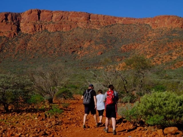
Mount Nameless, or Jarndrunmunhna in the local Aboriginal language, is 1128 metres above sea level. Overlooking Tom Price, the mountain summit can be accessed by 4WD and by foot along a challenging steep well-marked trail.
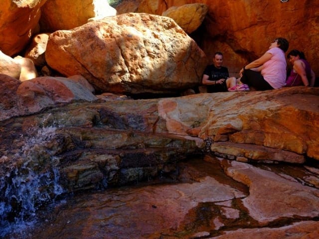
The spectacular Mount Nameless is located just 4km out of Tom Price's town center and is best known for its challenging 4WD track to the summit. It is one of the highest 4WD tracks in Western Australia and the mountain totally dominates the skyline around the mining town. For the more energetic, taking on the Mount Nameless hiking trail to the summit is well worth the effort. The views over surrounding hills and massive Rio Tinto iron ore mine site are spectacular. The trail is mostly steep made slightly easier by steps carved out of rock in some sections. Railings also aid the hiker in more difficult sections. From the Car Park at the base of the mountain, the hike up and return can take over 3 hours. It is not the thing to do on a hot summer day. Make sure you carry water. To get to the start of the 4WD track, head west out of the town along Mine road, and turn left (also onto Mine road). From there, take the first right onto Nameless Valley Drive, and then the first left onto a gravel track. This gravel road takes you past a mine site, and you will eventually end up at the start of the mountain. Make sure you obey the speed signs on the gravel road as there are frequent vehicles coming and going to the mine.
Tips
Start Point: Tom Price Tourist Park, or at base of Mount Nameless for the walk. Tom Price is 1,455km (16 hours) north of Perth
End Point: Tom Price Tourist Park, or at base of Mount Nameless for the walk. Tom Price is 1,455km (16 hours) north of Perth
Region: Tom Price, North West
For more information, a location map and GPS file please visit Trails WA.
Gallery
Got some great shots from this hike? Upload your photos here to inspire others and show off the beauty of the trail!
Click to view form >>
Submitting your photos doesn’t mean you lose ownership. You can be credited for your contributions, and you can request removal at any time.
Content use
Please don’t copy GPX files or content from this site to AllTrails or other platforms. Each trail has been personally mapped, documented, and refined to support Australia’s bushwalking and hiking community. While some details come from land managers, every listing reflects significant personal effort. This is a free, community-driven initiative—your respect helps keep it that way.
Walk map and GPX file
It looks like I don’t have a GPX file for this trail yet. If you have one to share, please email it to me! I’ll verify it against official maps before adding it to help other hikers have a safer, easier experience. Thanks for contributing to a better hiking resource.
Getting there
Getting to the trailhead: Tom Price.
Closest towns to this walk: Ashburton, Karijini, Onslow, Pannawonica, Paraburdoo, Tom Price
About the region
Tom Price is the most attractive purpose-built town in the Inland Pilbara with tree-lined streets, modern facilities, an impressive Visitor Centre and a relaxed country-town atmosphere. Once owned by the Rio Tinto mining company it is now owned and run by the Shire of Ashburton. Located below the impressive Mount Nameless, Tom Price has been described as the 'Top Town in Western Australia' because it is the highest town in Western Australia. It is nestled in the Hamersley Range, a flat-topped mass of Precambrian sediment which was deposited on the sea bed more than 500 million years ago. It is recognised as one of the oldest weathered surfaces on earth. The combination of millions of years of wind, rain and ice (during the Permian Ice Age) has eroded the whole area into a series of spectacular gorges. The end result is some of the most beautiful and dramatic landscapes in Australia. The gorges are notable for their distinctive horizontal bedding where layers of red, black and brown iron form bands of colour with conglomerates and sandstone. The area has been denuded by the harshness of the summers with ghost gums, red river gums and wildflowers (including the Sturt Desert Pea) giving the landscape a special beauty.
Similar walks nearby
Looking for more walks in or near Tom Price? Try these trails with a similar difficulty grade.
Track grade
Grade 4 (Hard) - Challenging Walks for Experienced Walkers: Grade 4 on the AWTGS signifies challenging walking tracks. Bushwalking experience is recommended for these tracks, which may be long, rough, and very steep. Directional signage may be limited, requiring a good sense of navigation. These walks are suited for experienced walkers who are comfortable with steeper inclines, rougher terrain, and potentially longer distances.
Explore safe
Plan ahead and hike safely! Carry enough water, pack layers for changing conditions, and bring safety gear like a torch, PLB, and reliable communication device. Check official sources for trail updates, closures, and access requirements, and review local weather and bushfire advice. Most importantly, share your plans with someone before you go. Being prepared makes for a safer and more enjoyable hike! Stay Safe, Explore More, and Always #ExploreSafe.
Packing checklists
What you carry in your pack depends on factors like weather, terrain, and your adventure type. Not sure what to bring? My free planning, food, and packing checklists are a great starting point, covering day hikes, overnight trips, and multi-day adventures. Use them to customise your kit and always prioritise safety.
Let someone know
Before heading out, take a moment to fill out your trip intentions form. It’s a quick way to share your hike details with family or friends. If something goes wrong, they can notify emergency services, ensuring a faster response and peace of mind. Stay safe and enjoy your adventure
Suggest an edit
Spotted a change on this trail? Maybe there are new features, the route has shifted, or the trail is permanently closed. Whatever the update, I’d love your input. Your feedback helps fellow hikers stay informed and ensures that our trail info stays fresh and reliable.
Acknowledgement of Country
Trail Hiking Australia acknowledges the Traditional Owners of the lands on which we hike and pay respects to their Elders, past and present, and we acknowledge the First Nations people of other communities who may be here today.


