Hike at a Glance
Max elevation: 1255m
Min elevation: 680m
Total Ascent: 825m
Important info
Please be advised that the Cement Creek Walking Track section of this hike is currently inaccessible due to closure. Parks Victoria has not provided a reopening date. While the upper portion of the track is passable, the lower rainforest section has become overgrown and difficult to navigate since its closure several years ago. If you choose to proceed with this route, exercise extreme caution and be prepared to backtrack if necessary. I recommend the alternative route via Mount Boobyala, Mount Donna Buang, and Mount Victoria for a safer and more enjoyable experience. See route map below.
Hike overview
The walk is 8 km long and will take a reasonably fit group about 4 hours, including a few breaks. Add an hour if you plan to walk the last 4.5 km down the road rather than drive back to the start. This is the most attractive walk in the Warburton area, primarily through cool temperate rainforest. Despite a 750-meter climb, the effort is well worth it. Most of the walk is moderately graded, except for two short but fairly steep sections near the start. If it has rained or there is snow on the ground, the first kilometre of the track may be wet and challenging to keep your feet dry, so carry a spare pair of dry socks.
The ascent via Cement Creek and Boobyalla Saddle.
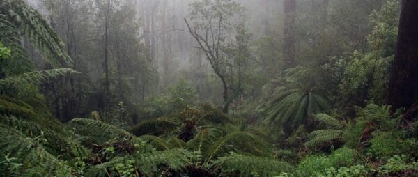
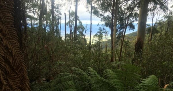
The track immediately plunges into tall eucalypt forest and crosses Cement Creek and some tributaries by a combination of bridges and stepping stones. If it has rained recently or there is snow on the ground, the first 1½ km can be quite wet and muddy with water running down the track. Soon the track begins to climb up on the north side of the creek. This is actually an old cable haulage tramline where logs were winched down the mountain. There are a few diversions where trees have fallen over the track, but it essentially continues in a straight line parallel to the creek. This is the steepest part of the walk, so take a few breaks and look around at the forest. Below the towering Mountain Ash canopy, you will see a rainforest understory of Tree Ferns, Sassafras, Blackwood and Myrtle Beech.
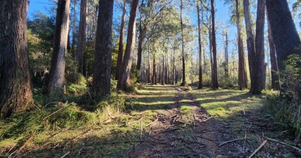
Soon the old cable haulage finishes and you emerge onto a flat section where the tramway was horse drawn before the climb resumes for a short distance. Soon after the end of this second climb, the scenery changes from rainforest with a Mountain Ash overstory to more open Alpine Ash woodland. Follow the track through the tall trees and just as they are changing to Snowgums, you will arrive at a track junction at Boobyalla Saddle.
Take a breather before the final section to the summit. Turn left and head south along an undulating track. There is an especially attractive spot where the track passes through a pure stand of Myrtle Beech. Before long, it joins a Melbourne Water road. Turn left and continue south for a few hundred metres until a dip in the road. Just as it starts to climb, take a track to the left heading into the forest. There is a short climb up a former ski run through beech and eucalypts and soon you will emerge at the the summit.
The summit boasts an impressive 21 metre high lookout tower with a curious double helix staircase. The view from the top is spectacular. Nearby is a slightly squalid shelter hut with partially open sides and a toilet block. At busy times in winter, there may be a caravan selling snacks.
The descent via Mount Victoria.
From the observation tower, walk 100 metres east to the toilet block. Contour north across the top of a fenced off former ski run. Soon you will pick up a good track that heads downhill, roughly paralleling the fence line. In snow the route is fairly clear and it is marked with occasional red metal arrows. At the bottom of the ski run is the ruin of an old ski lodge.
Soon you will reach a junction with a track to the right heading south to Ten Mile picnic area. Take the left hand track which stays fairly level for 2 km to Mount Victoria. The top is barely perceptible as it is really a knoll on a spur that looks like a mountain from near Warburton. The track then descends to a telephone tower. From here there is a short section of gravel road before the main sealed Donna Buang Road. If you have left a car here, drive down to the start of the walking track, otherwise it is an easy hour's walk along the road to your cars.
Winter
The Cement Creek walk is especially attractive for experienced groups in winter, although snow conditions in July and August make things a little harder. However walking through a silent beech forest in deep snow is a truly wonderful experience and rare outside Tasmania. Everyone in the group should have a good quality raincoat that won't tear on scrub as well as overpants, gloves, a warm hat, telephone and a spare pair of warm, dry socks. The snow can be quite deep, so it will be useful if at least one person in the group has snowshoes to help pack down the track.
While you should have a GPS, navigation in snow isn't too much of a problem on most of the route except for the top section of the track paralleling Cement Creek before Boobyalla Saddle. Keep an eye out for the markers nailed to trees on this section. They are more easily seen looking downhill, so make sure you turn around frequently so as to stay on the track.
Track grade
Grade 4 (Hard) - Challenging Walks for Experienced Walkers: Grade 4 on the AWTGS signifies challenging walking tracks. Bushwalking experience is recommended for these tracks, which may be long, rough, and very steep. Directional signage may be limited, requiring a good sense of navigation. These walks are suited for experienced walkers who are comfortable with steeper inclines, rougher terrain, and potentially longer distances.
Walk map and GPX file
Route via Mount Boobyala, Mount Donna Buang, and Mount Victoria
Max elevation: 1255 m
Min elevation: 680 m
Total climbing: 825 m
Total descent: -826 m
7.7km One Way via Cement Creek Walking Track (Closed)
Max elevation: 1252 m
Min elevation: 705 m
Total climbing: 610 m
Total descent: -284 m
13km Circuit via Cement Creek Walking Track (Closed)
Max elevation: 1252 m
Min elevation: 705 m
Total climbing: 691 m
Total descent: -691 m
Content use
Please don’t copy GPX files or content from this site to AllTrails or other platforms. Each trail has been personally mapped, documented, and refined to support Australia’s bushwalking and hiking community. While some details come from land managers, every listing reflects significant personal effort. This is a free, community-driven initiative—your respect helps keep it that way.
Gallery
Got any photos from this hike? Your photos can help others plan. Share shots from along the trail so fellow hikers know what to expect.
Click to add your photos >>
Getting there
Getting to the trailhead: Mount Donna Buang.
Drive through Warburton until the Warburton Highway, B 380, crosses the Yarra River. Shortly afterwards turn left on to The Acheron Way, C 507. The road immediately begins a steady climb which continues for 7 km to the Cement Creek junction. Park here and spend 15 minutes inspecting the impressive Rainforest Gallery, a 350 metre walking circuit that starts high in the canopy before descending to the forest floor.
The Cement Creek walking track starts 250 metres along the Donna Buang road. You can either walk or drive up and park in the large clearing at the start of the track on the left of the road.
Need a rental car to get you to the hike? Find one here.
Find a place to stay
Wondering where to stay near this hike? Find accommodation close to the trailhead — hotels, cabins and campgrounds nearby. Click the button to view the interactive map.
Closest towns to this walk: Badger Creek, Big Pats Creek, East Warburton, Gladysdale, Healesville, Launching Place, Marysville, Millgrove, Olinda, Reefton, Warburton, Yarra Junction
Let someone know
Heading out? Fill in a trip intentions form so someone knows your plans. If things go wrong, they can raise the alarm fast, giving you peace of mind on the trail.
About the region
Mount Donna Buang (1250 metres) is the nearest snowfield to Melbourne. The tall ash forests on it's slopes were harvested at the turn of the 20th century and the timber was moved by a network of tramlines and cable haulages. The industry took off in 1901 with the completion of the railway to Warburton.. Before the Second World War, Doona was also a minor ski resort with cleared runs, a huge ski jump and four ski lodges. In 1935 12,000 watched ski races on Donna. However the snow was never terribly reliable and after the war, two of the lodges that survived the 1939 fires were moved to the more dependable snowfield at Mount Buller, while the ruins of another can be seen at the foot of an old ski run.
Today most of the mountain is parkland. It is a accessed by a sealed road and is a popular tourist destination. In winter it attracts families to play in the snow. There is a 21 metre high lookout tower on the summit accessed by a strange double helix staircase. From the top there are impressive views of the mountains and forests, as well as the farmlands and towns of the Yarra Valley.
While you can drive to the top, there are a number of walking tracks up the mountain. One is a long day hike from Dom Dom Saddle, another begins at the aptly named Martyr Road in Warburton while a third starts half way up, near the Cement Creek Rainforest Gallery. There is also an easier option of a scenic walk near the summit.
Summary provided by: David Sisson | www.australianmountains.com/donnabuang/#10
Similar walks nearby
Looking for more walks in or near Mount Donna Buang? Try these trails with a similar difficulty grade.
Explore safe
Plan ahead and hike safely! Carry enough water, pack layers for changing conditions, and bring safety gear like a torch, PLB, and reliable communication device. Check official sources for trail updates, closures, and access requirements, and review local weather and bushfire advice. Most importantly, share your plans with someone before you go. Being prepared makes for a safer and more enjoyable hike! Stay Safe, Explore More, and Always #ExploreSafe.
Packing checklists
What you carry in your pack depends on factors like weather, terrain, and your adventure type. Not sure what to bring? My free planning, food, and packing checklists are a great starting point, covering day hikes, overnight trips, and multi-day adventures. Use them to customise your kit and always prioritise safety.
Suggest an edit
Notice something different about this trail? Whether it’s a new feature, a route change, or a closure, share your update so we can keep our info accurate and helpful for fellow hikers.
Click to suggest edits >>
Acknowledgement of Country
Trail Hiking Australia acknowledges the Traditional Owners of the lands on which we hike and pay respects to their Elders, past and present, and we acknowledge the First Nations people of other communities who may be here today.


3 Reviews on “Mount Donna Buang - Cement Creek & Mt Victoria Hike (7.7km)”
Please be advised that the Cement Creek Walking Track section of this hike is currently inaccessible due to closure. Parks Victoria has not provided a reopening date. While the upper portion of the track is passable, the lower rainforest section has become overgrown and difficult to navigate since its closure several years ago. If you choose to proceed with this route, exercise extreme caution and be prepared to backtrack if necessary. I recommend the alternative route via Mount Boobyala, Mount Donna Buang, and Mount Victoria for a safer and more enjoyable experience.
To be honest the combination of this post and details as well a map off avenza maps really helped. Alot of the trails at the top super over grown also. Thanks for the info guys!
We attempted this walk over the weekend and completely lost the track just as we were leaving the rainforest and heading into the alpine ash forest. We crossed an overgrown cleared area (filled with stinging nettles!) but could not find the track heading out the other side of the clearing. We decided against bush bashing our way up to the ridge line, and decided instead to return back to the rainforest gallery, and enjoyed the wonderful forest just as much on the way down as the way up.
We then drove to the summit and walked out towards Mt Boobyalla and saw the beginning of the track down, but didn’t have time or energy to pursue it downhill and see if we could join up with where we had got to.
It would be great for someone who knows the track to put some more route tags up, or
I suggest anyone doing the walk needs to have better directions of how to repick up the track than we did after the clearing.
Sounds like you had an adventure. The section of the track that you mentioned has been closed for some time (as noted in the hike description). Unfortunately bush bashing, map and compass and the GPX files would be required.
Completed 30/1/2021.
Start of path difficult to find description helped but took some effort. Well marked early missed a turn and spent around an hour and a half finding old tags looks like the old tramline as was flat and had some old bolts ect. Wised up doubled back and found path. Plenty of markers and tags lots of fallen trees… alot of rain yesterday so found the trail was part of the creek bed at times. Top is still over grown occasional tag but I just went for it following an old map. Plenty of leaches and cuts. Was a lovely walk such a shame its been shut.
When I was updating the walks section, I re-walked the route in May 2016 and Janet is right, the top section of the Cement Creek route is overgrown with ferns and navigation was a bit tricky. However some people have cut back the trees and shrubs on the bottom section of the track and marked the route with flagging tape where it isn’t obvious. Hopefully they will return to slash and mark the top part this summer, as it’s a great walk and it would be a shame if it reverted to jungle.
Impossible to find Cement Creek – it was marked very clearly on my GPS, I went into the vegetation and looked for it for a while. We switched gear drove a little further and started by Mounty Victoria on to Mount Boobyala via Mount Donna Buang. Very nice. At some point we were meant to cross again cement creek trail and again impossible to spot in the overgrowth.