Hike at a Glance
Max elevation: 1815m
Min elevation: 1284m
Total Ascent: 657m
Important info
The Cobberas mountain range is in the Cobberas Wilderness area of the Alpine National Park. The circuit walk to the rocky summit of Mt Cobberas No. 1 should only be attempted by experienced walkers.
Hike overview
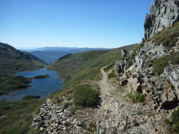
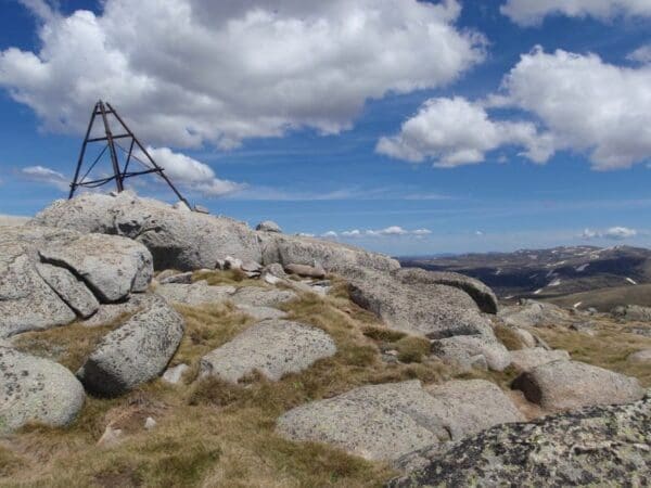
The Cobberas Range, a mountain range that is part of the Great Dividing Range within the Victorian Alps, is in north-eastern Victoria in Australia. The range is in the Cobberas Wilderness area of the Alpine National Park. This spectacular Mount Cobberas Circuit hike ascends Mount Coberas No 1, the highest peak in the area and provides an opportunity to explore other peaks along the trail.
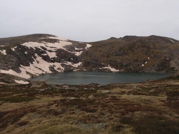
For seasoned hikers seeking an unforgettable challenge, the Mount Cobberas Circuit beckons from the remote heart of the Alpine National Park. This hidden gem rewards intrepid souls with breathtaking panoramas that unfold beneath jagged granite teeth. Windswept meadows stretch as far as the eye can see, dotted with sapphire lakes and ribbons of silver rivers. The path itself is a test of resilience, weaving through hidden gullies and scrambling over weathered boulders, marked only by the occasional flash of orange. But for those who conquer the challenge, the sense of accomplishment and connection with nature is unparalleled. So lace up your boots, grab your map, and prepare to be awestruck by the untamed beauty of the Mount Cobberas Circuit.
Track grade
Grade 5 (Difficult) - Walks for the Most Experienced: Grade 5 represents the most challenging walking tracks on the AWTGS. These are only recommended for very experienced and fit walkers with specialised skills, including navigation and emergency first aid. Tracks are likely to be very rough, very steep, and unmarked. Walks may be more than 20 kilometers. These challenging walks demand a high level of fitness and experience to navigate difficult terrain, significant elevation changes, and potentially unformed paths.
Walk map and GPX file
Max elevation: 1815 m
Min elevation: 1284 m
Total climbing: 657 m
Total descent: -658 m
Content use
Please don’t copy GPX files or content from this site to AllTrails or other platforms. Each trail has been personally mapped, documented, and refined to support Australia’s bushwalking and hiking community. While some details come from land managers, every listing reflects significant personal effort. This is a free, community-driven initiative—your respect helps keep it that way.
Getting there
Getting to the trailhead: The Cobberas Range.
Need a rental car to get you to the hike? Find one here.
About the region
The Cobberas Range is a remote area in the Victoria Alpine national park, close to the NSW border. The Cobberas area is in the East Alps Unit of the Alpine National Park, which is in the remote mountains of Victoria's East Gippsland region, adjacent to the Snowy River National Park. The Cobberas Range itself is just south of the NSW border, so too far for a day trip for most members. We tend to organise weekend activities where you can camp out with other members, or stay in Omeo or Gelantipy and travel out for a day.
Rising like granite giants from the rugged Victorian landscape, the Cobberas Range, cradled in the Alpine National Park's Cobberas Wilderness, carves a dramatic path through the Great Dividing Range. Features of the area include - magnificent peaks, rare and threatened flora and fauna, magnificent Alpine Ash forests, sub-alpine herbfields, snowgum woodland and snowgrass plains, pristine rivers and streams, historic huts, the list goes on.
Find a place to stay
Wondering where to stay near this hike? Find accommodation close to the trailhead — hotels, cabins and campgrounds nearby. Click the button to view the interactive map.
Closest towns to this walk: Benambra, Bindi, Ensay, Omeo, Swifts Creek
Let someone know
Heading out? Fill in a trip intentions form so someone knows your plans. If things go wrong, they can raise the alarm fast, giving you peace of mind on the trail.
Similar walks nearby
Looking for more walks in or near The Cobberas Range? Try these trails with a similar difficulty grade.
Suggest an edit
Notice something different about this trail? Whether it’s a new feature, a route change, or a closure, share your update so we can keep our info accurate and helpful for fellow hikers.
Click to suggest edits >>
Explore safe
Plan ahead and hike safely! Carry enough water, pack layers for changing conditions, and bring safety gear like a torch, PLB, and reliable communication device. Check official sources for trail updates, closures, and access requirements, and review local weather and bushfire advice. Most importantly, share your plans with someone before you go. Being prepared makes for a safer and more enjoyable hike! Stay Safe, Explore More, and Always #ExploreSafe.
Packing checklists
What you carry in your pack depends on factors like weather, terrain, and your adventure type. Not sure what to bring? My free planning, food, and packing checklists are a great starting point, covering day hikes, overnight trips, and multi-day adventures. Use them to customise your kit and always prioritise safety.
Acknowledgement of Country
Trail Hiking Australia acknowledges the Traditional Owners of the lands on which we hike and pay respects to their Elders, past and present, and we acknowledge the First Nations people of other communities who may be here today.
/Mount-Cobberas-Circuit-Hike_39.jpg)
/Mount-Cobberas-Circuit-Hike_24.jpg)
/Mount-Cobberas-Circuit-Hike_26.jpg)
/Mount-Cobberas-Circuit-Hike_45.jpg)
/Mount-Cobberas-Circuit-Hike_31.jpg)
/Mount-Cobberas-Circuit-Hike_48.jpg)
/Mount-Cobberas-Circuit-Hike_23.jpg)
/Mount-Cobberas-Circuit-Hike_8.jpg)
/Mount-Cobberas-Circuit-Hike_11.jpg)
/Mount-Cobberas-Circuit-Hike_17.jpg)
/Mount-Cobberas-Circuit-Hike_22.jpg)
/Mount-Cobberas-Circuit-Hike_12.jpg)
/Mount-Cobberas-Circuit-Hike_51.jpg)
/Mount-Cobberas-Circuit-Hike_38.jpg)
/Mount-Cobberas-Circuit-Hike_52.jpg)


4 Reviews on “Mount Cobberas Circuit Hike (15.1km)”
Mani Andreetta Muriel Pepper Steven Parker camping trip in 2024?
Lynda Maddison Muriel Pepper Steven Parker love to explore those ‘dark, brooding,’ Cobberas x
This is an awesome hike. Lots of brumby trails to confuse you and stunning views of the northern alps.