Hike at a Glance
Max elevation: 158m
Min elevation: 128m
Total Ascent: 39m
Hike overview
Explore the beauty of Mount Remarkable National Park on the easy Mambray Creek Walk. This 3-kilometer return trail is ideal for families and casual hikers, taking approximately 1.25 hours to complete.
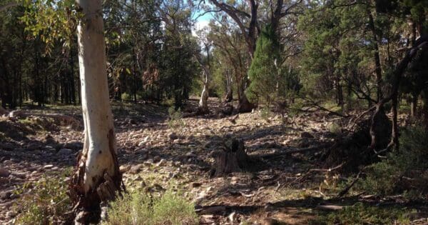
The trail winds through a scenic landscape of towering Red River Gums and native pine forest, offering a refreshing escape into nature. Along the way, keep an eye out for diverse birdlife flitting through the branches.
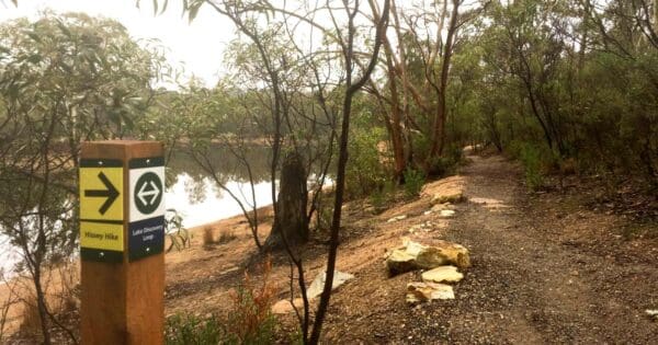
The Mambray Creek Walk also incorporates the shorter Wirra Water Walk. This interpretive section features signs that highlight the importance of water in the area. It's a perfect option for those seeking a leisurely stroll.
Start your walk from either the Mambray Creek Campground or the Day Visitor Area, making it convenient to access from various locations within the park.
Tips
- Dogs are not permitted in this park.
- The park is also closed on days of Catastrophic Fire Danger and may be closed on days of Extreme Fire Danger.
Track grade
Grade 1 (All-abilities) - Perfect for Families and Beginners: Grade 1 on the AWTGS represents the easiest walking tracks, perfect for families with young children or those new to bushwalking. No prior experience is required. These gentle walks feature a flat, even surface with no steps or steep sections. They are suitable for wheelchair users with assistance due to the even terrain. The total distance of a Grade 1 walk is typically no greater than 5 kilometers, making them a comfortable and manageable option for all ages and fitness levels.
Walk map and GPX file
Max elevation: 158 m
Min elevation: 128 m
Total climbing: 39 m
Total descent: -39 m
Content use
Please don’t copy GPX files or content from this site to AllTrails or other platforms. Each trail has been personally mapped, documented, and refined to support Australia’s bushwalking and hiking community. While some details come from land managers, every listing reflects significant personal effort. This is a free, community-driven initiative—your respect helps keep it that way.
Gallery
Got any photos from this hike? Your photos can help others plan. Share shots from along the trail so fellow hikers know what to expect.
Click to add your photos >>
Getting there
Getting to the trailhead: Mount Remarkable National Park.
The park is located 45km north of Port Pirie. Access is from National Highway One via Mambray Creek. You can also reach Alligator Gorge via a scenic but sometimes challenging drive starting 1km south of Wilmington on Main North Road. This road is very steep and unsuitable for caravans, camper trailers, and buses. Alternatively, walk into the park from the adjacent town of Melrose, nestled at the foot of Mount Remarkable.
Please note: There are no public roads that pass through Mount Remarkable National Park. Horrocks Pass and Port Germein Gorge are the nearest public roads to the park for crossing the Flinders Ranges east to west.
Need a rental car to get you to the hike? Find one here.
About the region
Within easy reach of Adelaide, Mount Remarkable National Park is an ideal place for a family getaway. There's plenty of diverse wildlife to spot, and campgrounds with good facilities make it a comfortable base for exploring.
The park is a popular destination for bushwalking, with trails for all ages and abilities. Hike to the 960-meter summit of Mount Remarkable for incredible views overlooking the Willochra Plain and Spencer Gulf.
The Willowie area offers a network of mountain biking and walking trails that meander through the foothills of the Mount Remarkable Range. Choose from short and longer trails of varying difficulty. These trails wind through the native forest and peaceful woodlands, echoing with bird calls and crossing numerous water courses. Keep an eye out for historical reminders like old farm buildings and equipment scattered throughout the trails.
The mild temperatures from April to October are the most comfortable for walking and enjoying the park's spectacular wildflowers. Summers are warm to hot with little rain, so take plenty of water if you choose to hike during those months.
Find a place to stay
Wondering where to stay near this hike? Find accommodation close to the trailhead — hotels, cabins and campgrounds nearby. Click the button to view the interactive map.
Closest towns to this walk: Booleroo Centre, Gladstone, Hawker, Laura, Melrose, Port Germain, Port Germein, Quorn, Stirling North, Wilmington, Wirrabara
Let someone know
Heading out? Fill in a trip intentions form so someone knows your plans. If things go wrong, they can raise the alarm fast, giving you peace of mind on the trail.
Similar walks nearby
Looking for more walks in or near Mount Remarkable National Park? Try these trails with a similar difficulty grade.
Suggest an edit
Notice something different about this trail? Whether it’s a new feature, a route change, or a closure, share your update so we can keep our info accurate and helpful for fellow hikers.
Click to suggest edits >>
Explore safe
Plan ahead and hike safely! Carry enough water, pack layers for changing conditions, and bring safety gear like a torch, PLB, and reliable communication device. Check official sources for trail updates, closures, and access requirements, and review local weather and bushfire advice. Most importantly, share your plans with someone before you go. Being prepared makes for a safer and more enjoyable hike! Stay Safe, Explore More, and Always #ExploreSafe.
Packing checklists
What you carry in your pack depends on factors like weather, terrain, and your adventure type. Not sure what to bring? My free planning, food, and packing checklists are a great starting point, covering day hikes, overnight trips, and multi-day adventures. Use them to customise your kit and always prioritise safety.
Acknowledgement of Country
Trail Hiking Australia acknowledges the Traditional Owners of the lands on which we hike and pay respects to their Elders, past and present, and we acknowledge the First Nations people of other communities who may be here today.


