Hike at a Glance
Max elevation: 838m
Min elevation: 778m
Total Ascent: 109m
Hike overview
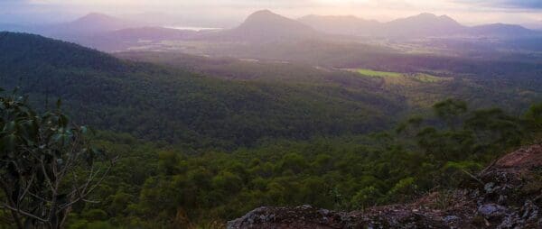
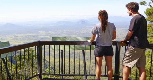
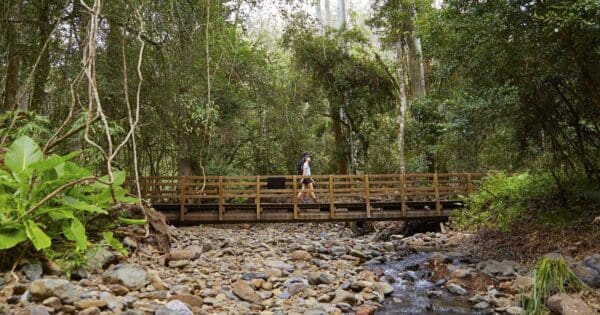
The Main Range Rainforest Circuit is a short yet rewarding 1.6km walk in Main Range National Park, Queensland. With a grade 3 difficulty, the hike typically takes around 45 minutes to complete, making it an ideal choice for a quick but immersive nature experience. The trail, located on the northern side of Cunninghams Gap, offers stunning views of the surrounding landscapes, including volcanic peaks, the Fassifern Valley, and Lake Moogerah. As you meander through the rainforest, you'll pass a monument dedicated to botanist Allan Cunningham, who explored the area in 1828. It’s worth stopping to reflect on his contributions to understanding the region’s unique flora.
As you continue along the track, take time to read the informative signs about the Gondwana Rainforests and the diverse plant and animal species that call this area home. The path gently ascends, leading you up a set of stairs that rewards you with panoramic views of the ancient volcanic peaks, the lush valley below, and the tranquil lake in the distance. If you visit during the cooler months, you might be lucky enough to hear the distinct call of the male Albert’s lyrebird, known for its remarkable mimicry.
For a smoother walk, park rangers recommend taking the circuit in a clockwise direction, starting with a left turn at the base of the stairs. The park, part of the Gondwana Rainforests of Australia World Heritage Area, is celebrated for its rich geological history, evolutionary significance, and incredible biodiversity, particularly its rare and endemic species.
Track grade
Grade 3 (Moderate) - Walks for Most Fitness Levels: Grade 3 on the AWTGS represents moderate walking tracks. These are ideal for walkers with some fitness who are comfortable with some hills and uneven terrain. While suitable for most ages, some bushwalking experience is recommended to ensure a safe and enjoyable experience. Tracks may have short, steep hill sections, a rough surface, and many steps. The total distance of a Grade 3 walk can be up to 20 kilometers.
Walk map and GPX file
Max elevation: 838 m
Min elevation: 778 m
Total climbing: 109 m
Total descent: -109 m
Content use
Please don’t copy GPX files or content from this site to AllTrails or other platforms. Each trail has been personally mapped, documented, and refined to support Australia’s bushwalking and hiking community. While some details come from land managers, every listing reflects significant personal effort. This is a free, community-driven initiative—your respect helps keep it that way.
Gallery
Got any photos from this hike? Your photos can help others plan. Share shots from along the trail so fellow hikers know what to expect.
Click to add your photos >>
Getting there
Getting to the trailhead: Main Range National Park.
The Main Range Rainforest Circuit is located in the Cunningham Gap section of Main Range National Park, approximately 120km south-west of Brisbane. To reach the trailhead, drive 116km south-west from Brisbane along the Cunningham Highway, or if you’re coming from Warwick, it’s a 50km drive east on the Cunningham Highway to Cunninghams Gap. The track begins at The Crest, easily accessible from the gap. Once there, you’re all set to enjoy this beautiful, short hike through the rainforest with scenic views and rich history.
Need a rental car to get you to the hike? Find one here.
About the region
Main Range National Park, located in the Scenic Rim of South East Queensland, is a place where nature’s beauty and geological history come together. Covering over 30,000 hectares, this park is part of the Gondwana Rainforests of Australia World Heritage Area, which is renowned for its exceptional biodiversity and ancient landscapes. The park is home to a diverse range of ecosystems, from cool subtropical rainforests to dry eucalypt forests, montane heath, and rocky outcrops. These varied habitats provide a sanctuary for a wide range of rare and endangered species, including the Albert’s lyrebird, the eastern bristlebird, and the black-breasted button-quail. The park's complex topography and rich soils support an impressive array of plant life, from towering trees to delicate wildflowers, each playing a vital role in the region’s delicate ecological balance.
The park’s most prominent feature is the Main Range itself, a dramatic escarpment formed from volcanic activity millions of years ago. Once part of a giant shield volcano, the range offers breathtaking views of the surrounding valleys and distant mountains. Over time, erosion has sculpted the landscape, creating rugged peaks and deep gorges, with numerous lookouts offering visitors a chance to take in the incredible scenery. The Main Range’s geological significance is matched by its ecological importance, with ancient plant species such as the giant spear lily and various rainforest trees still thriving in its protected environment.
Visitors to Main Range National Park can explore a range of walking tracks that showcase the park’s stunning landscapes, rich history, and diverse wildlife. Whether it’s a short walk through the rainforest or a more challenging hike up to one of the park's higher peaks, there’s something for everyone. The park is not only a place of natural beauty but also a site of historical significance. Early European explorers such as Allan Cunningham paved the way for the development of transport routes through the range, leaving behind a legacy that shaped the region’s development. Today, the park remains an important destination for outdoor enthusiasts, nature lovers, and those seeking to connect with the natural world in a truly special place.
Find a place to stay
Wondering where to stay near this hike? Find accommodation close to the trailhead — hotels, cabins and campgrounds nearby. Click the button to view the interactive map.
Closest towns to this walk: Allora, Boonah, Boondooma, Clifton, Crows Nest, Cunninghams Gap, Dungarees, Emu Vale, Esk, Gatton, Harrisville, Kalbar, Killarney, Laidley, Legume, Maryvale, Peak Crossing, Stanthorpe, Tannymorel, Toowoomba, Warwick, Yangan
Let someone know
Heading out? Fill in a trip intentions form so someone knows your plans. If things go wrong, they can raise the alarm fast, giving you peace of mind on the trail.
Similar walks nearby
Looking for more walks in or near Main Range National Park? Try these trails with a similar difficulty grade.
Suggest an edit
Notice something different about this trail? Whether it’s a new feature, a route change, or a closure, share your update so we can keep our info accurate and helpful for fellow hikers.
Click to suggest edits >>
Explore safe
Plan ahead and hike safely! Carry enough water, pack layers for changing conditions, and bring safety gear like a torch, PLB, and reliable communication device. Check official sources for trail updates, closures, and access requirements, and review local weather and bushfire advice. Most importantly, share your plans with someone before you go. Being prepared makes for a safer and more enjoyable hike! Stay Safe, Explore More, and Always #ExploreSafe.
Packing checklists
What you carry in your pack depends on factors like weather, terrain, and your adventure type. Not sure what to bring? My free planning, food, and packing checklists are a great starting point, covering day hikes, overnight trips, and multi-day adventures. Use them to customise your kit and always prioritise safety.
Acknowledgement of Country
Trail Hiking Australia acknowledges the Traditional Owners of the lands on which we hike and pay respects to their Elders, past and present, and we acknowledge the First Nations people of other communities who may be here today.


